Forecast for the Ogden Area Mountains

Wednesday morning, February 18, 2015
We have a LOW avalanche danger.
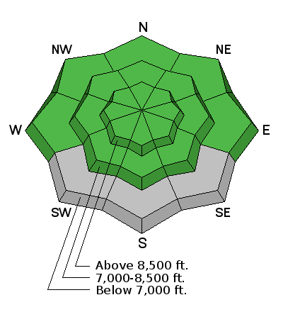

We have a LOW avalanche danger.

Our events and avalanche classes are going at full-tilt in February -
Fireside Chat at Black Diamond - Come down to Black Diamond this tonight at 730pm for our monthly Fireside Chat. UAC Director Bruce Tremper will be hosting this informal event.
Companion Rescue Workshops - Be confident in your backcountry avalanche companion rescue skills. We have two four hour clinics coming up - Sat Feb 21 5:30pm (NEW TIME) and Friday Feb 27 5:30pm. For more info, go to our Events page here.
Backcountry 101 for Snowshoers. Snowshoeing in the backcountry is safer and more fun when you have at least a basic understanding of avalanches. You'll learn about recognizing avalanche terrain and become proficient in companion rescue. Join us Thursday February 19th from 5:30-8:30pm and Saturday February 21st from 8:30am-4:00pm. Space is limited. Sign up HERE.
Women's Intro to Avalanches at Snowbasin. Join us February 19th and 21st for a Women's Intro to Avalanches at Snowbasin. This workshop begins with a three hour evening class in Ogden, followed by a 6 hour on-the-snow field day. Taught by Paige Pagnucco, Evelyn Lees and several others from the Utah Avalanche Center and members of Snowbasin Ski Patrol. Space is limited. Sign up HERE.
Skies are clear, ain't it a shame.
Mountain temperatures are about 10 degrees warmer than they were yesterday - with many stations now in the low 20s. Winds are northwesterly, blowing 15-20mph although the highest anemometers throughout the range reflect winds of 25-35mph. While many southerlies failed to soften yesterday, the February corn cycle should be on again today. Patches of soft settled powder exist in the sheltered northerly terrain.
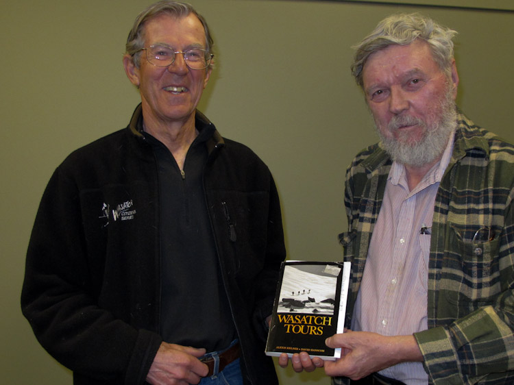
Low danger, fair weather, and easy mountain travel (except for slide-for-life conditions) are excellent times to see the nooks and crannies of the range. Dave Hanscom and Alexis Kelner called them "Super Tours" in their classic guidebooks Wasatch Tours. (photos: McLean, Wilson). Parties spread out from Deseret Peak to Timpanogos yesterday -
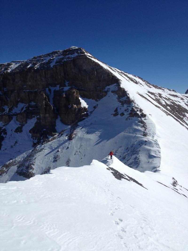
Nada

The snowpack is generally stable right now. Remember that risk is always inherent in mountain travel. Slide for life conditions, cornice fall, overstaying your welcome on the steep southerly aspects after they've become wet and unsupportable...
High pressure builds for today and tomorrow before a storm system from the Pacific Northwest crashes through Friday mid-morning. Unfortunately, the system - while bringing some wind and colder temps - doesn't bring much snowfall to the range. Perhaps 1-4" through the weekend. For today, we'll have clear skies, moderating northwest winds and temps pushing into the low 30s at 10,000', the low to mid-40s at 8000'.

Remember your information can save lives. If you see anything we should know about, please participate in the creation of our own community avalanche advisory by submitting snow and avalanche conditions. You can also call us at 801-524-5304, email by clicking HERE, or include #utavy in your tweet or Instagram.
If you trigger an avalanche in the backcountry - especially if you are adjacent to a ski area – please call the following teams to alert them to the slide and whether anyone is missing or not. Rescue teams can be exposed to significant hazard when responding to avalanches, and do not want to do so when unneeded. Thanks.
Salt Lake and Park City – Alta Central (801-742-2033), Canyons Resort Dispatch (435-615-3322)
Snowbasin Resort Dispatch (801-620-1017), Powder Mountain Dispatch (801-745-3772 x 123).
Sundance Dispatch (801-223-4150)
EMAIL ADVISORY If you would like to get the daily advisory by email you will need to subscribe here.
DAWN PATROL Hotline updated daily by 5-530am - 888-999-4019 option 8.
Twitter Updates for your mobile phone - DETAILS
UDOT canyon closures: LINK TO UDOT, or on Twitter, follow @UDOTavy, @CanyonAlerts or @AltaCentral
Utah Avalanche Center mobile app - Get your advisory on your iPhone along with great navigation and rescue tools.
Wasatch Powderbird Guides Blog/Itinerary for the Day.
Lost or Found something in the backcountry? - http://nolofo.com/
Discount lift tickets are now available at Backcountry.com. Thanks to Ski Utah and the Utah Resorts. All proceeds go towards paying for Utah Avalanche Center avalanche and mountain weather advisories.
To those skinning uphill at resorts: it is your responsibility to know the resort policy on uphill travel. You can see the uphill travel policy for each resort here. IMPORTANT: Before skinning or hiking at a resort under new snow conditions, check in with Ski Patrol. Resorts can restrict or cut off access if incompatible with control and grooming operations.
Benefit the Utah Avalanche Center when you shop from Backcountry.com or REI: Click this link for Backcountry.com or this link to REI, shop, and they will donate a percent of your purchase price to the UAC. Both offer free shipping (with some conditions) so this costs you nothing!
Benefit the Utah Avalanche Center when you buy or sell on ebay - set the Utah Avalanche Center as a favorite non-profit in your ebay account here and click on ebay gives when you buy or sell. You can choose to have your seller fees donated to the UAC, which doesn't cost you a penny.
This information does not apply to developed ski areas or highways where avalanche control is normally done. This advisory is from the U.S.D.A. Forest Service, which is solely responsible for its content. This advisory describes general avalanche conditions and local variations always exist.