Forecast for the Ogden Area Mountains

Mark Staples
Issued by Mark Staples for
Saturday, December 9, 2023
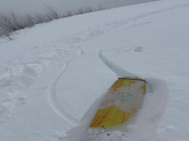
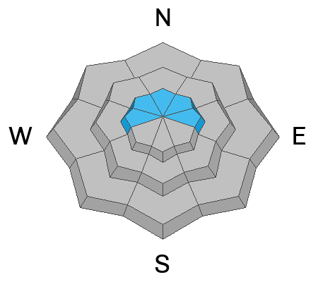
Today the avalanche danger is MODERATE at mid and upper elevations. On upper elevation west, north, and east aspects, a persistent weak layer lingers, and I'd give it a little more time before testing these slopes. Mid elevations and south facing upper elevations slopes simply have a lot of new snow which may sluff or fracture as a soft slab where it was drifted by winds yesterday morning.
Low elevations have a LOW avalanche danger.
Low
Moderate
Considerable
High
Extreme
Learn how to read the forecast here
Special Announcements
Weather and Snow
What a storm! Snow fell a little on Thursday and all day Friday. Storm totals are 10-14 inches of snow (0.8-1.4 inches of water).
Total snow depths are:
  • 45" near Snowbasin
  • 27-34" near Powder Mountain
  • 23-40" on Ben Lomond
  • 40" at Monte Cristo

This morning it's cold with temperatures mostly in the low teens F with north winds averaging 6-10 mph gusting 15 mph. Winds blew much stronger yesterday morning from the west averaging 15-25 mph, gusting 30-40.
Today will be sunny with temperatures only rising to near 20 degree F, and winds will remain light.
With all the new snow, there's great riding, but the tricky part is that there's a crust beneath the new snow. You'll notice it the most at low elevations where the crust in harder and there's less new snow.
Recent Avalanches
Yesterday above Nordic Valley, a skier "Had cracking and collapsing near ridgeline in wind drifted snow 6-18” deep".
Ad
Avalanche Problem #1
New Snow
Type
Location
Likelihood
Size
Description
The main avalanche issue is within the new snow. With 10-14 inches of new, cold snow, expect some sluffing especially where it's resting on top of a hard crust. Areas with drifting or simply touched by strong winds from the west yesterday morning will have a more cohesive slab that can avalanche. The tricky part is that these wind loaded areas will be camouflaged by snow that fell straight down yesterday afternoon.
What to do? Riding slopes less than 30 degrees is always a great option to avoid avalanches. Stick to the basics and only expose one person at a time, ride slopes with a clear runout so that an avalanche doesn't slam you into trees or rocks, and do your best to avoid slopes where winds drifted snow yesterday morning.
Avalanche Problem #2
Persistent Weak Layer
Type
Location
Likelihood
Size
Description
A persistent weak layer of old, weak, and faceted snow from November is still lurking at the highest elevations. It is getting buried deeply and on the road to recovery. On Thursday I rode near Farmington Canyon which has a similar snowpack to many other areas. We could easily find this weak layer, but it took a lot of force to fracture in our snowpack tests.
An avalanche on this layer would be big and deadly. For today, I'd simply ride south facing slopes in the sun and avoid this problem altogether.
General Announcements
This information does not apply to developed ski areas or highways where avalanche control is normally done. This forecast is from the U.S.D.A. Forest Service, which is solely responsible for its content. This forecast describes general avalanche conditions and local variations always occur.