Forecast for the Ogden Area Mountains

Drew Hardesty
Issued by Drew Hardesty for
Wednesday, December 5, 2018
Most terrain has a LOW avalanche danger. Localized areas of MODERATE danger, however, exists for new and developing drifts in steep wind exposed terrain. Evaluate snow and terrain carefully today.
Low
Moderate
Considerable
High
Extreme
Learn how to read the forecast here
Weather and Snow
Skies are overcast with what looks - via radar - to be light snow falling in the mountains. A cut-off Low pressure system off the coast of California will be the dominant weather feature for us this week, but it'll do little more than produce an inch or two and provide warmer temps and gusty south winds. Already temps are roughly 10 degrees warmer (currently mid to upper teens) than this time yesterday (at 5am), though the south to southwest winds are blowing 15-20mph with gusts to 25. The skiing and riding have been fantastic, but some wind and possibly some sun damage had now taken part of the pie. Still, snow depth are good with 3-4' up high and 1-2' down low.
Recent Avalanches
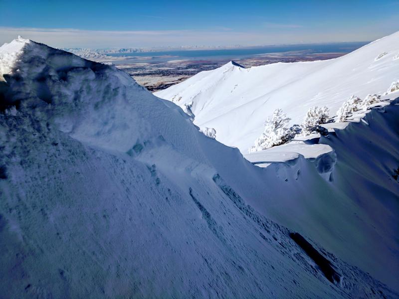
Backcountry observer Kory Davis was able to intentionally trigger a shallow new wind slab with a cornice drop along the Ogden skyline yesterday. The soft slab was 14" deep and 50' wide on a steep north facing slope at 9200'. (pic below). You can find his, along with a good number of other observations here. Other great info can be found on the OgdenAvalanche instagram feed.
Ad
Avalanche Problem #1
Wind Drifted Snow
Type
Location
Likelihood
Size
Description
Be on the lookout for some fresh but shallow wind drifts along the lee of ridgelines and around other terrain features in the higher elevations today. These drifts may be particularly sensitive and possibly triggered from a distance. Drifts are usually rounded and scalloped and - with these wind speeds anyway - soft and in predictable areas. Ski cuts and cornice drops are effective tools for mitigating these hazards; test slopes are good tools as well.
Avalanche Problem #2
Normal Caution
Type
Location
Likelihood
Size
Description
The Ogden mountains may have some of the strongest, most stable snowpacks across the state.  Old weak faceted snow is patchy and unconnected in the higher northerly terrain and we haven't heard of any avalanches, cracking or collapsing in this layering.  Still, if heading into the highest shady elevations, it's worth pulling out the shovel to determine if any old, grey and granular faceted snow exists at or near the ground...and how reactive it might be to snow tests.   Risk is inherent in mountain travel. Isolated and shallow wind pockets and minor sluffing of the new snow are possible in steep, high alpine terrain. These issues are manageable through proper assessment, terrain choices, ski cuts and the like. Radical terrain amplifies the consequences of even a minor mishap. Remember that good habits save lives: travel one at a time through avalanche terrain, carry and know how to use rescue equipment, and be close enough to your partners to effect a rescue if needed.
General Announcements
This information does not apply to developed ski areas or highways where avalanche control is normally done. This advisory is from the U.S.D.A. Forest Service, which is solely responsible for its content. This advisory describes general avalanche conditions and local variations always occur.