Fall Auction is now live! Check it out now

Forecast for the Ogden Area Mountains

Dave Kelly
Issued by Dave Kelly on
Tuesday morning, December 27, 2022
Expect changing avalanche conditions with rising danger as this warm wet storm moves through the Wasatch.
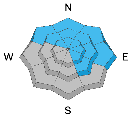
The avalanche danger is CONSIDERABLE at high elevation slopes where winds are blowing the strongest and creating dangerous avalanche conditions.
The avalanche danger is MODERATE on all other slopes with a complicated mix of avalanche problems.
Low
Moderate
Considerable
High
Extreme
Learn how to read the forecast here
Weather and Snow
Under building clouds temperatures are in the low 40's F at the trailheads and in the 30's F at the higher elevations. Winds are blowing southerly in the mid 30's MPH gusting to the 70's MPH.

Today, 8-12" of snow will fall with up to 1" of water by 5pm. This will be rain below 8000'. The rain and snow will be heavy at times. Temperatures will be 36-40 F. Winds will blow from the southwest 35 gusting to 65 MPH.

The National Weather Service has issued a Winter Weather Advisory from 900am on Tuesday until 900am on Thursday.

This is the first in a series of three storms that are moving through Utah over the next week.
Ad
Avalanche Problem #1
Persistent Weak Layer
Type
Location
Likelihood
Size
Description
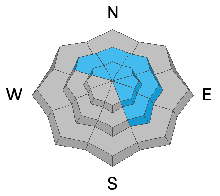
Most avalanche activity on this persistent weak layer has been on northerly facing terrain. This layer DOES exist at other aspects and elevations and it could begin producing avalanches when it gets loaded by a series of storms this week.

The places that are of most concern to me are the areas that had a stronger snowpack (extended column tests of with propagation in the high 20's). These are the slopes that will hold more water weight before they avalanche much wider and deeper. These will be unsurvivable avalanches. The uncertainty lies with how quickly or slowly we get new precipitation. Stay off of and out from under slopes over 30 degrees as the current snowpack adapts to the new snow.

There is more snow at lower elevations in the Ogden areas mountains and the potential for wet slab avalanches exists if rain percolates to the weak faceted snow.
Avalanche Problem #2
Wind Drifted Snow
Type
Location
Likelihood
Size
Description
Expect to see slabs of wind drifted snow building as snow falls today and the wind blows strong from the south and southwest. Winds are even moving some snow at mid elevations. I would avoid any steep wind drifted slope where you could trigger one of these wind slabs.
Avalanche Problem #3
Wet Snow
Type
Location
Likelihood
Size
Description
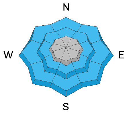
There is a high level of uncertainty with the rain/snow line. As this freezing level fluctuates I wouldn't be surprised to hear of wet loose avalanches at mid and low elevation areas later in the afternoon. Temperatures hovering at or above freezing for the last 24 hours gives me cause for concern on how well this low elevation snowpack will handle this onslaught of rain. There may be places where it melts it out and the only change is rising creek levels.
If I was traveling through this lower elevation rain soaked terrain I would avoid any location where I was sinking through the snowpack to the ground. These will be slow moving avalanches- but could pack enough of a punch to ruin your season.
Additional Information
Check out this weather discussion that Trent had with Mike from the National Weather Service
General Announcements
Help support the UAC while doing your Holiday Shopping. The UAC's Holiday Silent Auction opens at 8:00 AM MT on December 26 and will close at 8:00 PM MT on January 2. Take a look at items and bid HERE.

This information does not apply to developed ski areas or highways where avalanche control is normally done. This forecast is from the U.S.D.A. Forest Service, which is solely responsible for its content. This forecast describes general avalanche conditions and local variations always occur.