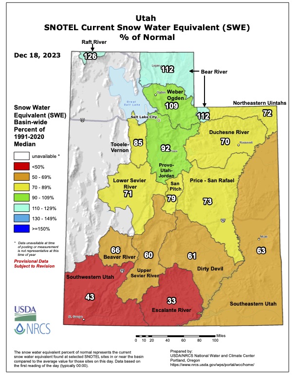
Forecast for the Ogden Area Mountains

Drew Hardesty
Issued by Drew Hardesty for
Tuesday, December 19, 2023
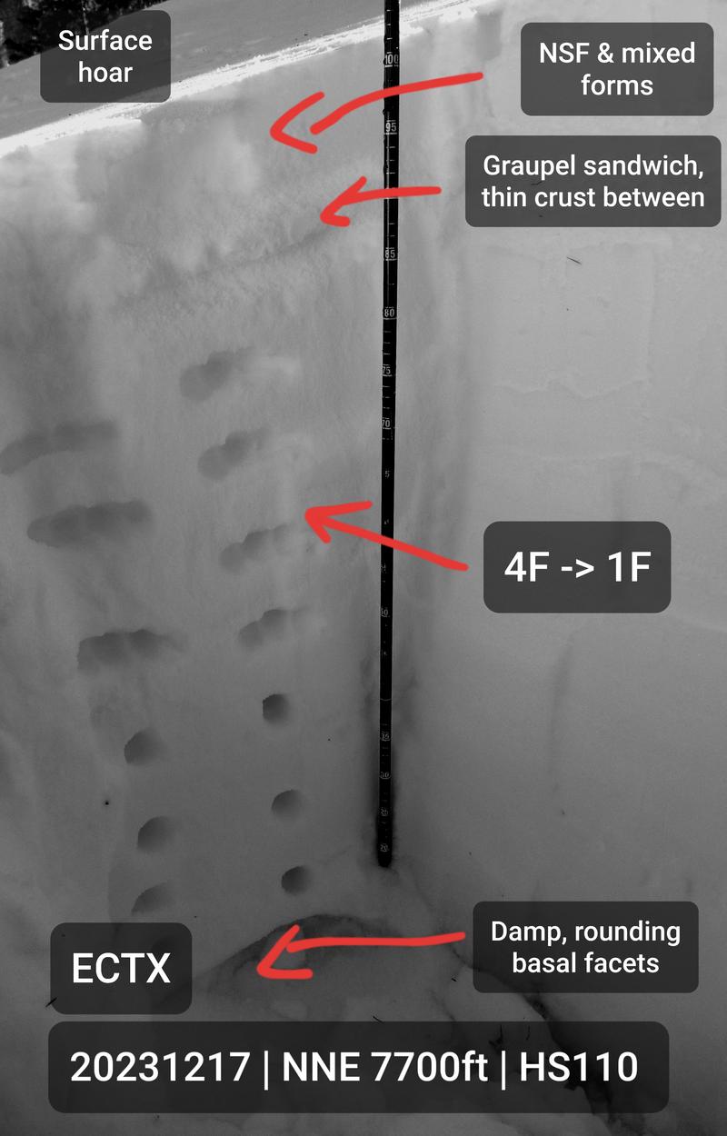
The overall avalanche danger is LOW. If you're traveling along the ridgelines, look for isolated shallow soft slabs of wind drifted snow. Wet loose avalanches should also remain on your radar in damp or punchy, unsupportable areas that received another poor refreeze. Remember that risk is inherent in mountain travel.
Low
Moderate
Considerable
High
Extreme
Learn how to read the forecast here
Weather and Snow
As of 5am, skies are mostly cloudy. Mountain temps are in the mid to upper-30s. Winds remain from the southwest, blowing 20-25mph. The most exposed anemometers have gusts to 45. The snowpack absorbed quite a bit of heat yesterday and even the northerly aspects will have a zipper crust this morning into the mid-elevations. It's becoming a snowpack that only a mother could love.
A very weak ripple in the southerly flow will bring clouds and some slight precipitation today. Winds should diminish over the course of the day. Temps will be in the upper 30s to mid-40s. All eyes are on Saturday's cold front that should bring a brief return to winter and put the dagger in the heart of the urban smog.

Even though it hasn't snowed in awhile, the overall snow-water-equivalent map for northern Utah is pretty darn good. The early December storm that brought 2.5-5.5" of snow-water-equivalent really saved the day.
Recent Avalanches
Ski areas reported triggering shallow new soft slabs of wind drifted snow in the higher elevations yesterday.
Ad
Avalanche Problem #1
Persistent Weak Layer
Type
Location
Likelihood
Size
Description
Our conditionally unstable snowpack with poor structure near the base of the pack has gone dormant for the time being. Derek DeBruin was up on the Cutler Ridge Sunday and his excellent observation can be found HERE>. You can see his photo of the overall snow structure on a north facing slope at 7700' below.
General Announcements
This information does not apply to developed ski areas or highways where avalanche control is normally done. This forecast is from the U.S.D.A. Forest Service, which is solely responsible for its content. This forecast describes general avalanche conditions and local variations always occur.