

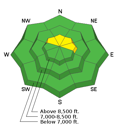
Forecast for the Ogden Area Mountains

Issued by Trent Meisenheimer on
Sunday morning, December 16, 2018
Sunday morning, December 16, 2018
The avalanche hazard is Moderate for Wind Drifted Snow. Overnight, southerly winds have formed fresh drifts of wind blown snow & wind slabs. These wind slabs will be most widespread along the upper elevation northerly ridge lines. Otherwise the hazard is Low.
Low
Moderate
Considerable
High
Extreme
Learn how to read the forecast here
 Special Announcements
The new UAC IOS mobile app is now available on the app store. Check out the new "My Weather" feature.
Snowbasin is currently closed to uphill travel. Please review their update uphill travel policy.
Check out the new free online avalanche course series developed by the Utah Avalanche Center. This is a great way to refresh your skills or prepare you for a Backcountry 101 or Level 1 class.
 Weather and Snow
Today, we will see a few high clouds along with warm and breezy conditions in the mountains as a storm approaches the west coast. Unfortunately, this storm splits as it moves overhead Utah on Monday. The storm may deliver a few inches of new snow on Monday if the northern piece sags far enough south. Southerly winds once again picked up last night around 11:00 pm and are currently blowing 20-25 mph gusting into the 30's & 40's across the high elevation terrain. Mid elevation winds are 15-20 mph gusting into the low 30's. If the valley haze and pollution isn't enough to convince you we are under a strong inversion the Temperatures should - the top of Ben Lomond (7,688') current temp is 39°F while Ben Lomond Trail (5,971') is 25°F. Usually, temperatures cool with height, but in this case we have warmer (more buoyant) air over colder (more dense) air that gets trapped in the valleys.
Coverage is decent, with total snow depths of 2 to 3 feet. Riding and turning conditions really took a hit by the southerly overnight winds on Friday. Most of the terrain has been wind damaged and only the most sheltered, shady, slopes have soft settled powder. Sunny slopes will support a melt freeze crust this morning that may or may not soften with today's heating.
 Recent Avalanches
There was a natural avalanche spotted on the apron of Mount Ogden that was reported by Snowbasin snow safety yesterday afternoon. It was not large enough to bury a person. Check out the all the recent Ogden area observations seen below HERE.

Avalanche Problem #1
Wind Drifted Snow
Type
Location

Likelihood
Size
Description
Overnight, the southerly winds picked up again and I am always shocked how the wind can find snow to drift, especially along the high ridge lines. Look for clues you’re in the wind zone, such as an eroded patterned snow surface or new cornices and rounded, smooth drifts. These new wind slabs, or drifts, will be on the lee sides of ridge crests and around terrain features, like gully walls and sub ridges, especially at the upper elevations. Avoid areas where the wind has drifted the snow into new wind slabs.
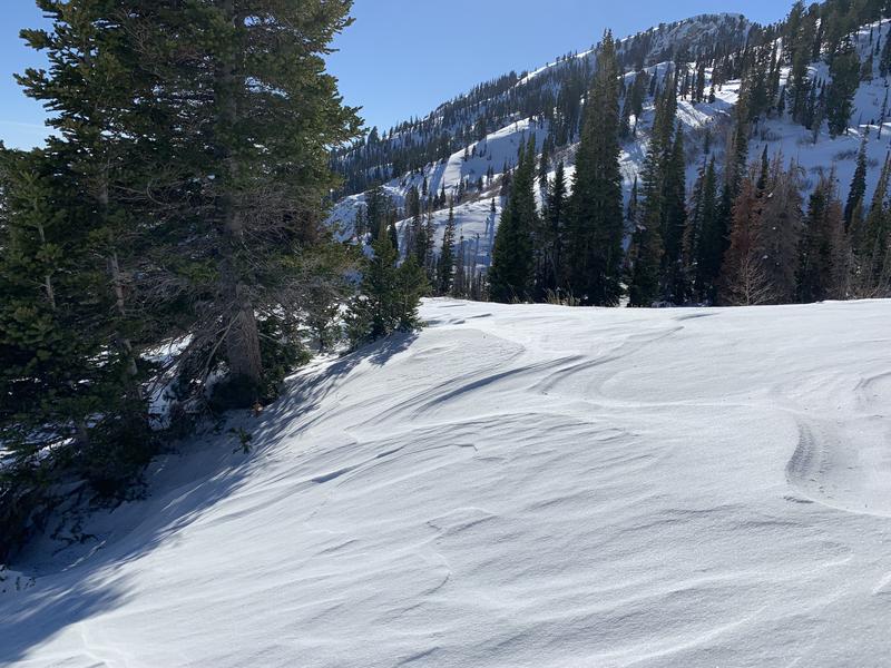
Photo: wind scoured surface. Ogden area mountains.
Additional Information
Help us verify our forecasts and let us know what you see out and about in the backcountry. Trigger an avalanche? Hear a whumph? Submitting observations is easy. Click on Observations and Avalanches in the menu bar at the top or from the convenience of your smartphone. Drew Hardesty will run you through the smartphone observation in this video. Super easy!
General Announcements
This information does not apply to developed ski areas or highways where avalanche control is normally done. This forecast is from the U.S.D.A. Forest Service, which is solely responsible for its content. This forecast describes general avalanche conditions and local variations always occur.