

Forecast for the Ogden Area Mountains

Issued by Evelyn Lees on
Saturday morning, December 15, 2018
Saturday morning, December 15, 2018
The avalanche hazard is Moderate for new wind drifts that formed overnight from the strong, southerly winds. These will be most widespread along the upper elevation ridge lines. Also, stay back from the edges of the cornices draped along some of upper elevation ridge lines.
Otherwise the hazard is Low.
Low
Moderate
Considerable
High
Extreme
Learn how to read the forecast here
 Special Announcements
The new UAC IOS mobile app is now available on the app store. Check out the new "My Weather" feature.
Snowbasin is currently closed to uphill travel. Please review their update uphill travel policy.
Check out the new free online avalanche course series developed by the Utah Avalanche Center. This is a great way to refresh your skills or prepare you for a Backcountry 101 or Level 1 class.
 Weather and Snow
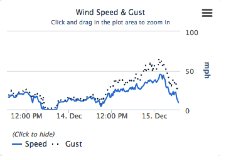
Skies are clear, and it’s downright balmy this morning, with temperatures mostly in the mid 20s to mid 30s. Though I don't like the 40 degree reading at the Ben Lomond trail head!! The southerly winds got going late afternoon and peaked overnight, with ridge lines averaging 25 to 35 mph, gusting in the 50s. With speeds now on a downward trend, lots of sun and temperatures warming into the low to mid 30s, it’s going to be a very pleasant day in the mountains.
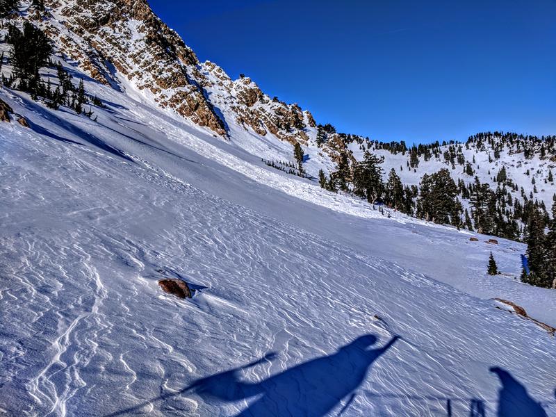
Coverage is decent, with total snow depths of 2 to 3 feet. Sunny slopes will be very crusty early, softening later, and there is dense, creamy powder on the shady slopes.
After the overnight increase in wind speed, winds are decreasing!! Top of Strawberry, Snowbasin, 9200'.
 Recent Avalanches
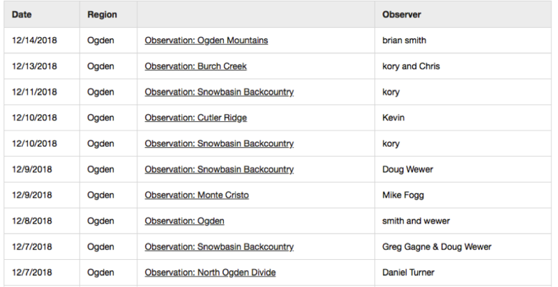
No new avalanches reported from the Ogden area backcountry. The resorts reported that the cornices are getting less sensitive. Check out the all the recent Ogden area observations seen below HERE.

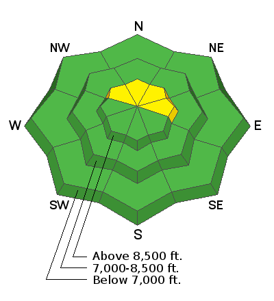
Avalanche Problem #1
Wind Drifted Snow
Type
Location
Likelihood
Size
Description
Overnight, the southerly winds drifted snow, especially along the high ridge lines. Look for clues you’re in the wind zone, such as an eroded patterned snow surface or new cornices and rounded, smooth drifts. These new wind slabs, or drifts, will be on the lee sides of ridge crests and around terrain features, like gully walls and sub ridges, especially at the upper elevations.
Continue to avoid travel on or below cornices along the upper elevation ridges, where they may break back further than expected.
Clues recent wind erosion pattern (Kory Davis photo) and a cornice (Mark White photo)

Additional Information
Help us verify our forecasts and let us know what you see out and about in the backcountry. Trigger an avalanche? Hear a whumph? Submitting observations is easy. Click on Observations and Avalanches in the menu bar at the top or from the convenience of your smartphone. I'll run you through the smartphone observation in the video below.
General Announcements
This information does not apply to developed ski areas or highways where avalanche control is normally done. This forecast is from the U.S.D.A. Forest Service, which is solely responsible for its content. This forecast describes general avalanche conditions and local variations always occur.