

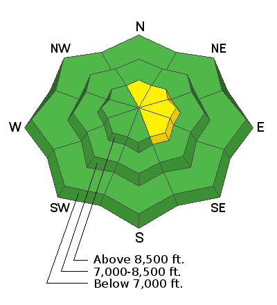
Forecast for the Ogden Area Mountains

Issued by Evelyn Lees on
Friday morning, December 14, 2018
Friday morning, December 14, 2018
The avalanche hazard is Moderate for new soft wind drifts that may form as the afternoon winds pick up. It may still be possible to trigger a few of the old, harder wind drifts and stay way back from the edges of the large, sensitive cornices draped along some of upper elevation ridge lines.
Otherwise the hazard is Low.
Low
Moderate
Considerable
High
Extreme
Learn how to read the forecast here
 Special Announcements
The new UAC IOS mobile app is now available on the app store. Check out the new "My Weather" feature.
Snowbasin is currently closed to uphill travel. Please review their update uphill travel policy.
Check out the new free online avalanche course series developed by the Utah Avalanche Center. This is a great way to refresh your skills or prepare you for a Backcountry 101 or Level 1 class.
 Weather and Snow
Under mostly clear skies, with just a few clouds, mountain temperatures are a pleasant 10 to 15 degrees warmer than yesterday morning, in the upper teens to upper 20s. Westerly winds are light, averaging 5 to 10 mph at the mid elevations, with gusts to 20 mph across the highest peaks. Temperatures, winds and clouds will all increase this afternoon, with highs near 40°F at 8,000’ and 30°F along the high ridge lines, and southwesterly winds averaging 15 to 25 mph, with gusts to 40 mph at the high elevations. Wednesday’s 2 to 5" of new snow was appreciated, with reports of improved turning and riding conditions, especially in gullies and lower angle terrain.
 Recent Avalanches
At the resorts, a few small avalanches were triggered with explosives in upper elevation, rocky terrain.
We greatly value of community of observers from the Ogden mountains, and we want to hear about what you're seeing! At the bottom of this forecast page we provide a short video illustrating how you can send us your valuable snow and avalanche observations.

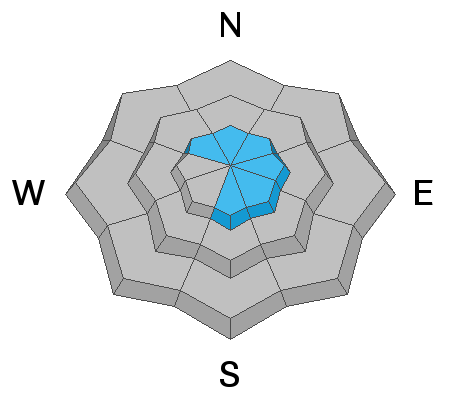
Avalanche Problem #1
Wind Drifted Snow
Type
Location
Likelihood
Size
Description
A few of Wednesday’s wind drifts and cornices can still be triggered. Smooth and rounded, the drifts are mostly along ridges and sub ridges. This afternoon’s increasing wind speeds could drift snow into new shallow, soft slabs on the lee sides of ridge crests and terrain features, especially at the upper elevations and those with an easterly component.
Also watch for large, sensitive cornices along the upper elevation ridges, where they may break back further than expected.
Additional Information
Help us verify our forecasts and let us know what you see out and about in the backcountry. Trigger an avalanche? Hear a whumph? Submitting observations is easy. Click on Observations and Avalanches in the menu bar at the top or from the convenience of your smartphone. I'll run you through the smartphone observation in the video below.
General Announcements
This information does not apply to developed ski areas or highways where avalanche control is normally done. This forecast is from the U.S.D.A. Forest Service, which is solely responsible for its content. This forecast describes general avalanche conditions and local variations always occur.