


Forecast for the Ogden Area Mountains

Issued by Drew Hardesty on
Monday morning, December 17, 2018
Monday morning, December 17, 2018
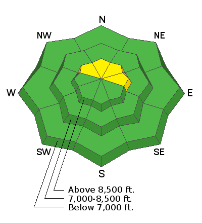
The avalanche danger is mostly LOW but for isolated pockets of MODERATE for both old and developing wind slabs in upper elevations. Look for and avoid any smooth, rounded, pillowy snow feature. These may be hard wind slabs and stubborn but not impossible to release. Cornices should be given a wide berth.
Low
Moderate
Considerable
High
Extreme
Learn how to read the forecast here
 Special Announcements
The new UAC IOS mobile app is now available on the app store. Check out the new "My Weather" feature.
Snowbasin is currently closed to uphill travel. Please review their update uphill travel policy.
Check out the new free online avalanche course series developed by the Utah Avalanche Center. This is a great way to refresh your skills or prepare you for a Backcountry 101 or Level 1 class.
 Weather and Snow
We'll have increasing clouds as a weak, splitting storm moves through today. We may see a trace to an inch or two if we're lucky, but at least we'll see some wind. The winds have already backed to the south and southeast overnight and are blowing 15-20mph in representative terrain off the ridgelines. Along the Ogden skyline, the south to southwest winds are cranking 35-40 with gusts to 45. Temps are balmy in the mid to upper 30s. Soft settled powder is more hunt and peck these days with plenty of sun and wind crust across the landscape.
 Recent Avalanches
Three large natural cornice fall were noted along the Ogden skyline and mostly attributed to the incessant winds and infernal heat. As always, be aware of traveling above and beneath these yawning whales littered along the ridgelines.

Avalanche Problem #1
Wind Drifted Snow
Type
Location
Likelihood
Size
Description
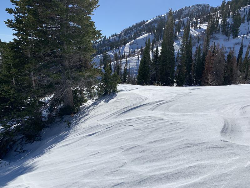
Overnight, the southerly winds picked up again and I am always shocked how the wind can find snow to drift, especially along the high ridge lines. Look for clues you’re in the wind zone, such as an eroded patterned snow surface or new cornices and rounded, smooth drifts. These new wind slabs, or drifts, will be on the lee sides of ridge crests and around terrain features, like gully walls and sub ridges, especially at the upper elevations. Avoid areas where the wind has drifted the snow into new wind slabs. Recent reports from the Ogden mountains found here.
Photo: wind scoured surface. Ogden area mountains.
Additional Information
A couple weak weather systems - today, tomorrow night, and again on Friday but not much in the way of snow. Clearing for late Wed/Thursday with ridgeline temps skyrocketing to the low 40s. Maybe some storms on or just before Christmas.
General Announcements
This information does not apply to developed ski areas or highways where avalanche control is normally done. This forecast is from the U.S.D.A. Forest Service, which is solely responsible for its content. This forecast describes general avalanche conditions and local variations always occur.