Forecast for the Ogden Area Mountains

Drew Hardesty
Issued by Drew Hardesty on
Monday morning, January 27, 2020
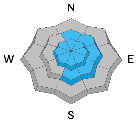
A MODERATE danger exists at the mid and upper elevations primarily for new and developing soft slabs of wind drifted snow. Human triggered avalanches are possible on wind drifted slopes. Areas of Moderate also exist in non-wind drifted terrain for new snow instabilities.
Low
Moderate
Considerable
High
Extreme
Learn how to read the forecast here
Special Announcements
NEW UAC Podcast: The Art of Storytelling Through Film - A Conversation with Trent Meisenheimer check it out HERE.
NEW UAC BLOG: The Anthropology of Risk - How Did We Get Here? Find it HERE.
Weather and Snow
Storm totals so far are about 5-7" (0.41"+) up high with 3" noted at the trailheads. Winds are from the west-northwest, blowing 15-20mph. Temps have cooled into the mid-20s. Riding conditions will be vastly improved. The storm should wind down soon and turn more showery if it has not already. Winds should remain moderate from the northwest.

Looking down the road, we'll stay cool and unsettled with another minor storm slated for tomorrow night into Wednesday with sunny skies and warm temps expected for the weekend.
Did I mention warm? Weekend ridgetop temps may reach into the mid-40s. It is February by then, after all. The heat wave should be brief; however, the models do bring a strong cold front on Monday.
Recent Avalanches
No significant activity reported from the backcountry.
Derek DeBruin and Nikki each had excellent reports from the backcountry yesterday.
Ad
Avalanche Problem #1
Wind Drifted Snow
Type
Location
Likelihood
Size
Description
Sensitive slabs of wind drifted snow will be encountered along the mid- to higher elevations and to the lee of terrain features such as ridgelines, sub-ridges, scoops and rocky outcrops. They'll be more prominent on terrain with an easterly component and may present as smooth, rippled and pillowy. Shooting cracks will be evident in wind drifted terrain. Winds are forecast to remain strong enough from the northwest to continue drifting snow over the course of the day (15-20mph).
Cornices: Many ridgelines now have large and overhanging cornices. As you travel along ridgelines be sure to give cornices a wide berth as they typically break much further back than expected.
TREND: Steady
Avalanche Problem #2
New Snow
Type
Location
Likelihood
Size
Description
These new snow avalanches have a number of crusts to run upon and may allow for larger debris piles, particularly in steep walled gullies and dramatic transitions in terrain (steep to quickly flat). Quick hand shears and test slopes will give a good indication on this avalanche problem is behaving.
TREND: Decreasing danger
General Announcements
This information does not apply to developed ski areas or highways where avalanche control is normally done. This forecast is from the U.S.D.A. Forest Service, which is solely responsible for its content. This forecast describes general avalanche conditions and local variations always occur.