Forecast for the Ogden Area Mountains

Greg Gagne
Issued by Greg Gagne on
Friday morning, January 24, 2020
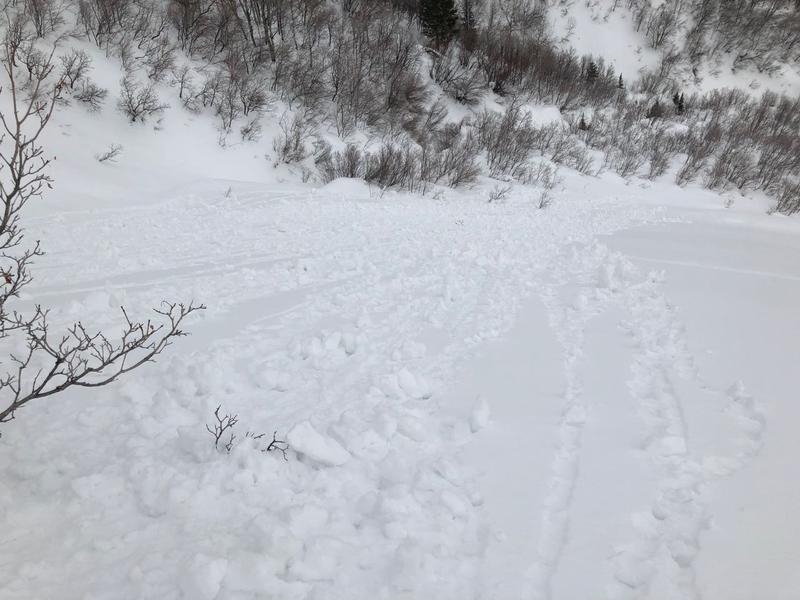
Avalanche conditions are generally safe and the avalanche danger is LOW. Regardless, mountain travel has risks, so still watch for (1) wet, loose snow at lower elevations, (2) fresh wind drifts and large cornices at the upper elevations.
Low
Moderate
Considerable
High
Extreme
Learn how to read the forecast here
Special Announcements
We are very sad to report an avalanche fatality from Saturday above Farmington Canyon. An 18-year-old male snowmobiler was caught, fully buried and killed. The final report is available HERE. Our deepest condolences go out to the friends, family, rescuers, and everyone affected by this tragic accident.

Are you looking to improve your avalanche skills? We are offering a Backcountry 101: Introduction to Avalanches class at Powder Mountain February 14-15. (Link)
Weather and Snow
Currently, temperatures in the Ogden mountains range through the 20's F. Winds are out of the southwest and light, gusting in the teens along the uppermost ridgelines. A period of riming occurred on many surfaces during the day on Thursday, with a trace to 1" of new snow.
For today, temperatures will rise into the 20's and 30's and we can expect 2-3" of new snowfall this afternoon. Winds will still be light, gusting into the low to mid teens at the upper elevations.
This weekend - Dirty ridging in place with periods of mid and high clouds. Winds will remain light and temperatures mild, generally in the 20's. Another weak system expected later on Sunday.
Recent Avalanches
Ogden-area resorts reported reactive soft slabs at the upper elevations. The snow became damp below about 8,000' with loose, wet rollerballs reported.
Ad
Avalanche Problem #1
Normal Caution
Type
Location
Likelihood
Size
Description
The avalanche hazard is Low in the Ogden mountains, but there are a few concerns to watch for:
- If greenhousing occurs, expect small, wet loose avalanches at the lower elevations.
- Small soft slabs of recent wind drifts may still be reactive at the upper elevations.
- Cornices have grown quite large and may be sensitive as you approach them. These large cornices often break much further back than expected, so be sure to give them a wide berth when traveling along the exposed ridgelines.
- New snow this afternoon should bond well to the existing snow surface, but loose sluffing in storm snow may be possible during any period of higher precipitation.
General Announcements
This information does not apply to developed ski areas or highways where avalanche control is normally done. This forecast is from the U.S.D.A. Forest Service, which is solely responsible for its content. This forecast describes general avalanche conditions and local variations always occur.