Avalanche Warning
The avalanche danger for the warning area is HIGH for the mountains of northern and central Utah and southeast Idaho, which includes the Wasatch Range...the Bear River Range...Uinta Mountains...Manti-Skyline plateau...and the mountains of southwestern Utah.
Strong winds and heavy snowfall have created dangerous avalanche conditions. Avalanches failing on a widespread persistent weak layer buried under the new snow are very likely. Avoid all avalanche terrain.
This avalanche warning is in effect from through Tuesday at 6:00am.
Skies are mostly cloudy. Mountain temperatures are in the upper teens to low 20s. Winds are from the west-northwest, blowing 20-30mph with gusts to 60.
Storm totals so far: (snow/snow-water-equivalent)
- LCC: 85"/6.75" SWE
- BCC: 66"/5.45" SWE
- PC: 50"/4.4" SWE
- Ogden: 50-70"/4.5-5.5" SWE
- Provo: 60"/5.69" SWE
For today, we'll have mostly cloudy skies with temps in the 20s. Winds will blow from the northwest 20-30mph. We will get a bit of a break tomorrow ahead of another storm for Wednesday. Another potentially significant storm is on tap for the weekend.
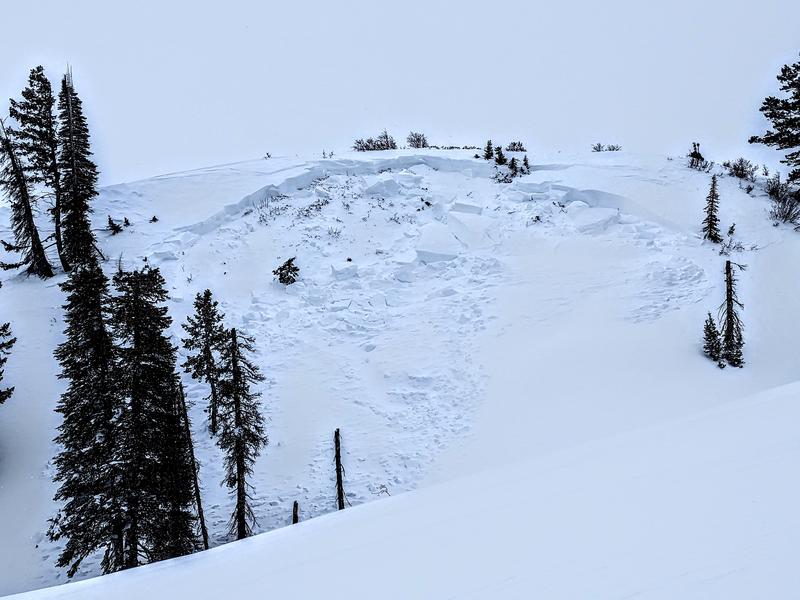
Large and destructive natural avalanches roared down Saturday night into early Sunday with periods of natural avalanches running yesterday mid-morning. Many of these avalanches were 2-4'+ deep and hundreds of feet wide and noted on a variety of aspects and elevations. Winds and avalanche conditions were so extreme that some roads and operations struggled to open if they opened at all.
Many old-timers are scratching their heads, wondering if they have ever seen an avalanche "here" or "there". The takehome is that avalanches are occurring in unusual terrain.
Avalanches were running within the new snow, avalanches were failing on the December layer of facets. Some have even stepped down to near the ground.
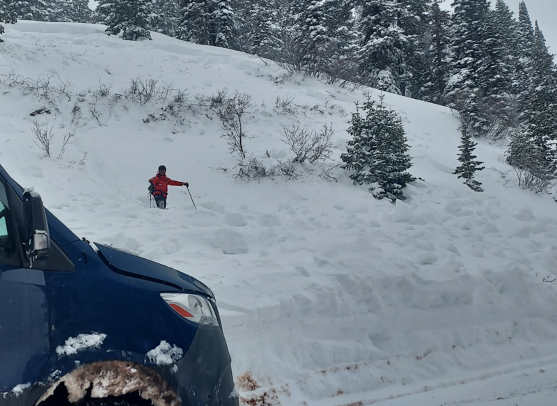
Since Friday, we have heard about two full avalanche burials (Main Porter, American Fork) with rumors of a third; all recovered by partners or bystanders. We've also heard of many more skiers and riders being caught and carried; again with a good outcome. Tragically, a skier was killed in an avalanche in Wyoming yesterday (
Details).
Thanks to the many observers who sent us photos of activity yesterday in the north fork toward Ben Lomond - some below -
photo:c lech
Be sure to check all the avalanche activity
HERE