Forecast for the Ogden Area Mountains

Monday morning, January 5, 2026
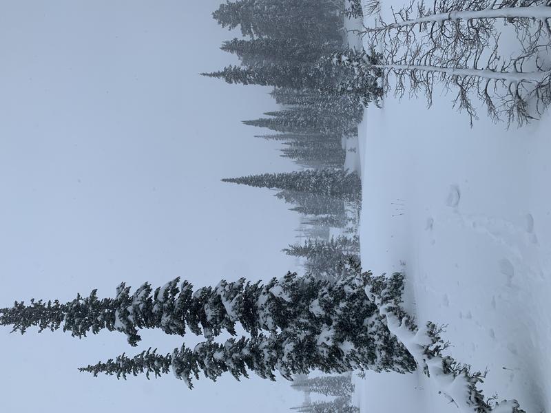
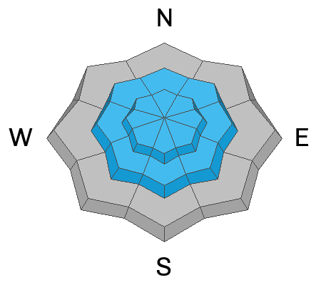
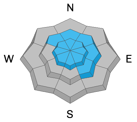
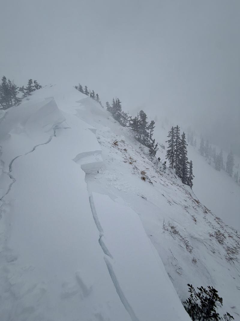
The avalanche danger is CONSIDERABLE at the upper elevations and on northerly-facing slopes at the mid elevations where human-triggered avalanches are likely. Avalanches may fail one to two feet deep within the storm slab of new and wind-drifted snow, but also may step down to deeper weak layers buried over three feet deep on northerly-facing slopes at the upper elevations.
Fortunately, this dense snow is supportable and provides excellent travel and riding conditions on lower-angled (less than 30° in steepness) slopes.
Remember: If you are ducking ropes or stepping out of bounds at a ski area, you are stepping into potentially dangerous avalanche conditions. It’s worth noting that Utah leads the nation in avalanche fatalities where riders have exited the ski area boundaries and never made it home.