Forecast for the Moab Area Mountains

Eric Trenbeath
Issued by Eric Trenbeath for
Saturday, April 9, 2022
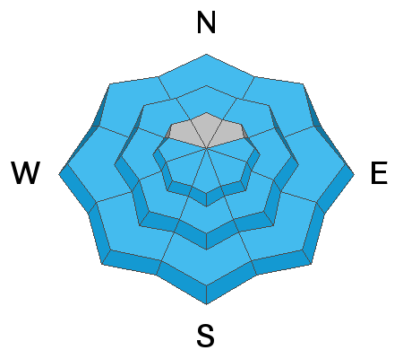
The avalanche danger starts out LOW this morning but will rise to MODERATE as the day heats up. Be alert to signs of loose, wet instability such as rollerballs and pinwheels, and get off of and out from under steep slopes when they become wet and sloppy.
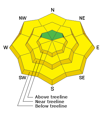
Low
Moderate
Considerable
High
Extreme
Learn how to read the forecast here
Special Announcements
Road Conditions: The road is down to dry, bare dirt.
Grooming: Done for the season.
Weather and Snow
24 Hour Snow 0" 72 Hour Snow 0" Base Depth at Gold Basin 48" Wind SW 15-20 G30 Temp 36F
Winds shifted to the SW overnight and have been on the increase since about 1:00 a.m. Today look for clear skies this morning with increasing clouds later today as broad low pressure trough clips by to the north. Pre-frontal SW winds will blow in the 25-35 mph range and high temps at 10,000' will be near 50 degrees. Temps tonight will drop into the upper teens, and Sunday will be mostly to partly sunny with cooler temperatures and breezy NW winds. An unsettled pattern is setting up for the week with a likely shot of snow on Tuesday.
Snowpack
Temps did not drop below freezing last night but with clear skies there should still be a surface re-freeze and a narrow corn window this morning. Work slopes according to the sun riding SE aspects first, and finish up on SW by about noon. NW winds mid week did a number on the snow surface in the high country and northerly aspects are crusted over and remain in a transitional state. There are also a few scattered, shallow wind slabs up there that you'll want to keep an eye out for. Visiting CAIC forecaster Dylan Craaybeek noted some of these up on Little Tuk on Thursday, and he sent in this observation.
Gold Basin SNOTEL site (10,000')
Storm Totals in Gold Basin
Wind Station on Pre Laurel Peak (11,700')
Ad
Avalanche Problem #1
Wet Snow
Type
Location
Likelihood
Size
Description
As the day heats up, the likelihood for loose, wet avalanches will increase. In our travels on Friday, we observed only minor activity, but without a solid re-freeze last night and warmer temps today, we may see a little more action. Be alert to signs of instability such as roller balls, and pinwheels, and get off of and out from under steeps slopes if they become wet and sloppy. Work aspects according to the sun. Get in early and plan on being off of steep terrain other than high north by around noon.
Avalanche Problem #2
Normal Caution
Type
Location
Likelihood
Size
Description
Beyond the predictable and manageable effects of daytime heating and loose, wet snow avalanches, the danger is generally low. But low danger doesn't mean no danger and the La Sals are a big little mountain range where even a small avalanche could have serious consequences in the wrong terrain. As you branch out into the high country and take on bigger objectives, here are a couple of other things to keep in mind:
  • Isolated, unstable wind slabs may still exist in upper elevation, wind exposed terrain. Remain on the lookout for unstable areas of wind drifted snow, especially in consequential terrain where even a small triggered wind slab could carry you over a cliff. Wind slabs are recognizable by their smooth rounded appearance and they may sound hollow underneath.
  • A persistent weak layer of faceted snow still exists on northerly aspects. This weak layer is largely non-reactive however, it could still pose a threat in areas of extreme terrain right around treeline. Minimize your exposure to this problem by avoiding sparsely wooded, steep, rocky, radical terrain right around treeline.
Minimize your risk by continuing to observe safe travel techniques. Maintain awareness of the terrain and only expose one person to danger at a time.
General Announcements
Who's up for some free avalanche training? Get a refresher, become better prepared for an upcoming avalanche class, or just boost your skills. Go to https://learn.kbyg.org/ and scroll down to Step 2 for a series of interactive online avalanche courses produced by the UAC.
This forecast is from the U.S.D.A. Forest Service, which is solely responsible for its content. This forecast describes general avalanche conditions and local variations always occur.