Forecast for the Moab Area Mountains

Dave Garcia
Issued by Dave Garcia for
Tuesday, March 26, 2024
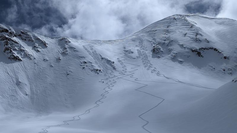
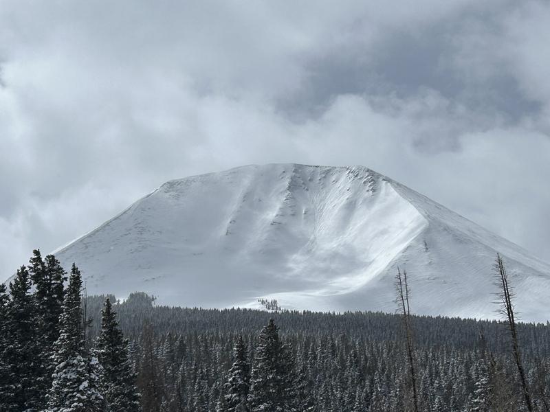
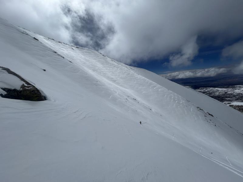
Most slopes offer a LOW avalanche danger today. A MODERATE danger is found above treeline, where recently deposited slabs of wind-drifted snow exist. These slabs will be sensitive to the weight of skiers and riders. If are looking to ski in the alpine, you need to be able to recognize and avoid these fat, pillowy, wavy-looking deposits of wind-drifted snow.
Low
Moderate
Considerable
High
Extreme
Learn how to read the forecast here
Special Announcements
Road Conditions: The Geyser Pass Road will be closed for plowing this morning.
Grooming: Trails are buried by the new snow.

Support the UAC website backend platform rebuild to ensure the ongoing security of the website and the data stored on the site rebuild by donating to our spring campaign. Save lives by making a donation today! HERE
Weather and Snow
6:00 a.m. Snow and Weather Data
24 Hour Snow 0" 72 Hour Snow 13" Season Total Snow 181" Depth at Gold Basin 68"
Winds on Pre-Laurel Peak: Light WNW Temp 15° F Percent of Normal: 130%

Weather
Light snow showers are tracking across the Northern and central portions of Western Colorado and Northeast Utah early this morning as a weak shortwave passes through. Today will be mostly cloudy with scattered snow showers, with a better chance for snow later in the day. Little to no accumulation is expected. High temperatures will reach 20 degrees and winds will blow out of the WNW at 10-15 mph this morning, and will increase to 15-20 mph this afternoon. This shortwave will leave our area tonight, and Wednesday will be sunny with highs in the low 20's. The end of the week will see slowly warming temperatures, with gusty SW winds expected. There is another system on the horizon bringing more precipitation Sunday into Monday.
General Conditions
Our weather instruments had a slight lag yesterday morning, and I under-reported snow totals. Storm totals from Sunday morning to Monday morning are 13" of snow at 1.2" SWE. The skiing and riding yesterday was 5 stars and as good as its been all season. The mountains took on a healthy dose of strong March sunshine, and solar aspects will have a crust this morning. Seek out Northerly aspects for deep, in your face powder conditions. Multiple parties got into big terrain yesterday. There is a window for getting on big alpine lines, but it is not full green light conditions. Recently deposited slabs of wind-drifted snow exist in alpine terrain. You need to be able to identify and avoid these fat, round pillows of drifted snow if you are poking around in the alpine. The predominant wind direction has been from the NW since Sunday morning. In my recent travels I have been observing deep drifts on the leeward sides of ridges and subtle terrain features in the alpine. Charlie has a good write-up of our travels on Haystack Mt. yesterday, where we found a deep and stable snowpack, and diligently avoided slabs of wind-drifted snow.
This photo is a great example of the recent loading pattern. The skin track and ski tracks thread the needle, and avoid some obvious slabs of wind-drifted snow.
Snowpack and Weather Data
Gold Basin Storm Stake (10,000')
Gold Basin SNOTEL site (10,000')
SNOTEL site near Geyser Pass Winter Trailhead (9600')
Wind Station on Pre-Laurel Peak (11,400')
NWS forecast for the La Sal Mountains.
Recent Avalanches
This natural avalanche on the North face of Mellenthin ran during the storm. The slide involved storm snow, but it was observed from a distance, and hard to say whether it was a natural storm slab avalanche or if it involved wind-drifted snow.
Ad
Avalanche Problem #1
Wind Drifted Snow
Type
Location
Likelihood
Size
Description
Since Sunday morning, winds have been out of the NW, and we have observed recently deposited slabs of wind-drifted snow on many slopes above treeline. Some of these wind slabs are 18-24" deep. You can find these drifts on all aspects, even South. Southerly aspects have been top-loaded, while Northerly aspects have been cross-loaded. Sustained Northwest winds are somewhat abnormal for the La Sals, and expect to find drifts in unusual places. The bulls-eye location for this problem seems to be NE-E-SE.
A note about near-treeline terrain: recent wind-drifted snow is not widespread near the treeline, but some of our near-treeline terrain behaves like alpine terrain, meaning it is subjected to the same loading patterns. If you are getting into big, steep, open slopes near the treeline, continue to be on the lookout for wind-drifted snow.
In the photo below, you can see some wind-loaded slopes in the background behind the skier. The skier is using a subtle aspect change to avoid the wind drifts. Aspect is key right now.
Additional Information
Want some more insight into the La Sal Mountains as well as the communal impacts of a tragic avalanche? Check out the latest UAC podcast with forecaster Eric Trenbeath where he discusses the range, it's often treacherous snowpack, and how the devastating avalanche in February, 1992, affected the Moab community.
Our avalanche beacon checker sign and beacon training park are up and running. A huge thanks to Talking Mountain Yurts for sponsoring those this season!
Sign up for forecast region-specific text message alerts. You will receive messages about changing avalanche conditions, watches, warnings and road plowing closures.
Follow us on Instagram @utavy_moab
General Announcements
This forecast is from the U.S.D.A. Forest Service, which is solely responsible for its content. This forecast describes general avalanche conditions and local variations always occur.