Forecast for the Moab Area Mountains
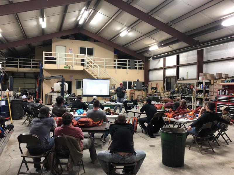
Eric Trenbeath
Issued by Eric Trenbeath for
Saturday, March 23, 2019
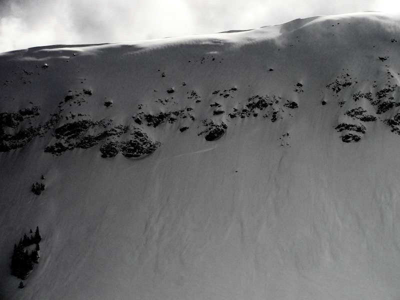
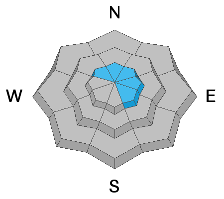
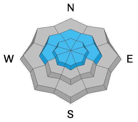
The avalanche danger is MODERATE and human triggered avalanches involving new and wind drifted snow are possible. Steep, upper elevation, wind drifted slopes that face NW-N-SE are where you are most likely to encounter a problem. The new snow will also be very susceptible to daytime heating if the sun comes out for any length of time today. Look for signs of wet instability on sun exposed slopes such as roller balls and pinwheels, and get off of steep slopes if they become wet and sloppy. There also remains an isolated, or MODERATE danger for triggering a deep avalanche, failing on a buried persistent weak layer. Though the likelihood of triggering this type of avalanche has lessened, the consequences have not, and this type of avalanche is un-survivable. The problem exists primarily on steep slopes facing NW-N-E, but in some cases, it may be found on all aspects of the compass, particularly at upper elevations.
Low
Moderate
Considerable
High
Extreme
Learn how to read the forecast here
Special Announcements
The road to Geyser Pass Trailhead, and the Upper Two Mile Road have not been plowed. Access is tricky with up to 8" of snow and underlying ice that will turn to mud. 4wd, and a healthy sense of adventure are required. Numerous vehicles made it yesterday.
And a big shout out to the sledders in San Juan County who are attending the Motorized Backcountry 101 Course. After sitting through a three hour classroom session, we're looking forward to a great day out in the field!
Weather and Snow
Occasional bursts of heavy snowfall yesterday added an additional 6"-8" bringing snow totals since Thursday up to about 15". SW winds yesterday blew in the 15-20 mph range with gusts to to 30 along ridge tops before tapering off and shifting to the NW in the afternoon. Unfortunately all of our wind stations are down this morning, but region wide winds are averaging 10-15 mph from the WNW, with gusts into the 20's. 10, 000' temps are in the mid 20's. Today look for partly sunny skies, high temps at 10,000' in the mid 30's, and light to moderate NW winds shifting back to the SW by afternoon.
We found excellent riding conditions on the east side of the range with over the hood powder, as well as opportunities for getting stuck. At lower elevations the snow was quite moist by later in the day, but at mid and upper elevations, snow quality remained excellent. This time of year good snow doesn't last long, so get out and get it while the gettin is good!
New snow totals in Gold Basin (10,000')
Snotel totals at the Geyser Pass Trailhead (9600')
Winds at 11,000 feet on Abajo Peak (11,330') about 45 miles south.
National Weather Service point forecast.
Recent Avalanches
In our travels yesterday we observed numerous natural soft slab avalanches involving new and wind drifted snow. These appeared to average between 12"-18" deep, and were occurring on upper elevation slopes facing primarily N-NE-E. Michael Janulaitis was out and about yesterday and noticed similar activity. Read his observation here.
We observed numerous soft slab avalanches within the new snow such as the ones in this photo submitted by Michael Janulaitis.
You can also see a comprehensive of list of avalanches this season here.
Ad
Avalanche Problem #1
Wind Drifted Snow
Type
Location
Likelihood
Size
Description
Winds haven't been too out of hand but they have blown enough to drift some snow. Expect to find recently formed wind drifts 12"-18" deep on the lee sides of ridge crests and terrain features in upper elevation, wind exposed terrain, primarily on slopes facing NW-N-SE. Cracking in the snow surface is sign of instability, and wind loaded slopes typically have a smooth, rounded appearance. Avoid steep slopes with recent deposits of wind drifted snow.
Avalanche Problem #2
New Snow
Type
Location
Likelihood
Size
Description
Most of the new snow instabilities will have settled out by today, but 15" is a significant amount of snow. Today it may still be possible to trigger a loose snow sluff, or cohesive soft slab within the most recent snow on steep slopes on all aspects at mid and upper elevations. The new snow will also be very susceptible to heating from the sun if it comes out for any length of time today. Look for signs of wet instability on sun exposed slopes such as roller balls and pinwheels, and get off of steep slopes if they become wet and sloppy.
Avalanche Problem #3
Persistent Weak Layer
Type
Location
Likelihood
Size
Description
Last week's storm produced a widespread avalanche cycle with slides breaking anywhere from 4'-12' deep on a persistent weak layer that has plagued us for much of the season. While we've experienced many active periods of natural activity since the new year began, this was the event that finally brought the house down. In total, 32" of snow with 3.6" of water weight was the straw that broke the proverbial camel's back. This was quite a thumping, and now, the big question is how long does it take for things to stabilize? Time and warm temperatures have certainly aided in the process. At this point, triggering a deep and dangerous avalanche has become less likely. The problem is that signs of instability will not be presenting themselves and you may be able to put one, two, or several riders on a slope before someone finds the right trigger point. And if one is found, the avalanche will be un-survivable.
Additional Information
Check out this clip of local Moab sledders playing it safe and making sure their beacons are on at the Geyser Pass Trailhead.
General Announcements
Your information can save lives. If you see anything we should know about, please help us out by submitting snow and avalanche observations HERE. You can also call me at 801-647-8896, or send me an email: [email protected].
Support the UAC through your daily shopping. When you shop at Smith's, or online at REI, Backcountry.com, Patagonia, NRS, Amazon, eBay by clicking on these links, they donate a portion of your purchase to the UAC. If you sell on eBay, you can have your See our Affiliate Page for more details on how you can support the UAC when you shop
This forecast is from the U.S.D.A. Forest Service, which is solely responsible for its content. This forecast describes general avalanche conditions and local variations always occur.