The 2021 Spring Awareness Campaign is underway. Help us save lives through avalanche forecasts and education. Consider making a donation to show your support
HERE.
The Geyser Pass Road has been plowed and is down to the dirt in most areas. Patches of ice and snow exist and it turns muddy as the day heats up. All-wheel-drive recommended.
The Lower Utah Nordic Alliance (LUNA) groomed into Gold Basin on Friday.
24 Hour Snow 0" 72 Hour Snow 2" Base Depth in Gold Basin 63" Wind NE 10-15 G23 Temp 15F
Look for mostly sunny skies with light to moderate NE winds becoming northwesterly by afternoon. High temps at 10,000' will be near 30F. A series of troughs will keep us under a cool and unsettled weather pattern for most of the week with the next one arriving tomorrow morning. Snow showers should develop sometime around noon with 2"-4" possible. This system moves on by Wed with the next one moving into the Great Basin on Thursday and eventually reaching our area sometime on Friday.
Snowpack Discussion
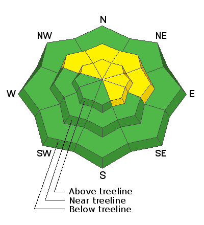
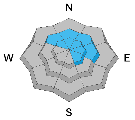
Reports from yesterday were of dust on crust conditions with a spongy layer of graupel in some areas. Time and warm temperatures have helped the snowpack adjust to the large snow load we received last weekend but it's still possible to trigger a deep and dangerous avalanche on a buried persistent weak layer of sugary, faceted snow near the ground. This weak layer exists on slopes that face NW-N-E-SE, and thin snowpack areas consisting of steep, rocky terrain are the most likely trigger points.
It's now been a week since the last avalanche cycle. Getting out and about we've observed numerous slides that ran on northerly aspects near and above treeline that failed on a buried persistent weak layer of sugary, faceted snow near the ground. Most of these avalanches occurred in rocky, shallower snowpack areas or in repeat running slide paths. The likelihood of triggering one of these slides is lessening with each day but it still remains possible.


