Forecast for the Moab Area Mountains

Dave Kelly
Issued by Dave Kelly for
Monday, March 20, 2023
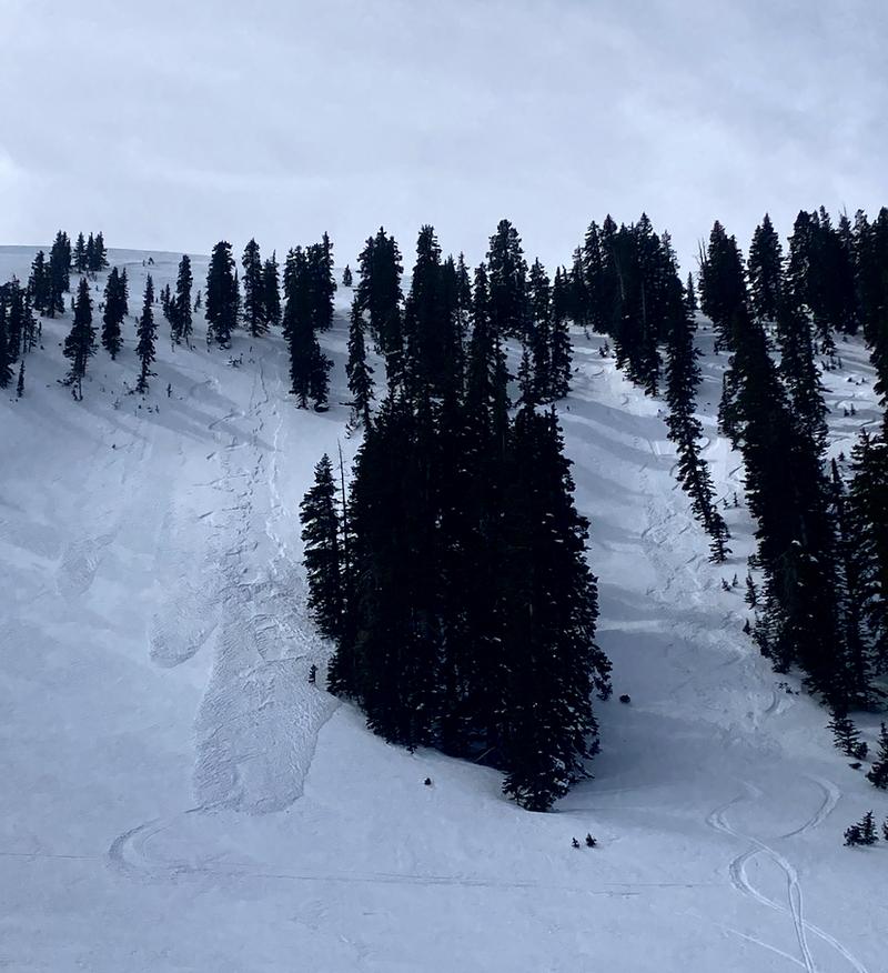
A CONSIDERABLE avalanche danger exists above treeline where human triggered avalanches are likely in new wind-drifted snow. At treeline the avalanche danger is MODERATE and below treeline the avalanche danger is generally LOW.

The primary concern for today will be wind-drifted snow avalanches up to 2' deep. This snow will be on the leeward side of ridgetops or cross-loaded across high alpine terrain. On northerly aspects, it is still possible to trigger an older deeper wind slab that will be buried under today's new snow.

The likelihood of triggering an avalanche at and below treeline on slopes over 30 degrees will rise if snowfall rates exceed the forecast.
Low
Moderate
Considerable
High
Extreme
Learn how to read the forecast here
Special Announcements
Geyser Pass Road: The road was plowed on Friday. A snowpacked surface exists up high with muddy conditions down low.
Grooming: Trails were last groomed on Friday.
Weather and Snow
6:00 a.m. Snow and Weather Data
24 Hour Snow 6" 72 Hour Snow 6" Season Total Snow 263" Base Depth at Gold Basin 92"
Winds on Pre-Laurel Peak: current winds south 25 gusting to 35 with a max gust of 45MPH Temp 15˚ F

Weather
Under snowy skies it is currently 25˚F at the Geyser Pass trailhead. The Pre-Laurel winds are currently blowing from a southerly direction 20 gusting to 30 MPH with a max gust of 45MPH from the south.

For today, we will see continued snowfall. 8-10" of snow expected and southerly winds blowing 20-30 MPH and gusting to the 40's. Expect to see temperatures from 24-28 ˚F. There is a chance of thundersnow today where snowfall rates could exceed 2" an hour, which will elevate the avalanche danger.

The first wave of the Atmospheric River is just arriving and will bring snowy weather to the region today through Wednesday. The National Weather Service has issued a Winter Storm Warning valid until midnight on Wednesday for locations over 8,000' where snowfall totals could exceed 2' of snow with 2-3" of water and strong winds.

General Conditions
Yesterday there were reports of soft snow in wind-protected areas. The southerly facing slopes were a breakable melt-freeze crust and even though it is the first day of Spring we haven't yet seen a solid melt freeze cycle and as of Saturday these sun affected slopes were not fully supportable. V. Wetter's photo shows us that the run of cold clear nights and days prior to this storm means that the snow surface has weakened and newly falling snow will not bond well to the old snow surfaces. Any new snow avalanche on steep consequential terrain could be hazard if you are pushed over a cliff or into a stand of trees.

Snowpack and Weather Data
Gold Basin Storm Stake (10,000')
Gold Basin SNOTEL site (10,000')
SNOTEL site near Geyser Pass Winter Trailhead (9600')
Wind Station on Pre-Laurel Peak (11,400')
NWS forecast for the La Sal Mountains.
Recent Avalanches
Yesterday V. Wetter reported 4" wind slabs and dry point releases on the north facing side of Horse Creek at treeline.
Ad
Avalanche Problem #1
Wind Drifted Snow
Type
Location
Likelihood
Size
Description
Areas of wind-drifted snow will be your primary concern above treeline where you will be likely to trigger avalanches 1-2' deep and increasing in size and depth as we add more new snow throughout the day.

On Saturday we found north-east winds had been blowing and drifting surface snow into stiff wind slabs at the ridgetops and starting to sculpt the surface lower on the slope. Yesterday the winds blew from a southerly direction loading high alpine slopes from the opposite direction. This means that the upper alpine terrain has been wind-affected and surface conditions will be variable.
Avalanche Problem #2
New Snow
Type
Location
Likelihood
Size
Description
With 2" of snow overnight and 8-10" of snow forecasted for today there is a possibility of riders triggering new snow avalanches in terrain over 30 degrees. The old snow surface had started to facet and the new snow won't bond well in steep terrain. It is a good day to practice sluff management when entering or traveling in any terrain over 30 degrees. Anywhere the new snow has been wind-affected expect to see deeper more sensitive avalanches.
Additional Information
Thanks to everyone who made it out the Banff Film Festival this weekend. We had an awesome turnout and a great selection of movies were shown.

Persistent Weak Layers - If you've been following along, you know we've been tracking various weak layers in the snowpack, the most prominent of which was buried by a storm on Valentine's Day. Throughout this period, the location of this weak layer was spotty, and was only occasionally reactive to stability tests. Two rounds of heavy snowfall have failed to produce avalanches on any weak layer, and we have determined they are not widespread, or reactive enough to be deemed a problem. Isolated areas with buried weak snow may still remain, primarily on northerly aspects in wind sheltered areas. You can minimize your exposure by avoiding very steep, radical terrain in these areas, and by practicing safe travel techniques.
General Announcements
This forecast is from the U.S.D.A. Forest Service, which is solely responsible for its content. This forecast describes general avalanche conditions and local variations always occur. This forecast will be updated by 7:30 tomorrow morning.