Forecast for the Moab Area Mountains

Dave Garcia
Issued by Dave Garcia for
Wednesday, March 2, 2022
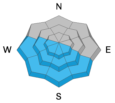
The warm sunny weather continues, and the snowpack remains dangerous. There is a slab present on a widespread weak layer of facets, and observers continue to experience frequent collapsing. The avalanche danger remains CONSIDERABLE and human triggered avalanches are likely on slopes facing W-N-SE where this weak layer exists.
Human triggered avalanches are possible on all other slopes and the danger is MODERATE. As the day heats up be alert to signs of wet snow instability on sun exposed slopes.
Low
Moderate
Considerable
High
Extreme
Learn how to read the forecast here
Special Announcements
Road Conditions: The road is plowed. AWD and good tires are recommended. Warms temps are making things a bit sloppy, expect mud down low.
Grooming: LUNA groomed into Gold Basin yesterday. Follow LUNA on Instagram @luna_moab.
Weather and Snow
6:00 a.m. weather data:
24 Hour Snow 0" 72 Hour Snow 0" Base Depth at Gold Basin 52" Wind NW 0-5 Temp 26F
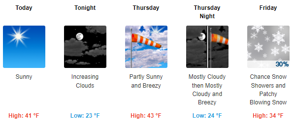
Skies remain clear this morning and highs will be a few degrees warmer than yesterday. Warm temps will continue into Friday before precipitation and moisture increases ahead of a series of low pressure troughs. This will give us a chance for some snow by the weeekend.
NWS Weather Forecast for the La Sal Mountains
Gold Basin SNOTEL site (10,000')
Storm Totals in Gold Basin
Wind Station on Pre Laurel Peak (11,700')
Snowpack
Solar aspects will once again have a crust this morning before things warm up. Sheltered terrain is still the best place to find quality skiing and riding. The main avalanche problem is a layer of weak, faceted snow underneath the new snow from last week that continues to be reactive.
Recent Avalanches
On Sunday I triggered this avalanche 2 ft deep and 25 ft wide. I triggered the slide on a steep, shady West facing roll over at 10,600 ft.
Ad
Avalanche Problem #1
Persistent Weak Layer
Type
Location
Likelihood
Size
Description
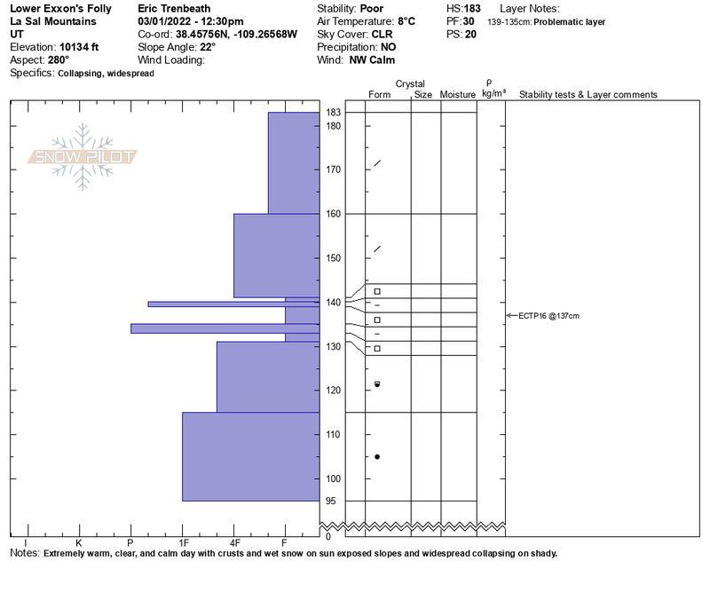
Buried facets exist beneath the new snow. You will find this weak layer on aspects facing W to N to SE. It is most widespread near tree line and below. This weak layer can also be found up high, but prior to the storm the alpine was hammered by wind and sun, leaving a spotty distribution of this buried layer. We are continuing to experience widespread collapsing in our travels. Tim Matthews experienced collapsing at low elevations on Monday. Eric Trenbeath experienced multiple collapses and got results (ECTP 16) in a west facing pit. Read Eric's observation for some great details. On Sunday, I got an ECTP 11 in a west facing pit at 11,250. The trend stays the same and the snow continues to speak to us.
Very warm temperatures this week may eventually have a stabilizing effect on this weak layer, but this type of healing takes time. And with how much feedback we are getting from the snow lately it's going to be a while before I have much confidence skiing in avalanche terrain.
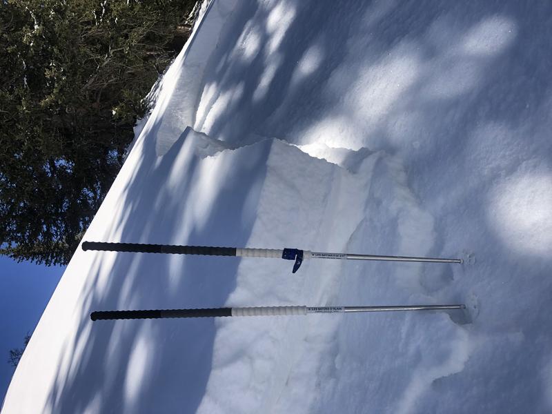
The photo below shows a snowpit after an extended column test. Results were ECTP 16 (Trenbeath).
Avalanche Problem #2
Wet Snow
Type
Location
Likelihood
Size
Description
Temperatures will be even warmer than yesterday with 10,000 ft highs in the low 40's. Valley bottoms dipped to the upper 20's last night. Pre Laurel Peak stayed above freezing, bottoming out around 33 degrees. Solar aspects will heat up fast today. Local observers have not seen evidence of wet activity so far, but it is always a possibility when the weather is this warm. Keep this in mind today when traveling on sunny aspects and if the snow feels wet, or doesn't support your weight, it's time to move to another slope. Roller balls and pinwheels are a great indicator of wet activity.
Additional Information
Eric Trenbeath drew up this snow profile for a pit he dug on a west aspect yesterday. His stability test failed on the layer of facets between the two pencil hard crusts. This is very similar to what I saw in a west facing pit on Sunday, and confirms the instability on that aspect.
General Announcements
Who's up for some free avalanche training? Get a refresher, become better prepared for an upcoming avalanche class, or just boost your skills. Go to https://learn.kbyg.org/ and scroll down to Step 2 for a series of interactive online avalanche courses produced by the UAC.
This forecast is from the U.S.D.A. Forest Service, which is solely responsible for its content. This forecast describes general avalanche conditions and local variations always occur.