UDOT PLANNED AVALANCHE CLOSURES!!

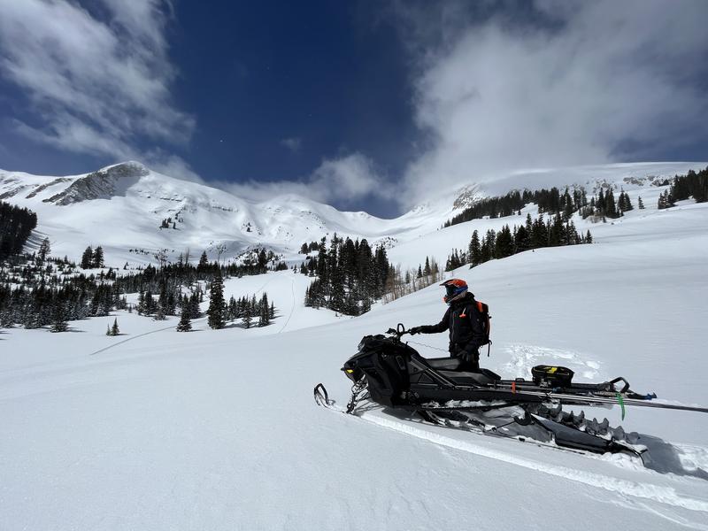
Forecast for the Moab Area Mountains

Eric Trenbeath
Issued by Eric Trenbeath for
Saturday, March 18, 2023
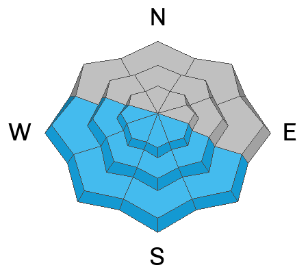
A MODERATE avalanche danger exists on all aspects near and above treeline and human triggered avalanches are possible. Below treeline, the avalanche danger is generally LOW.

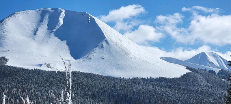
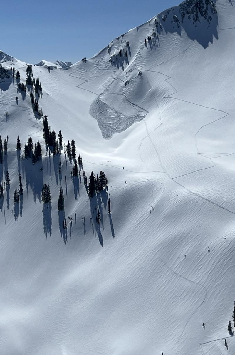
Shallow, fresh slabs of wind drifted snow may be found on all aspects above treeline. It is still possible to trigger a deeper, older slab on steep, northerly aspects near treeline and above.

On sun exposed slopes be alert to signs of loose, wet instability such as roller balls or pinwheels, and sloppy, wet snow as the day heats up.
Low
Moderate
Considerable
High
Extreme
Learn how to read the forecast here
Special Announcements
The Banff Centre Mountain Film Festival World Tour is showing tonight! For tickets and information go here.
Geyser Pass Road: The road was plowed on Friday. A snowpacked surface exists up high with muddy conditions down low as the day heats up.
Grooming: Matt re-tuned all trails yesterday and trails are in great shape.
Weather and Snow
6:00 a.m. Snow and Weather Data
24 Hour Snow 0" 72 Hour Snow 10" Season Total Snow 257" Base Depth at Gold Basin 91"
Winds on Pre Laurel Peak NNE 20-25 G 30 Temp 2

Weather
Skies are clear and temperatures are again cold this morning with most mountain stations reporting single digits. It's 10F at the Geyser Pass trailhead. NE winds were on the increase overnight averaging 20-30 mph since 10:00 p.m. These wind speeds seem anomalous for the region and they should back off as the day gets going. Otherwise, sunny skies are on tap with cool high temps in the upper 20's. Tomorrow will see increasing clouds and SW winds ahead of the next Atmospheric River that will bring a series of troughs through the region Mon-Wed. This looks to be a stronger event than the last two, and we could see 2"-3" of water by Thursday.

General Conditions
In our travels to the east side of the range yesterday, visiting Wasatch forecaster Dave Kelly and I continued to find good powder conditions on sheltered northerly aspects. Let's hope the NE winds haven't messed that up too much. Winds have been blowing long and strong enough to create shallow fresh slabs of wind drifted snow, primarily at upper elevations, and older slabs that formed during the storm may still be sensitive to the weight of a skier or rider. The danger for triggering an older slab is greatest on steep, northerly facing slopes above treeline. The recent snow seems to have settled pretty well into place though there may be some lingering instabilities out there. The March sun has done its work on sun exposed slopes and they will be well crusted over this morning. As the day heats up, be alert to signs of loose, wet instability such as rollerballs, pinwheels, and sloppy wet snow.
Visiting forecaster Dave Kelly takes in the view over in Dark Canyon.

Snowpack and Weather Data
Gold Basin Storm Stake (10,000')
Gold Basin SNOTEL site (10,000')
SNOTEL site near Geyser Pass Winter Trailhead (9600')
Wind Station on Pre-Laurel Peak (11,400')
NWS forecast for the La Sal Mountains.
Recent Avalanches
A handful of pockety, natural avalanches ran during Wednesday's storm event on steep, northerly facing slopes above treeline.
Ad
Avalanche Problem #1
Wind Drifted Snow
Type
Location
Likelihood
Size
Description
An unfortunate round of NE winds overnight has likely been blowing and drifting the recent snow into fresh slabs on all aspects at upper elevations. Fresh slabs should exhibit cracking in the snow surface as a sign of instability. On steep, northerly aspects, it is still possible to trigger an older, deeper wind slab. Suspect terrain that has a smooth, rounded, or pillowy appearance. Even a small avalanche can be devastating in consequential terrain.
Groomer extraordinaire Gavin Harrison sent in this pic of the N Face of Mount Mellenthin. Note the pillowy areas of wind drifted snow.
In the Wasatch Mountains yesterday, a skier triggered an avalanche in terrain with a similar looking snow surface. Suspect any slope that appears to be wind drifted.
Avalanche Problem #2
Wet Snow
Type
Location
Likelihood
Size
Description
The most recent storm snow has now gone through a couple of days of strong sunshine and overnight refreezes and I don't expecet mcuh in the way of loose, wet avalanche activity today. Nevertheless, the March sun is strong, and as the day heats up be alert to signs of loose, wet instability such as rollerballs, pinwheels, or sloppy wet snow, and stay off of steep slopes when these signs are present.
Additional Information
Persistent Weak Layers - If you've been following along, you know we've been tracking various weak layers in the snowpack, the most prominent of which was buried by a storm on Valentine's Day. Throughout this period, the location of this weak layer was spotty, and was only occasionally reactive to stability tests. Two rounds of heavy snowfall have failed to produce avalanches on any weak layer, and we have determined they are not widespread, or reactive enough to be deemed a problem. Isolated areas with buried weak snow may still remain, primarily on northerly aspects in wind sheltered areas. You can minimize your exposure by avoiding very steep, radical terrain in these areas, and by practicing safe travel techniques.
General Announcements
This forecast is from the U.S.D.A. Forest Service, which is solely responsible for its content. This forecast describes general avalanche conditions and local variations always occur. This forecast will be updated by 7:30 tomorrow morning.