Forecast for the Moab Area Mountains

Eric Trenbeath
Issued by Eric Trenbeath for
Friday, March 17, 2023
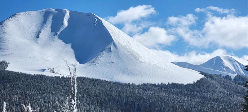
Most terrain has a MODERATE danger and human triggered avalanches are possible. Areas of CONSIDERABLE danger exist on steep, wind drifted, northerly aspects above treeline.

Lingering instabilities may exist in the recent storm snow while unstable slabs of wind drifted snow are the primary concern. Backcountry travelers should avoid steep, wind drifted slopes.

As the day heats up, be alert to signs of loose, wet instability such as rollerballs or pinwheels, and sloppy, wet snow.
Low
Moderate
Considerable
High
Extreme
Learn how to read the forecast here
Special Announcements
The Banff Centre Mountain Film Festival World Tour is coming to Moab tonight and tomorrow! For tickets and information go here.
Geyser Pass Road: The road was plowed on Friday. A snowpacked surface exists up high with muddy conditions down low as the day heats up.
Grooming: Matt and Gavin were hard at it yesterday trails are groomed through Gold Basin and Geyser Pass. Thanks guys!
Weather and Snow
6:00 a.m. Snow and Weather Data
24 Hour Snow 0" 72 Hour Snow 10" Season Total Snow 257" Base Depth at Gold Basin 91"
Winds on Pre Laurel Peak SW 2- 5 Temp 1

Weather
Skies are clear, calm winds teeter back and forth on the compass, and it's a frigid 1 degree up there! Short lived high pressure is building over the region and we'll see sunny skies this morning with a chance for clouds and even snow showers this afternoon as a weak shortwave undercuts the ridge. Temps will creep up into the low 20's, and winds will be light out of the NE before swinging to more westerly later in the day. Sunny skies and dry weather are back on Saturday. Enjoy it while you can as the next Atmospheric River event is shaping up to impact the region starting Monday!

General Conditions
8"-10" of heavy, wet snow fell on Wednesday with 1.5" to 1.75" of Snow Water Equivalent (SWE). This brings weekly totals up to 2' at 3.5" SWE and the mountains are plastered and white! In our travels yesterday, Dave Garcia and I found excellent turning and riding conditions, but the most recent snow had formed a cohesive slab that was not well bonded (see video for full details). This bond should be gaining strength and I suspect it will be less reactive today. We also observed a fair amount of wind drifted snow, primarily above treeline on northerly aspects, as well as a handful of "pockety" natural avalanches in these same areas. This is where the danger remains the greatest, and steep, wind drifted, northerly aspects should be avoided. Pay attention to how the recent snow is behaving. Look for signs of instability such as cracking in the snow surface and see if the new snow has slab-like properties before committing to steeper terrain.
The sun came out faster than expected yesterday and southerly aspects took a hit. Expect them to be crusted over today. Clouds this afternoon may prevent them from getting too moist today, but be alert to signs of loose, wet instability such as rollerballs, pinwheels, and sloppy wet snow.
To see all La Sal observations click here

Snowpack and Weather Data
Gold Basin Storm Stake (10,000')
Gold Basin SNOTEL site (10,000')
SNOTEL site near Geyser Pass Winter Trailhead (9600')
Wind Station on Pre-Laurel Peak (11,400')
NWS forecast for the La Sal Mountains.
Recent Avalanches
We observed a handful of pockety, natural avalanches that ran during the storm on steep, northerly facing slopes above treeline. See the La Sal avalanche database here.
Ad
Avalanche Problem #1
Wind Drifted Snow
Type
Location
Likelihood
Size
Description
Unstable slabs of wind drifted snow are the primary concern today, particularly on steep, northerly aspects. The danger is greatest above treeline, and steep, wind drifted slopes should be avoided. Even a small avalanche can be devastating in consequential terrain. Look for slopes that have a smooth, rounded, or pillowy appearance.
Groomer extraordinaire Gavin Harrison sent in this pic of the N Face of Mount Mellenthin. Note the pillowy, wind drifts.
Avalanche Problem #2
Normal Caution
Type
Location
Likelihood
Size
Description
Outside of the steep, wind drifted, northerly aspects, conditions are not yet green light. You may still find unstable areas of wind drifted snow on other aspects as well as lingering instabilities in the most recent storm snow. Look for signs of instability such as cracking in the snow surface, or slab like blocks between your skis. Avoid slopes that have a smooth, rounded pillowy, appearance or that show signs of recent drifting.
As the day heats up be alert to signs of loose instability such as rollerballs, pinwheels, or sloppy wet snow, and stay off of steep slopes when these signs are present.
Persistent Weak Layers - We've been tracking weak layers in the snowpack and have determined that they are not widespread, or reactive enough to warrant listing as a problem type anymore. The Valentine's layer is now deep below the snow surface and has, to the best of our knowledge, been unnaffected by the recent storm loads. Isolated areas with faceted snow may still remain, primarily on northerly aspects in wind sheletered areas. You can minimize your exposure by avoiding steep, radical terrain in these areas and by practicing safe travel techniques.
General Announcements
This forecast is from the U.S.D.A. Forest Service, which is solely responsible for its content. This forecast describes general avalanche conditions and local variations always occur. This forecast will be updated by 7:30 tomorrow morning.