Join us at our 2nd Annual Blizzard Ball

Forecast for the Moab Area Mountains

Issued by Chris Benson on
Tuesday morning, March 16, 2021
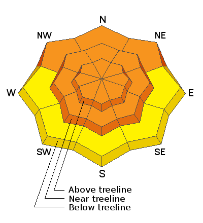
Heavy snowfall combined with wind has created dangerous avalanche conditions! On all steep, wind drifted slopes near and above treeline, the avalanche danger is CONSIDERABLE and human-triggered avalanches are likely. The most dangerous slopes contain buried persistent weak layers underneath new and wind-drifted snow and face NW-NE-SE. On slopes facing W-S-E below treeline, the avalanche danger is MODERATE. Overall, cautious route-finding and conservative decision making are essential.
Low
Moderate
Considerable
High
Extreme
Learn how to read the forecast here
Special Announcements
The Geyser Pass Road will be plowed this morning and the road is closed. Please be patient, and hopefully, the road will be open soon.
The Lower Utah Nordic Alliance (LUNA) has no plans to groom.
Weather and Snow
24 Hour Snow 1" 72 Hour Snow 29" Base Depth in Gold Basin 72" Wind SSE 20 G30 Temp 19F
Today look for cloudy skies with 3-5" of snow possible as a fast-moving closed low passes through. Thunder-snow and graupel are a possibility. SE winds 10-20 mph will switch to the west in the afternoon. High temps at 10,000' will be near 30F. Conditions dry out and warm up for the remainder of the week with another chance of unsettled weather for the upcoming weekend.
Wind, temperature, humidity on Pre Laurel Peak (11,700')
Snotel site near Geyser Pass Trailhead (9600')
Storm totals at the Gold Basin study plot (10,000')
Snowpack Discussion
Last weekend's storm brought the largest loading event of the season, with snow totals in the 2-3' range, with a significant wind event on Sunday evening where 90-mph NW winds blasted the mountains. In terms of "water-weight", this storm dumped 3.4" of SWE since Friday March 12th, which is nearly 1/3 of the entire season's total snow-water-equivalent in three days! Yesterday, time, warm temperatures and light winds helped the snowpack adjust to this large load. New snowfall and forecasted winds today will not do much to increase the avalanche danger, but this new snow will make it more difficult to assess which slopes may be wind-loaded. You can still expect to find deep and drifted snow and dangerous avalanche conditions today.
Recent Avalanches
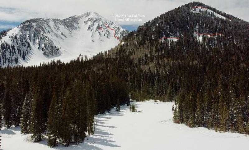
Several large avalanches were observed yesterday on northerly aspects in the La Sal Pass area that probably ran sometime on Sunday, the 14th. No avalanches were observed on southerly slopes in this area.
Ad
Avalanche Problem #1
New Snow
Type
Location
Likelihood
Size
Description
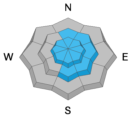
Human triggered avalanches involving the new snow remain likely on steep slopes on all aspects near and above treeline today. Storm totals increase with elevation, and yesterday's warm temps have settled and probably stiffened the slab. Light snowfall amounts today will not do much to add to this avalanche problem.
Avalanche Problem #2
Wind Drifted Snow
Type
Location
Likelihood
Size
Description
Strong NW winds on Sunday transported snow forming deep, unstable drifts near and above treeline. Sunday's wind event will be evident, but don't forget about slabs formed from southerly winds late last week. With snow in the forecast today that may disguise patterns on the snow surface, take time to dig down and investigate the snowpack for signs of a dense, thick windslabs and be sure to avoid these areas.
Avalanche Problem #3
Persistent Weak Layer
Type
Location
Likelihood
Size
Description
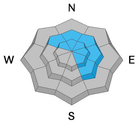
Several large avalanches on northerly aspects were noted yesterday and most likely failed on weak snow near the ground. You are likely to trigger a similar avalanche on slopes that face NW-NE-SE near and above treeline as these weak layers are still adjusting the weight of the recent storm snow.
General Announcements
This forecast is from the U.S. Forest Service, which is solely responsible for its content. This forecast describes general avalanche conditions and local variations always occur.