Join us at our 2nd Annual Blizzard Ball

Forecast for the Moab Area Mountains

Eric Trenbeath
Issued by Eric Trenbeath on
Monday morning, March 15, 2021
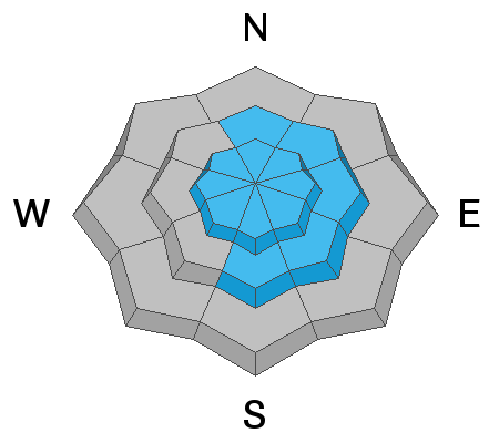
Heavy snowfall combined with wind has created dangerous avalanche conditions! On all steep, wind drifted slopes facing N-E-S at upper elevations the avalanche danger remains HIGH and human-triggered avalanches are very likely in these areas. All other terrain has a CONSIDERABLE avalanche danger. Backcountry travelers need to have excellent route finding skills and know how to recognize, as well as stay off of and out from under avalanche terrain.
Low
Moderate
Considerable
High
Extreme
Learn how to read the forecast here
Special Announcements
The Geyser Pass Road will be getting plowed sometime later today and it is currently impassable. Grand County plow crews will be busy with residential areas first. Please be patient.
The Lower Utah Nordic Alliance (LUNA) has no plans to groom.
Weather and Snow
24 Hour Snow 5" 72 Hour Snow 28" Base Depth in Gold Basin 72" Wind NW 10-15 G20 Temp 21F
NW winds finally backed off this morning after climaxing with gusts up to 90 mph around 8:00 p.m. last night. Today look for partly cloudy skies as a transient ridge slides over the region. WNW winds will be mostly light switching to SW later today. High temps at 10,000' will be near 30F. On Tuesday, the next closed low moves in just south of the 4 Corners bringing us another chance for snow though amounts look light. Conditions dry out and warm up for the remainder of the week.
Wind, temperature, humidity on Pre Laurel Peak (11,700')
Snotel site near Geyser Pass Trailhead (9600')
Storm totals at the Gold Basin study plot (10,000')
Snowpack Discussion
If more than 3' of snow over the past week hasn't been enough then yesterday's winds definitely were. Blowing and drifting snow reached epic proportions yesterday as reported by Travis Nauman in this observation. Expect to find deep and drifted snow and dangerous avalanche conditions today. Human-triggered avalanches within the new snow remain likely on steep slopes on all aspects, and human-triggered avalanches on steep, wind drifted slopes remain very likely. I don't yet know if this was enough of a load to trigger avalanches down to buried persistent weak layers in the snowpack, but for now I'm assuming that deep and dangerous, human-triggered avalanches up to 5' deep remain possible on steep slopes facing NW-N-E-SE. Back-country travelers need to have excellent route finding skills and know how to stay off of and out from under avalanche terrain.
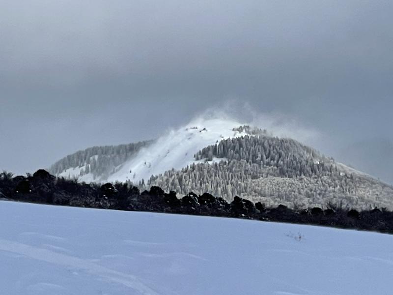
Tim Mathews sent in this photo of blowing snow yesterday. This is at a fairly low elevation with the ridge topping out at around 10,500'. More than 2000' of terrain exists above this.
Ad
Avalanche Problem #1
New Snow
Type
Location
Likelihood
Size
Description
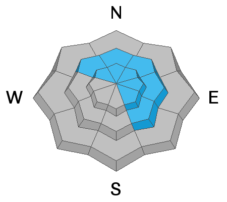
Human triggered avalanches involving the new snow remain likely on steep slopes on all aspects and elevations today. On steep slopes facing NW-N-E-SE, the additional snow load may be enough to trigger an avalanche on a buried persistent weak layer deeper in the snowpack. Bottom line - stay off of, and out from under all avalanche terrain today.
Avalanche Problem #2
Wind Drifted Snow
Type
Location
Likelihood
Size
Description
Strong winds yesterday transported incredible amounts of snow forming deep, unstable drifts pretty much everywhere. They will be a little less sensitive today but no less dangerous. On slopes facing NW-N-E-SE deep drifts threaten to reawaken buried persistent weak layers causing a much deeper avalanche. Bottom line travel advice remains the same - avoid avalanche terrain, especially where windloaded.
Avalanche Problem #3
Persistent Weak Layer
Type
Location
Likelihood
Size
Description
I don't yet know if this was enough of a load to awaken buried persistent weak layers of sugary faceted snow, but I've seen it happen after big dumps in March time and time again. I hope some visibility will add clarity to the situation but for now I'm going to assume that deep and dangerous avalanches up to 5' deep are possible on steep slopes facing NW-N-E-SE.
General Announcements
This forecast is from the U.S. Forest Service, which is solely responsible for its content. This forecast describes general avalanche conditions and local variations always occur.