Sign Up for the Utah Snow and Avalanche Workshop (USAW) on December 7th!

Forecast for the Moab Area Mountains

Eric Trenbeath
Issued by Eric Trenbeath on
Monday morning, March 14, 2016

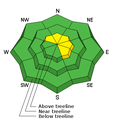
Overall, the avalanche danger is generally LOW but strong west southwest winds may cause the danger to rise to MODERATE in upper elevation, wind exposed terrain where wind loading may cause slabs to form on the lee sides of ridge crests and terrain features.

Low
Moderate
Considerable
High
Extreme
Learn how to read the forecast here
Special Announcements

This advisory has been posted on Monday, March 14 and will provide a general danger rating with potential problems to be aware of for the upcoming week.

Please help guide our discussions of website maintenance, upgrades or possible changes in coming years. Take this brief survey. As a way of saying thanks we'll be raffling a free avalanche class and other free stuff like hats, beanies, water bottles, etc

Weather and Snow

Spring like snow surfaces reign in the mountains with a variety of wind and sun crusts, as well as wind scoured snow surfaces above treeline. Some areas of settled powder remain on sheltered northerly aspects.

A storm system tracking through to the north will bring clouds and strong westerly winds through Tuesday. Little or no snow accumulation is expected but the severity of the winds may increase the avalanche danger. See detailed problems below.

Winds, temperature and humidity on Pre-Laurel Peak

New snow totals, temperature and humidity in Gold Basin

Total snow depth and temperature at Geyser Pass Trailhead

Ad
Avalanche Problem #1
Wind Drifted Snow
Type
Location
Likelihood
Size
Description

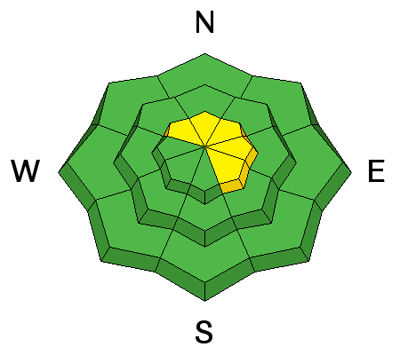
In spite of the crusted over south and west facing slopes, strong west southwest winds will be able to move snow around as they etch into the snow surface. Be on the lookout for recently developed, shallow wind slabs on the lee sides of ridge crests and terrain features in upper elevation, wind exposed terrain. Additionally, it may still be possible to trigger an isolated, but deeper wind slab that formed earlier in the week. Suspect smooth rounded pillows of drifted snow on steep, northerly aspects.

Avalanche Problem #2
Persistent Weak Layer
Type
Location
Likelihood
Size
Description

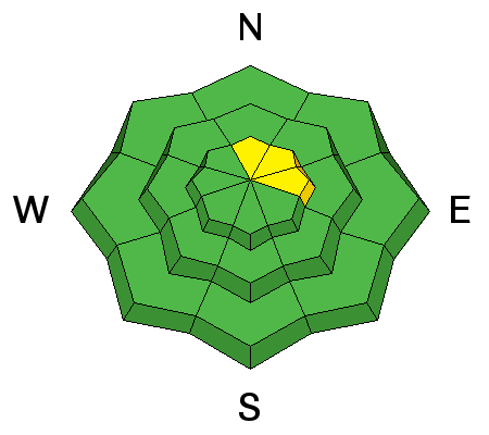
Much more the exception than the rule, it is still possible to trigger an avalanche on weak, sugary, faceted snow near the ground in isolated locations. Particularly if new wind slabs form over top off the underlying weak snow. You may encounter this problem on northerly aspects in areas of steep, rocky, radical terrain where the snowpack is shallow and weak. Slide paths that have been repeat runners during the season are also suspect.

Additional Information

Today

Scattered snow showers, mainly between 7am and 5pm. Mostly cloudy, with a high near 32. Very windy, with a west southwest wind 25 to 30 mph increasing to 35 to 40 mph in the afternoon. Winds could gust as high as 60 mph. Chance of precipitation is 40%.

Tonight

Scattered snow showers, mainly between 7pm and 3am. Mostly cloudy, with a low around 10. Wind chill values as low as -10. Very windy, with a northwest wind 40 to 45 mph decreasing to 30 to 35 mph after midnight. Winds could gust as high as 60 mph. Chance of precipitation is 30%.

Tuesday

Isolated snow showers before 9am, then isolated snow showers after 11am. Mostly sunny, with a high near 26. Wind chill values as low as -15. Windy, with a west northwest wind 20 to 30 mph, with gusts as high as 45 mph. Chance of precipitation is 10%.

Tuesday Night

A 10 percent chance of snow. Partly cloudy, with a low around 13. Windy, with a northwest wind 20 to 30 mph, with gusts as high as 45 mph.

Wednesday

Mostly sunny, with a high near 25. Blustery, with a northwest wind 15 to 20 mph, with gusts as high as 30 mph.

Wednesday Night

Partly cloudy, with a low around 16.

Thursday

A 10 percent chance of snow after noon. Mostly sunny, with a high near 30.

Thursday Night

A slight chance of snow. Partly cloudy, with a low around 15. Blustery.

Friday

A slight chance of snow. Mostly sunny, with a high near 23. Blustery.

General Announcements

Road Conditions: The road is a mix of dirt at lower elevations that turns to mud as the day progresses. It is snowpacked higher up.

To post an observation go here. You can view Moab observations here. You can also give me a call on my cell phone at 801-647-8896

To receive this advisory by email go here.

This information does not apply to developed ski areas or highways where avalanche control is normally done. This advisory is from the U.S.D.A. Forest Service, which is solely responsible for its content. This advisory describes general avalanche conditions and local variations always exist.