Forecast for the Moab Area Mountains

Paige Pagnucco
Issued by Paige Pagnucco for
Monday, March 11, 2024
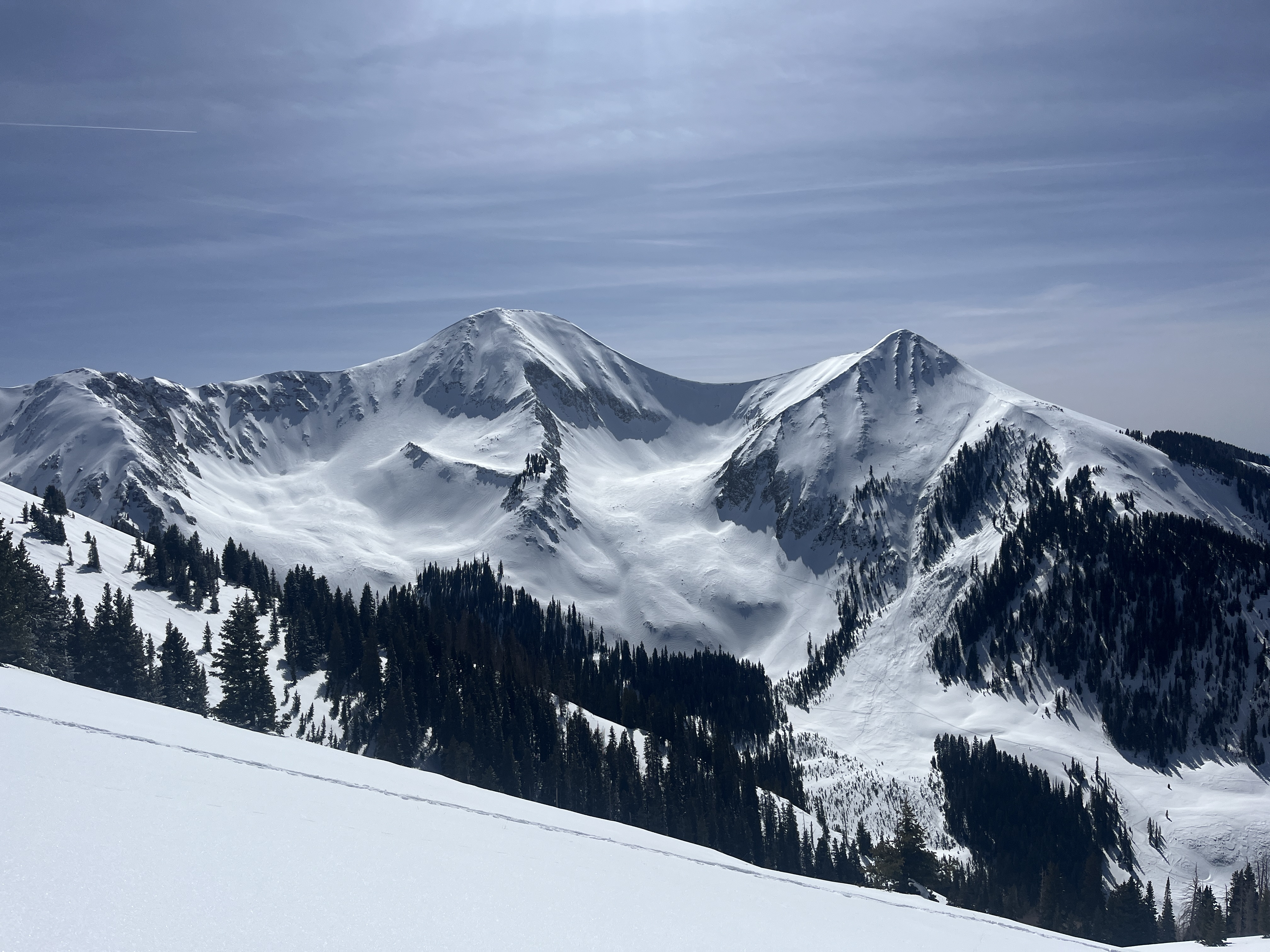
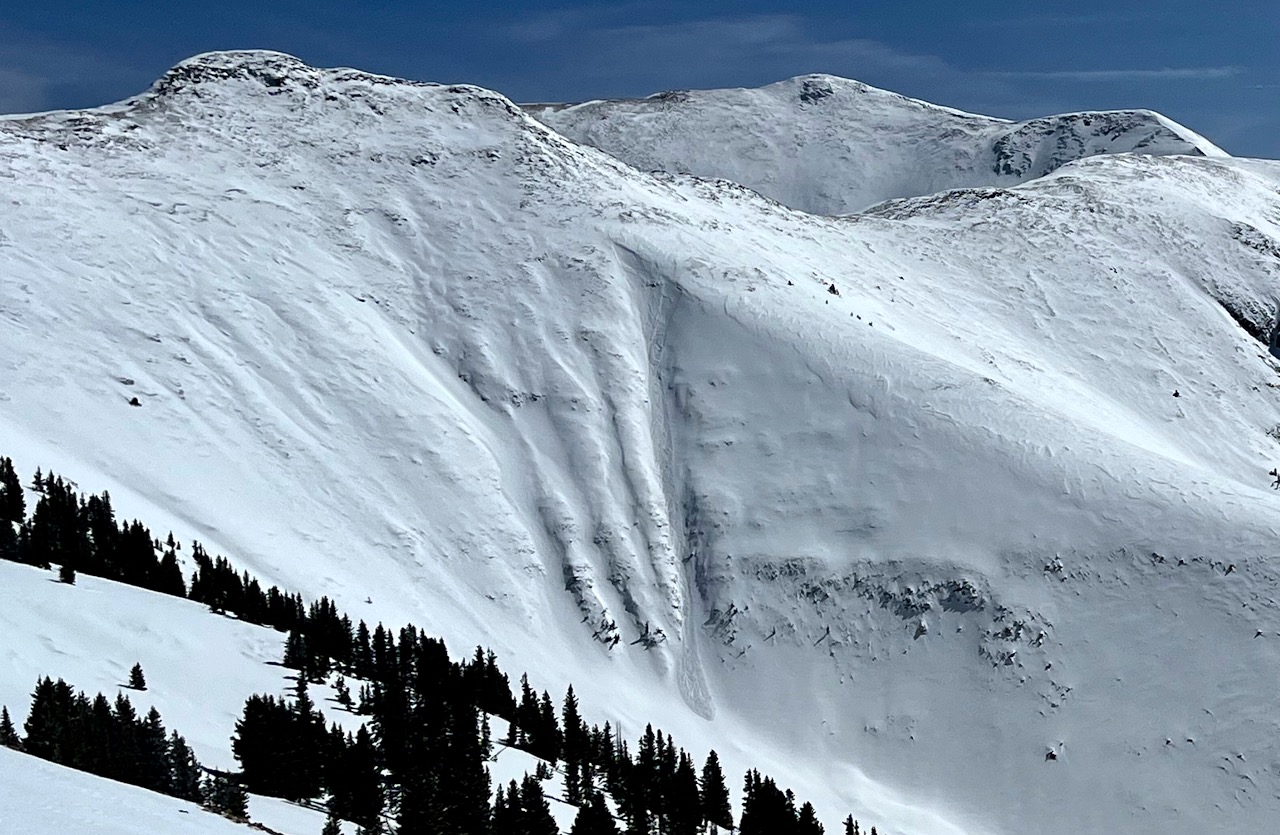
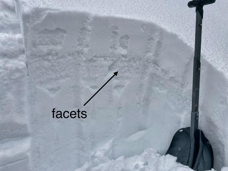
The avalanche danger is generally LOW.
LOW danger does not mean NO danger, so don't let your guard down. Although unlikely, you could still trigger a small slide up to a foot deep on isolated slopes near and above treeline. Pay attention to increasing southerly winds as well which could create areas of wind-drifted snow on leeward-facing steep slopes.
Low
Moderate
Considerable
High
Extreme
Learn how to read the forecast here
Special Announcements
Road Conditions: The Geyser Pass Road to the winter trailhead is plowed and mostly dirt and mud with areas of packed snow.
Grooming: Trails were groomed a few days ago by LUNA.
Weather and Snow
6:00 a.m. Snow and Weather Data
24 Hour Snow 0" 72 Hour Snow 0" Season Total Snow 146" Depth at Gold Basin 52"
Winds on Pre-Laurel Peak: S 20-25 mph gusting 30 mph Temp 21° F Percent of Normal: 93%

Weather
Today will be partly cloudy with a high of 32 F at 11,000 ft. It'll be breezy with winds blowing from the south-southwest 20 to 25 mph. Tuesday will be similar with a bit more sun. Tuesday night, a storm moves into the area bringing 2-4 inches of snow. Snow showers remain in the forecast through the work week but the upcoming weekend looks clear.
General Conditions
What a great weekend in the La Sals! Sunshine, calm winds, and a mostly stable snowpack allowed riders to get into big alpine terrain. Surface conditions are variable but we found shallow, soft snow in shady, sheltered terrain (and crusted or damp snow in sunny terrain) yesterday.
A persistent weak layer of old snow from Dec/Nov has become dormant as the last avalanches on this layer were about a month ago. Over the last four weeks, five storms have delivered snow with about 2" of SWE combined with a major wind event last weekend.
On Friday, Mark found weak, near-surface facets on a northerly-facing slope capped by the recent snowfall. Yesterday, we found giant depth hoar (large facets) on a west-facing slope where the snow was fairly shallow. But we also found really stable snow on a north-facing slope where the snow depth was about 235 cm.
A beautiful day yesterday in the mountains with calm winds and fairly mild temps. Riders found their way into bigger terrain and reported variable conditions.

Snowpack and Weather Data
Gold Basin Storm Stake (10,000')
Gold Basin SNOTEL site (10,000')
SNOTEL site near Geyser Pass Winter Trailhead (9600')
Wind Station on Pre-Laurel Peak (11,400')
NWS forecast for the La Sal Mountains.
Recent Avalanches
Yesterday, we observed a small natural wind slab avalanche around 11,800' on a west-facing slope. No other avalanches were reported.
Ad
Avalanche Problem #1
Normal Caution
Type
Location
Likelihood
Size
Description
The snowpack is generally stable and avalanches are unlikely, but you'll need to keep a few things in mind as you travel today:
  • Facets (weak snow) do exist in the top part of the snowpack in some places. It's hard to know exactly where they formed so you just need to dig a little ways down to find them.
  • Winds are a bit stronger today and may move any loose snow around. Watch for loading on leeward-facing slopes. Wind-drifted snow could overload any existing weak snow and create sensitive, shallow wind slabs.
  • Continue to practice safe travel protocols - one person at a time in avalanche terrain.
  • Carry and know how to use avalanche rescue gear (beacon, shovel, and probe).
Additional Information
Want some more insight into the La Sal Mountains as well as the communal impacts of a tragic avalanche? Check out the latest UAC podcast with forecaster Eric Trenbeath where he discusses the range, it's often treacherous snowpack, and how the devastating avalanche in February, 1992, affected the Moab community.
Our avalanche beacon checker sign and beacon training park are up and running. A huge thanks to Talking Mountain Yurts for sponsoring those this season!
Sign up for forecast region-specific text message alerts. You will receive messages about changing avalanche conditions, watches, warnings and road plowing closures.
Follow us on Instagram @utavy_moab
General Announcements
This forecast is from the U.S.D.A. Forest Service, which is solely responsible for its content. This forecast describes general avalanche conditions and local variations always occur.