UDOT PLANNED AVALANCHE CLOSURES!!

Forecast for the Moab Area Mountains

Dave Garcia
Issued by Dave Garcia for
Tuesday, December 6, 2022
A MODERATE avalanche danger exists on slopes that face NW-N-E near treeline and above where slabs of wind drifted snow exist on top of a weak, fragile snowpack. Human triggered avalanches are possible on these slopes. Avoid travel in wind drifted alpine terrain. South and westerly facing slopes and most areas below treeline terrain have LOW danger.
It's still low tide out there and rocks, stumps, and deadfall are lurking just beneath the surface. A ride in even a small avalanche in these low snow conditions would be rugged.
Low
Moderate
Considerable
High
Extreme
Learn how to read the forecast here
Special Announcements
We will be giving a free Know Before You Go Avalanche Awareness talk tonight at 6:00 p.m. at the MARC (111 E 100 N).
Join us for the 1st Annual UAC Moab/LUNA Winter Kickoff Party on Saturday, Dec 10 at the MARC. The event will be from 7-9 PM. Get your tickets here.
Join the Utah Avalanche Center and the Division of Outdoor Recreation to celebrate the Fourth Annual Avalanche Awareness Week, from December 4 - December 11. Click HERE to view a full list of events throughout the state.
Road Conditions: Grand County has not yet begun plowing the road to Geyser Pass Trailhead. The road is hard-packed snow and slick in places. Good tires and all wheel drive are recommended.
Grooming: The Geyser Pass Road above the winter trailhead closes on Dec 15. Grooming will commence after that, but but for now, the road above the trailhead is snowpacked and well traveled and cross country ski conditions are pretty good.
Weather and Snow
24 Hour Snow 2" 72 Hour Snow 2" Season Total Snow 43" Base Depth at Gold Basin 24"
Winds on Pre Laurel Peak WSW 8 G 13 Temp 21F
A good looking winter storm is on our door step. Snowfall started around 3 AM and we have picked up two inches so far. We should see light accumulation today with maybe another two inches. Wind speeds will be reasonable today and blow in the 10-15 MPH range out of the SW. A strengthening SW flow will have the best period for snow accumulations tonight and Wednesday. Storm totals by Thursday morning will give us just under an inch of water and about a foot of snow. Thursday and Friday will be sunny and the trough train looks to return over the weekend with an active pattern through the model run.
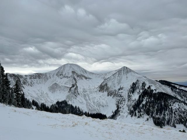
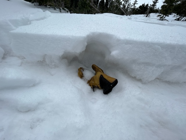
A few inches of snow will really help turning and riding conditions today. Alpine terrain consists of scoured slopes and a complex pattern of fresh wind drifts sitting on top of old hard wind drifts. These drifts overlie a base of very weak faceted snow. I do not have much confidence in this very weak snow structure. If we get an inch of water by Thursday things will become dangerous and we can expect to see some avalanche activity. It's also still low tide out there with lots of rocks, stumps, and logs lurking about.
Things are definitely in need of a fresh coat of paint!
Gold Basin Storm Stake (10,000')
Gold Basin SNOTEL site (10,000')
SNOTEL site near Geyser Pass Winter Trailhead (9600')
Wind Station on Pre-Laurel Peak (11,400')
NWS forecast for the La Sal Mountains.
If you are getting up into the mountains please submit an observation and let us know what you are seeing!
Recent Avalanches
A list of avalanches for the La Sal Range can be viewed here
Ad
Avalanche Problem #1
Persistent Weak Layer
Type
Location
Likelihood
Size
Description
A cold dry period for two and half weeks in mid November resulted in a very weak snowpack. A persistent weak layer of faceted snow developed at all elevations on aspects facing W-N-E. This weak foundation of snow was buried by seven inches of new snow on 11/29. Warm temperatures over the past several days have caused the surface snow to form a cohesive slab on top of the buried weak faceted snow. Snowfall starting this morning and continuing into Wednesday will begin to add stress to our fragile snowpack. Red flags will not be in your face this morning. Audible collapses and shooting cracks are signs that this layer is being overloaded and failing. Look for increasing danger as the snow piles up and adds weight to this weak foundation. The danger for triggering an avalanche on this layer will rise as the storm goes on. With an inch of water and a foot of snow forecasted to accumulate by Thursday morning we should start to see some avalanche activity.
If you see the surface snow cracking out like this, you have found the slab. Notice the cohesive nature of the surface snow in this photo.
Strong snow over weak snow. The weak layer of facets below the slab is obvious in this photo.
Avalanche Problem #2
Wind Drifted Snow
Type
Location
Likelihood
Size
Description
Strong, erratic winds over the past week have created a complex layer of fresh wind drifts on top of old harder wind drifts. These hard slabs of wind drifted snow are sitting on top of a very weak snowpack consisting of faceted snow. You can trigger bigger, deeper, and wider avalanches failing on a buried persistent weak layer anywhere wind has drifted snow on top. Fresh snowfall today may cover up wind drifted snow and make them harder to notice. Hollow drum like sounds are a good indication of wind drifted snow. Avoid any slopes that have recent deposits of wind drifted snow.
Additional Information
General Announcements
This forecast is from the U.S.D.A. Forest Service, which is solely responsible for its content. This forecast describes general avalanche conditions and local variations always occur.