Join us at our 2nd Annual Blizzard Ball

Forecast for the Moab Area Mountains

Dave Garcia
Issued by Dave Garcia on
Tuesday morning, December 24, 2024
The overall avalanche danger is LOW. Human-triggered avalanches are unlikely, but not impossible. The most suspect areas are rocky, extreme terrain with steep convexities. Continue to practice safe travel protocols, crossing potentially hazardous slopes one at a time.
Loose snow sluffing is possible on steep northerly aspects near treeline and below where the snowpack is weakening and losing cohesion.
Conditions remain thin and rocks, stumps, and dead fall still pose a significant hazard.
Low
Moderate
Considerable
High
Extreme
Learn how to read the forecast here
Special Announcements
Geyser Pass Road: The road is plowed to the trailhead. Surface is dirt down low, snowpacked and icy above. AWD with good tires recommended.
Grooming Conditions: Surfaces are currently packed solid from weeks of ski and snowmobile traffic. We really need some fresh snow to start grooming.
Now is a great time to dial in your safety gear including putting fresh new batteries in your beacons! Local shops across the state will be handing out free Batteries for Beacons now until February 1, 2025. All you need to do is fill out a quick survey and grab the AAA or AA batteries you need to keep your beacon fresh this season. Head into Moab Gear Trader to get yours!
Weather and Snow
6 A.M. Snow and Weather Data
24 Hour Snow: 0" 72 Hour Snow: 0" Season Total Snow: 46" Depth at Gold Basin: 23"
Winds on Pre-Laurel Peak: NNW 5-9 Temp: 18° F Percent of Normal (SWE): 105%
Weather
Mild conditions continue today ahead of the next storm that will arrive Christmas day. Mountain temperatures will be just above freezing with a high of 34 degrees F. Winds from the NNW will shift to the SSW and blow just 5-10 MPH. Overnight lows will drop to 21 degrees. Snowfall will begin early tomorrow morning, with 3-5 inches of accumulation expected. A series of disturbances will bring chances for snow during the later part of the week, with additional accumulation Thursday into Friday. The pattern remains active through next week, but these systems will likely favor the Northern mountains.
General Conditions
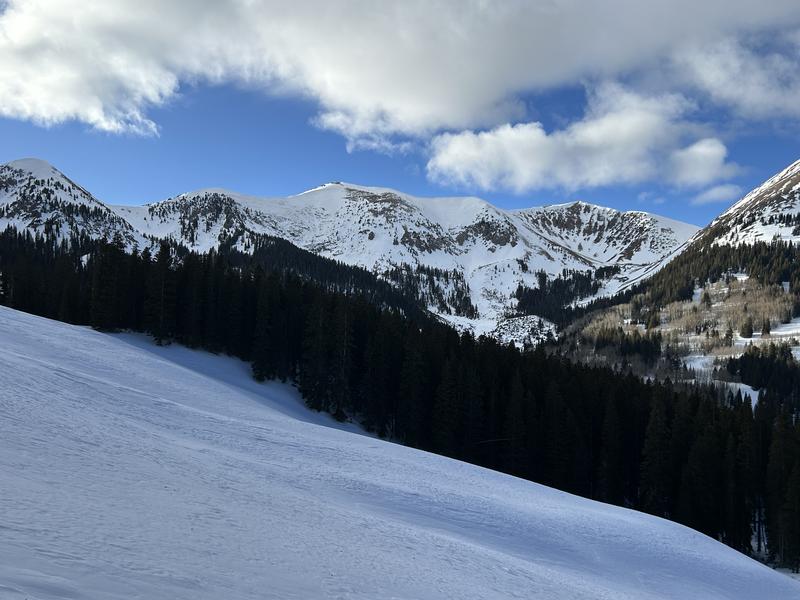
Yesterday Nate and I took a trip up into the alpine terrain of Beaver Basin. We observed solar aspects desperately in need of snow and showing lots of rocks. Above the treeline, we traveled on rock-hard wind board. Alpine terrain is a mix of scoured surfaces and wind crusts. We also spent some time below the treeline and found abundant weak recrystallized snow. We were able to trigger some small facet sluffs on short steep pitches. These loose sluffs would have entrained a fair amount of snow in bigger terrain, enough to knock a person off their feet. The sugary surface snow is likely to become our next weak layer if we get enough snow and wind this week to build a slab on top.
East-facing alpine terrain in Beaver Basin looking wind-swept and rocky. The softest snow is near treeline and below.
Snowpack and Weather Data
Gold Basin SNOTEL site (10,000')
SNOTEL site near Geyser Pass Winter Trailhead (9600')
Wind Station on Pre-Laurel Peak (11,400')
NWS forecast for the La Sal Mountains.
Recent Avalanches
Ad
Avalanche Problem #1
Persistent Weak Layer
Type
Location
Likelihood
Size
Description
It has been four weeks since our last storm and natural avalanche cycle. The persistent weak layer problem has gone largely dormant during the prolonged period of mild weather. However, poor snowpack structure still exists and is fairly widespread. The PWL problem will undoubtedly come back to life with the next loading event. Backcountry travelers need to be aware of changing conditions this week.
For today, you should continue to be suspicious of steep, rocky, radical terrain above the treeline. On these slopes, you may find isolated hard slabs of wind-drifted snow overlying weak, sugary faceted snow.
In our travels at the mid and lower elevation bands, we have found very weak, cohesionless snow and it is easy to trigger sluffs in steep terrain. Looking ahead, this loose, unconsolidated snow will almost certainly become our next persistent weak layer once more snow arrives.
Additional Information
Sign up for text alerts to get the most up to date information about changing conditions, road plowing, special avalanche announcements.
Follow us on Instagram @utavy_moab
General Announcements
This forecast is from the U.S.D.A. Forest Service, which is solely responsible for its content. This forecast describes general avalanche conditions and local variations always occur.