Forecast for the Moab Area Mountains

Dave Garcia
Issued by Dave Garcia for
Sunday, December 17, 2023
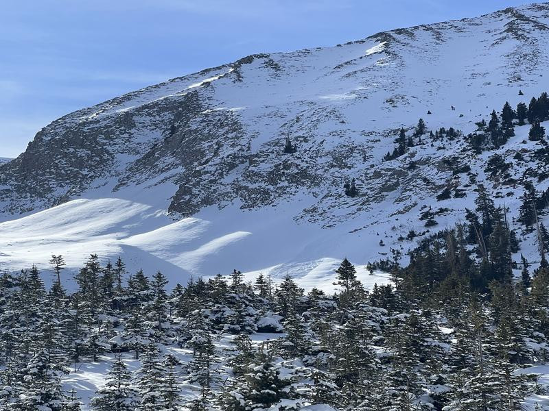
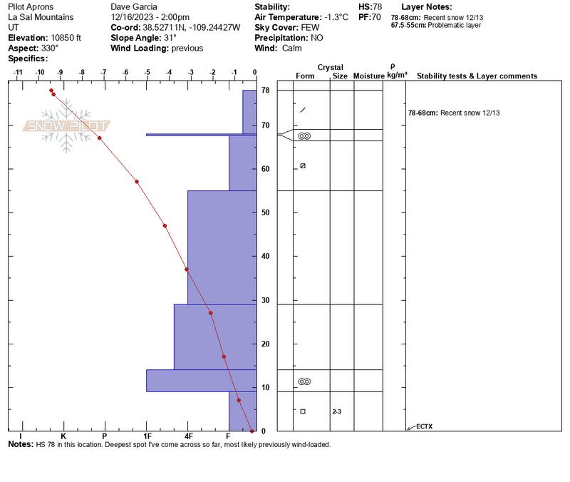
Recent snow has not significantly changed the avalanche danger, and there's still not quite enough coverage for off trail riding and sliding. Triggering an avalanche is unlikely, but on upper elevation, northerly aspects, isolated slabs of wind drifted snow overlying weak, sugary, faceted snow may exist. These areas are extremely difficult to access at this time but if a slope looks like it has enough snow to ride, it has enough to slide. Suspect the deepest snow areas on the leeward sides of ridge crests and terrain features. Even a small avalanche triggered could take you for a very bumpy ride. We'll start providing regular forecasts when there is enough snow to get around on.
Low
Moderate
Considerable
High
Extreme
Learn how to read the forecast here
Special Announcements
The Geyser Pass Road is a snowpacked and icy surface. AWD and good tires required.
Grooming: The Geyser Pass Road above the winter trailhead is officially closed to wheeled vehicles and grooming has commenced.
Weather and Snow
General Conditions
The mountains received 5" of new snow on Dec 13, bringing our base in Gold Basin back up to 22". There's just over a foot of snow at the Geyser Pass winter trailhead. Season snowfall total is 34". There is not enough snow for skiing and riding, but some folks have been venturing off trail with caution to check on conditions. On Saturday, my party found a mixed bag of surface conditions including melt-freeze crusts, old wind crusts, surface hoar, and recycled powder. Check out our observation here. Long range models hint at a possible storm later next week and then again around Christmas. There is enough snow on the Geyser Pass Road for cross-country skiing and with the road closing on Dec 15, regular grooming will commence.
Chris Benson was up in Gold Basin on Saturday and sent in this excellent observation. He also shot some great aerial footage showing the overall snow coverage.
Other observations are starting to come in. See the most recent observations here.
Snowpack and Weather Data
Gold Basin Storm Stake (10,000')
Gold Basin SNOTEL site (10,000')
SNOTEL site near Geyser Pass Winter Trailhead (9600')
Wind Station on Pre-Laurel Peak (11,400')
NWS forecast for the La Sal Mountains.
Recent Avalanches
Chris Benson sent in this photo of a small (D1) natural avalanche that initiated in the Tuk No cliffs and ran down into Tele Gold. The trigger is unknown, but I would guess that a soft slab of wind-drifted snow overloaded the recently buried near surface facet layer.
Ad
Avalanche Problem #1
Normal Caution
Type
Location
Likelihood
Size
Description
Several inches of pre-existing snow has turned to weak, sugary facets at the base of the snowpack on northerly aspects. Time will tell how big of a problem this becomes, but we'll be keeping an eye on it. For now, it's only a concern in upper elevation, northerly facing terrain where winds have drifted slabs over top. Most of the areas where you would encounter a problem are difficult to access because of the low coverage, but if you find yourself in the upper elevations, remember that if it has enough snow to ride, it has enough snow to slide. Suspect the deepest snow areas on the leeward sides of ridge crests and terrain features. Even a small avalanche triggered could take you for a very bumpy ride.
With any additional loading from wind or storm snow, I will have concern for both the basal facets, and the layer of buried near surface facets in the top of the pack. Don't let the height of snow in this profile fool you, most areas are not this deep. Previously wind-drifted snow can account for the HS of 78cm in this pit.
Additional Information
It’s never too early to start thinking about avalanches. Here are a few things to consider doing:
1-Sign up for an avalanche class.
2-Take a free online avalanche course the UAC built for Know Before You Go or other courses listed on the KBYG website (Develop skills -> Online Learning).
3-Get your avalanche rescue gear ready for winter. Put fresh batteries in your transceiver and update the firmware. Inspect your shovel and probe. Get your airbag backpack ready by possibly doing a test deployment and updating the firmware if it is an electric version.
General Announcements
This forecast is from the U.S.D.A. Forest Service, which is solely responsible for its content. This forecast describes general avalanche conditions and local variations always occur.