Join us at our 2nd Annual Blizzard Ball

Forecast for the Moab Area Mountains

Eric Trenbeath
Issued by Eric Trenbeath on
Thursday morning, December 15, 2022
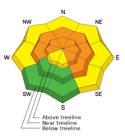
Accumulating and wind drifted snow has kept the avalanche danger at CONSIDERABLE on steep slopes that face W-N-SE and dangerous, human triggered avalanches, failing on a buried persistent weak layer 2'-4' deep are likely. Slopes steeper than 30 degrees should be avoided in this terrain.
NW winds at upper elevations have blown just enough to drift the recent, low density snow, and a MODERATE danger for triggering a shallow wind slab exists on all aspects above treeline.
Low
Moderate
Considerable
High
Extreme
Learn how to read the forecast here
Special Announcements
Road Conditions: A few inches of snow has fallen on the road since Grand County plowed on Tuesday. AWD and good tires required.
Grooming: A few inches of snow has fallen since Matt and Dave groomed on Tuesday. Traffic has packed things out into Gold Basin.
Weather and Snow
24 Hour Snow 0" 72 Hour Snow 19" Season Total Snow 74" Base Depth at Gold Basin 46"
Winds on Pre Laurel Peak NW 10-15 Temp 8F
Weather
A weak shortwave trough will bring cloudy skies and a chance for snow this morning. Any accumulation will be light. Northwest flow will keep things cold with high temps at 10,000' only getting up into the low teens. Partly cloudy skies tonight will give way to sunny and cold conditions tomorrow. Cold, dry weather lasts into next week.

General Conditions
Conditions are excellent, though still just a bit thin, and we found great turning and riding yesterday. We're now up to almost 20" of new snow at just over an 1.5" of water this week with the final 5" coming in at very low density. Cold temperatures and light winds have mostly preserved the snow though some due south aspects will be lightly crusted today. The recent snow has fallen on top of a very poor snowpack structure and the entire snowpack beneath the November 28 storm is loose, weak, and faceted. Incremental loading is keeping us in a dangerous state. Outward signs of instability aren't widespread but we did experience a good collapse yesterday on a westerly aspect, and natural activity during the storm is enough reminder of the danger we face.

Snowpack and Weather Data
Gold Basin Storm Stake (10,000')
Gold Basin SNOTEL site (10,000')
SNOTEL site near Geyser Pass Winter Trailhead (9600')
Wind Station on Pre-Laurel Peak (11,400')
NWS forecast for the La Sal Mountains.
Click here for a list of recent observations. If you're getting out in the backcountry please let us know what you are seeing by submitting observations here.
Recent Avalanches
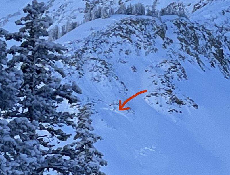
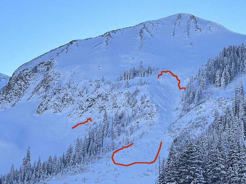
In our travels yesterday we observed a handfull of natural avalanches that ran at some point during the storm cycle. Not very wide, I would describe them as "pockety" which makes it difficult to predict exactly where they are going to occurr. All occurred on northerly aspects and appeared to be 2'-3' deep which is defintely enough to cause you some serious problems. They likely failed on the faceted weak layer.
Ad
Avalanche Problem #1
Persistent Weak Layer
Type
Location
Likelihood
Size
Description
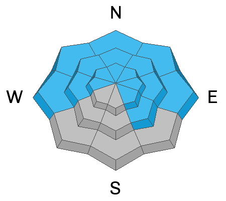
A persistent weak layer of faceted snow that developed during the cold dry period in mid November is now present on aspects that face W-N-SE. Recent and wind drifted snow has incrementally loaded this weak layer and we are in a tentative state. Outward signs of instability may not be present, but audible collapses and shooting cracks are sure signs that the buried weak layer is failing under the weight of the new snow. This condition is most dangerous and wide spread on slopes facing NW-N-E, where wind drifted snow has built thick slabs on top. These hard slabs are 1-4' thick and can produce very large, deep, and potentially deadly avalanches. The only good strategy right now is to avoid slopes steeper than 30 degrees that face W-N-SE.
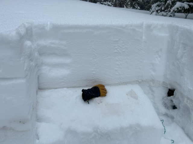
The buried weak layer sits right behind my glove in this photo. If you dig down, it is easy to locate because of the brown dust in the layer.
Avalanche Problem #2
Wind Drifted Snow
Type
Location
Likelihood
Size
Description
NW winds at upper elevations have blown just enough to drift the recent, low density snow and it is possible to trigger a shallow wind slab exists on all aspects above treeline. On northerly aspects, recent wind drfits will only add more stress to the buried persistent weak layer, and steep northerly facing terrain shold be avoided due to the possbility of a much deeper and more dangerous avalanche.
Additional Information
General Announcements
This forecast is from the U.S.D.A. Forest Service, which is solely responsible for its content. This forecast describes general avalanche conditions and local variations always occur. This forecast will be updated by 7:30 tomorrow morning.