Forecast for the Moab Area Mountains

Eric Trenbeath
Issued by Eric Trenbeath for
Thursday, January 19, 2023
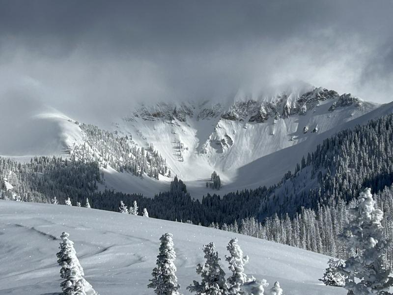
Areas of CONSIDERABLE danger exist on steep, wind drifted slopes above treeline that face NW-N-NE-E and human triggered avalanches are likely.

Most other terrain has a MODERATE danger, where human triggered wind drifts as well as avalanches running in the new snow, are possible.

A low probability/high consequence scenario remains for dangerous avalanches failing on a buried persistent weak layer. Avoid steep, wind drifted slopes and areas of rocky, extreme terrain.
Low
Moderate
Considerable
High
Extreme
Learn how to read the forecast here
Special Announcements
Road Conditions: Grand County will again be plowing the road today and the gate will be closed while work is in progress. With all of the deep, new snow, expect work to take most of the day.
Grooming: All trails were groomed with the snowcat yesterday.
Weather and Snow
24 Hour Snow 1" 72 Hour Snow 19" Season Total Snow 169" Base Depth at Gold Basin 85"
Winds on Pre Laurel Peak WSW 5-10 Temp 2

Weather
Short lived high pressure will provide clear skies and sunshine this morning before high clouds start moving in ahead of the next system. SW winds will be light and high temps at 10,000' will be in the mid teens. The low pressure system moves into AZ late tonight and through the 4 Corners tomorrow morning bringing snowfall to the La Sal and Abajo mountains. This system has much less moisture available than what we've been seeing and 3"-5" look possible. High pressure builds on Saturday signaling a pattern change and a more northerly storm track that will favor the northern and central Rockies.
General Conditions
By all accounts, conditions are five star if not difficult to access. Deep snow abounds with close to 3' falling since Sunday. Capping it all off is several inches of low density powder that remains mostly unaffected by the wind. Dave Garcia was up yesterday and he observed very little instability within the new snow with most of the activity confined to loose, dry sluffing that occurred during the height of the storm. Other observers reported some minor, isolated cracking in the snow surface. Unstable areas of wind drifted snow will be your greatest concern today and they may be stubborn to trigger luring you further down slope before they release. Avoid steep, wind drifted slopes today.
The November persistent weak layer is deeply buried and it has just been given a significant load test. We're about ready to put this problem to bed so to speak, but we'd like to get around over the next few days and make sure this latest round of snow didn't produce any surprises. For now, continue to avoid steep, wind drifted northerly aspects, and areas of rocky, radical terrain, where a low probability, high consequence scenario may still exist.
Clearing skies yesterday revealed loose snow avalanches that ran during the storm. Dave Garcia photo.

Snowpack and Weather Data
Gold Basin Storm Stake (10,000')
Gold Basin SNOTEL site (10,000')
SNOTEL site near Geyser Pass Winter Trailhead (9600')
Wind Station on Pre-Laurel Peak (11,400')
NWS forecast for the La Sal Mountains.
Recent Avalanches
No new avalanches have been reported. Here is the La Sal Avalanche Database.
Ad
Avalanche Problem #1
Wind Drifted Snow
Type
Location
Likelihood
Size
Description
Strong SW through NW winds have blown and drifted snow on to leeward aspects during several stormy periods this week with the greatest danger found on northerly aspects above treeline. Deep drifts may be more more stubborn to trigger today, luring you further down slope before they release. Wind drifts are recognizable by their smooth, rounded appearance and cracking is a sign of instability.
Any avalanche triggered in new or wind drifted snow has the potential to step down to more deeply buried weak layers, causing larger and more dangerous avalanches. Avoid steep, wind drifted slopes.
Avalanche Problem #2
New Snow
Type
Location
Likelihood
Size
Description
Most instabilities within the most recent storm snow appeared to have settled out quickly but there is a lot of new snow around. Continue to be aware ot the possibility for long running, loose snow sluffs in steep terrain. Utilize test slopes and see how the snow is behaving before committing to larger terrain.
Avalanche Problem #3
Persistent Weak Layer
Type
Location
Likelihood
Size
Description
About three feet of snow and 3.6 inches of water weight since Sunday has been piled on top of the November persistent weak layer. This has been a significant load test, much more than what the weight of a skier or rider could apply. Prior to this storm, stability tests were largely non-reactive and the weak layer was already deeply buried. No avalanches failing on this layer have been observed since the New Year's storm. We are very close to being done with this problem, but we'd like to get around over the next few days and make sure this recent storm didn't produce any surprises. To avoid this potential problem for a few more days, continue to avoid areas of steep, rocky, radical terrain, especially where wind drifted.
Additional Information
General Announcements
This forecast is from the U.S.D.A. Forest Service, which is solely responsible for its content. This forecast describes general avalanche conditions and local variations always occur. This forecast will be updated by 7:30 tomorrow morning.