Join us at our 2nd Annual Blizzard Ball

Forecast for the Moab Area Mountains

Eric Trenbeath
Issued by Eric Trenbeath on
Monday morning, January 18, 2021
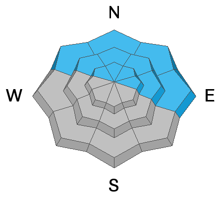
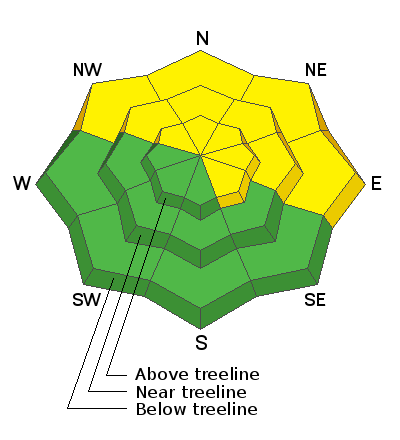
It is still possible to trigger an avalanche on steep, northerly facing slopes that have enough snow to ski or ride. However, due to a lack of sufficient snow cover on the majority of the terrain, the avalanche danger is isolated to specific features and therefore MODERATE. With the current snowpack structure, steep, NW-N-E facing slopes with sufficient cover should be avoided for the foreseeable future. Expect the danger to instantly increase with any new snow load, especially if accompanied by wind. Most south-facing terrain has LOW danger.
Low
Moderate
Considerable
High
Extreme
Learn how to read the forecast here
Special Announcements
The Geyser Pass Road is plowed. The surface is snow packed on dirt.
The Lower Utah Nordic Alliance (LUNA) groomed on Saturday.
Weather and Snow
A low pressure system moving through the Great Basin will bring us a chance for snow tonight into Tuesday, with perhaps a better looking system later in the week. Today look for mostly cloudy skies, light to moderate NW winds, and high temps in the mid 20's. Snow showers should develop tonight and finish rather quickly tomorrow morning. 2"-4" are possible.
Wind, temperature, humidity on Pre Laurel Peak (11,700')
Snotel site near Geyser Pass Trailhead (9600')
Storm totals at the Gold Basin study plot (10,000')
Snowpack Discussion
It's getting pretty monotonous describing the current snowpack because there isn't much of one. Signs of instability such as cracking and collapsing continue to occur though instances are becoming more localized. Snow depths on northerly aspects above about 10,000' range from 12" - 24" while southerly aspects are mostly bare. The existing snowpack is very weak and faceted along with the presence of one or two crusts. Below treeline, the entire snowpack is starting to lose cohesion and there isn't much of an overriding slab. Near treeline and above, an overriding slab can be found in areas that have denser deposits of wind drifted snow. Above treeline, the snow in many areas has been ravaged by the wind, and scoured surfaces alternate with smooth, hard slabs, crusts, and in the words of Chris Benson "soul searching sastrugi." Conditions are deceiving due to the overall lack of coverage and the general inaccessibility of avalanche terrain, but if you went searching for an avalanche you could still find one.
Ad
Avalanche Problem #1
Persistent Weak Layer
Type
Location
Likelihood
Size
Description
Our snowpack is rife with persistent weak layers of loose, sugary, faceted snow along with a couple of melt feeze layers. Red flag signs of instability such as collapsing and whumphing continue to be observed though they are becoming more localized. Although avalanche terrain remains difficult to access due to low coverage, human-triggered avalanches remain possible on steep, northerly facing slopes that have sufficient snow cover.
General Announcements
This forecast is from the U.S. Forest Service, which is solely responsible for its content. This forecast describes general avalanche conditions and local variations always occur.