Forecast for the Logan Area Mountains

Toby Weed
Issued by Toby Weed on
Friday morning, April 3, 2026

Evaluate snow and terrain carefully: Heightened avalanche conditions exist today on drifted upper elevation slopes, and people could trigger soft slab avalanches of drifted storm snow up to 2 feet deep. Rising temperatures and a hot spring sun this weekend will elevate the danger of wet avalanches entraining the fresh snow.

We've stopped issuing daily forecasts for the season, but we’ll continue to share snow observations, avalanche information, and condition updates.

Low
Moderate
Considerable
High
Extreme
Learn how to read the forecast here
Special Announcements

Researchers Ian McCammon and Sara Boilen are developing new tools for managing human factors for backcountry skiers and boarders. This survey asks about personal experiences with human factors and will take 7 - 8 minutes to fill out. Link is HERE.

Weather and Snow

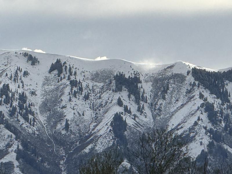
The storm in the first 2 days of April deposited a foot-and-a-half of new snow at upper elevations in the Bear River Range, with the Tony Grove Snotel at 8400 feet reporting 17 inches of new snow containing 2.5 inches of SWE (snow water equivalent). Meanwhile, winds blowing generally from the west increased yesterday afternoon and overnight, with average wind speeds around 25 mph and gusts over 40 mph recorded at our Paris Peak weather station. Temperatures plummeted after the storm passed, and this morning they're lower than we've seen in weeks, with 19°F at Tony Grove and 12°F at 9500 feet on Paris Peak.

Not enough and too late, fresh snow from April 2 blankets the Bear River Mountains above Cache Valley. Unfortunately, the new snow will rapidly melt off the bare slopes at mid and lower elevations, making access to the fresh powder challenging.

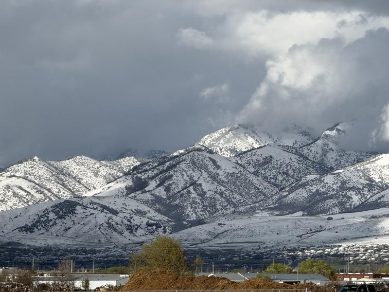
Since all the trailheads and trails at low elevations have melted out, access to the fresh powder will be the challenge this weekend, limiting traffic in the high country. If you make it up into upper elevations, you should evaluate the snow carefully, especially in drifted terrain, since soft slab avalanches of storm snow up to 2 feet deep are possible on slopes steeper than 30 degrees. Wet avalanches entraining saturated storm snow will become increasingly likely in sunny terrain as temperatures rise again this weekend.

The weather may have the upper hand, and we’re beginning to wind things down for the season, but it’s been a memorable ride. Access has become incredibly challenging, yet it’s always a good reminder of how dynamic these seasons can be. It’s hard to imagine those banner years when we’ve ridden into June—but we know they'll come around again. This season will stand out for many reasons, and we hope you were able to get out, spend time in the mountains, and enjoy the snow we did have. Thank you to our backcountry community for your continued support—we truly couldn’t do this work without you. And a huge thank you to Ski-Doo; your generous support makes what we do possible.

The black line says it all. Tony Grove actually looks good compared to the state, which isn't saying much.

Recent Avalanches

Here is a video about a recent natural wet avalanche that we looked at in the Mount Naomi Wilderness.

The avalanche in Smithfield Dry is a great example of just how far wet avalanches can run. The deep debris pile ran all the way down to the canyon bottom, where it crossed the hiking trail. Thanks to Greg Davis for letting us know about this...

***Find avalanche reports and observations from the Logan and Bear River Mountain zone and across the state HERE.

Avalanche Problem #1
Wind Drifted Snow
Type
Location
Likelihood
Size
Description

Winds from the west increased yesterday afternoon, drifting the fresh snow into lee slope avalanche starting zones. Expect heightened avalanche conditions on upper elevation slopes with recently wind-deposited snow, where people could trigger slab avalanches up to about 2 feet deep.

I could see plumes of snow drifting off the Wellsville Range from Cache Valley yesterday evening.

Avalanche Problem #2
Wet Snow
Type
Location
Likelihood
Size
Description

As temperatures warm this weekend, loose wet avalanches are increasingly possible.

  • Watch for active roller balls and surface sluffs that indicate the snow is losing strength.
  • If you're sinking into saturated snow above your ankles, move to shadier slopes or lower-angle terrain.
  • Pay attention to and avoid terrain traps below you, such as gullies or cliffs, where even a small avalanche can have severe consequences.
  • As temperatures climb throughout the day, avoid being on or under steep slopes.
Additional Information
  • Travel with a partner, and cross or ride slopes steeper than 30 degrees one at a time while the rest of your group watches from a safe spot.
  • Ensure that everyone in the group has avalanche rescue equipment (a transceiver, probe, and shovel) and knows how to use it.

-----------------------------------------------------------------------------------------------------------------------------------------------------------------

For all questions on forecasts, education, Know Before You Go, events, online purchases, or fundraising, call 801-365-5522.

Did you know the UAC hosts a podcast? Episode 2 of Season IX is just out - AI, Machine Learning, and the Value of Expert Intuition at the Utah Avalanche Center.

Are you interested in learning more about avalanches? Visit our education page for details on all our classes.

For more information, visit the UAC weather page here: UAC Weather Page For Logan-specific weather, go here: Logan Mountain Weather

-Remember, the information you provide could save lives, especially if you see or trigger an avalanche. To report an avalanche or submit an observation from the backcountry, go HERE

-Receive forecast region-specific text message alerts to receive messages about changing avalanche conditions, watches, and warnings. Sign up and update your preferences HERE

This forecast is from the U.S.D.A. Forest Service, which is solely responsible for its content. This forecast describes general avalanche conditions and local variations always occur.

General Announcements
This information does not apply to developed ski areas or highways where avalanche control is normally done. This forecast is from the U.S.D.A. Forest Service, which is solely responsible for its content. This forecast describes general avalanche conditions and local variations always occur.