Donate to the 2024 Spring Campaign to help rebuild the UAC website.

Forecast for the Logan Area Mountains

Toby Weed
Issued by Toby Weed for
Wednesday, April 3, 2019
MODERATE: Shallow avalanches of new storm and wind drifted snow are possible on mid and upper elevation slopes. Wet avalanches entraining saturated new snow are likely around and below the rain-snow line, (about 7500') with some natural wet loose activity possible. Human triggered avalanches failing on a buried persistent weak layer, 1 to 2+ feet deep, remain possible on some northerly facing upper elevation slopes. Evaluate snow and terrain carefully.
Low
Moderate
Considerable
High
Extreme
Learn how to read the forecast here
Special Announcements
When the forecasting ends, the UAC’s work keeps going strong. Summer is a busy time for the UAC. During the summer we are working hard on our fall and winter planning; putting together the Fall Fundraiser and USAW; updating our awareness and education programs; this summer we will be finishing up the website redesign project. Your donation shows you’re invested in this community all year round! You can still be part of the UAC’s success in 2019. Consider making a donation by April 8.
Weather and Snow
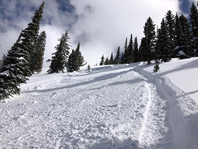
The Tony Grove Snotel at 8400' reports about 4 inches of new snow, with .5" SWE from overnight and yesterday evening. It's 32 ºF this morning and there is 85"of total snow. It's 27 ºF at the 9700' CSI Logan Peak weather station, and southwest winds are currently averaging around 18 mph. You'll find significantly more new snow at upper elevations today, with the rain-snow line hovering around 7500'. Expect the new snow at mid elevations to be heavy and sodden, rain soaked below that, and wind drifted up higher.

A low pressure system will bring rain showers and high elevation accumulating snow through this morning. High pressure aloft will return for Thursday. A weak weather disturbance will move through Utah Friday, with a somewhat stronger, yet brief, storm for early Saturday. We'll see snow showers in the mountains today and rain below about 7500', with 1 to 3 inches of additional accumulation possible. High temperatures at 8500' expected around 37ºF, with 7 to 15 mph west wind. Snow showers are possible tonight and it'll be mostly cloudy, with low temperature around 27 ºF, and 7 to 14 mph west winds. It'll be partly sunny tomorrow, with high temperatures near 43 ºF and 7 to 14 mph south-southwest wind.
Recent Avalanches
On Saturday, 3/30/19, two riders were caught, carried, and partially buried in the Whites Canyon Area just north of the Idaho State Line in the Franklin Basin Area. Luckily, there were no injuries. See report HERE

Sledders also triggered a couple avalanches near Bloomington Lake on Saturday, and a rider was caught and carried, but managed to ride out of a 20" deep and 60' wide soft slab avalanche.
Ad
Avalanche Problem #1
New Snow
Type
Location
Likelihood
Size
Description
Storm and wind slab avalanches consisting of fresh and drifted new snow are possible on mid and upper elevation slopes.
  • Use caution in upper elevation areas where drifts form, like on the lee side of major ridges and in and around terrain features like sub-ridges, gullies, scoops, tree stringers, and cliff bands.
  • Stay off and out from under large ridge top cornices, which are likely to break further back than expected and could trigger avalanches on steep slopes below.
Avalanche Problem #2
Wet Snow
Type
Location
Likelihood
Size
Description
Warmth and rain at lower elevations today will cause the snow to become soft and saturated and prone to avalanching in many areas. Avoid being on or under steep slopes with saturated surface snow, and stay out of runout gullies.
Avalanche Problem #3
Persistent Weak Layer
Type
Location
Likelihood
Size
Description
1' to 2' deep avalanches avalanches failing on a buried persistent weak layer of surface hoar or near surface facets will be possible for people to trigger again today on upper elevation slopes facing the north half of the compass.
Surface hoar feathers on the snow surface on 3/12/19 in the Southern Bear River Range.
Additional Information
I will update this forecast Friday morning.
General Announcements
The new weather station at the WSU Bloomington Canyon Yurt is up and running. Data available HERE
Now is a great time to practice companion rescue techniques with your backcountry partners. You should check out and use the new Avalanche Beacon Training Park we set up at the Franklin Basin trailhead. Special thanks to Northstars Ultimate Outdoors, USU Outdoor Program, and Beaver Mountain Ski Patrol for helping us to make this possible.
The Beaver Mountain Backside is the backcountry, and it is avalanche terrain. Same goes for the steep rocky terrain adjacent to Cherry Peak Resort. If you leave a ski area boundary, you and your partners should carry and practice with avalanche rescue equipment and follow safe backcountry travel protocols.
Check out the improved weather links, road conditions, and weather links for each forecast region on the new UAC IOS App. Do you use the NOAA point forecast? If so, now you can bookmark your favorite weather locations in "My Weather" in the App. HERE
Are you new to the backcountry or looking to refresh your skills? The UAC has released a free 5-part avalanche skills eLearning series. HERE
If you would like to get the daily advisory by email you subscribe HERE.
Support the UAC through your daily shopping. When you shop at Smith's, or online at REI, Backcountry.com, Patagonia, NRS, Amazon, eBay by clicking on these links, they donate a portion of your purchase to the UAC. If you sell on eBay, you can have your See our Affiliate Page for more details on how you can support the UAC when you shop
Remember your information can save lives. If you see anything we should know about, please help us out by submitting snow and avalanche observations. HERE You can call us at 801-524-5304, email by clicking HERE, or include #utavy in your Instagram.
This forecast is from the U.S.D.A. Forest Service, which is solely responsible for its content. The forecast describes general avalanche conditions and local variations always occur.