The final UAC report for the Upper Weber Canyon avalanche accident on March 9 has been published and is available
HERE. The UAC would like to thank Park City Powder Cats for sharing information about the timeline of the accident and allowing UAC staff access to the avalanche after the incident.
Temperatures dropped well below freezing again overnight at most mountain stations, and the cold has set up and refrozen the saturated snow. Wet avalanches are unlikely and the refrozen snow is generally stable. You'll need to put the scrapers down, and the snow is so hard and slick on some slopes that it may be difficult to self arrest a fall if you start sliding.
In the spring it's a good idea to get in the habit of getting out early, so you can finish up early and avoid being in avalanche terrain late in the day when the snow is softened by warmth and more prone to avalanching. But, today the snow on many slopes will stay pretty hard until afternoon.
The 8400' Tony Grove Snotel reports 21° F
and 128" of total snow. It's a chilly 13° F and the wind is lightly blowing from the northwest this morning at the Logan Summit UDOT sheds.
Here is the NWS point forecast (36 hrs) for Upper Elevations in the Central Bear River Range:
Today: Sunny, with a high near 37. Wind chill values as low as 6. West southwest wind 8 to 10 mph.
Tonight: Mostly clear, with a low around 22. South wind 7 to 10 mph.
Sunday: Sunny, with a high near 49. South southwest wind 11 to 18 mph.
Looks like warm daytime temperatures also on Monday, with increasing clouds and westerly wind. Snow showers are likely on Tuesday and the snow could be heavy at times, with 4 to 8 inches of accumulation possible at upper elevations. Cooler temperatures and clouds will prevail through the remained of the work week.
- Wednesday, ID Hwy 36 was closed due to a canal breach in the Mink Creek area. The resulting flood created a destructive slush avalanche and mudslide which crossed the road and damaged a few structures. HERE
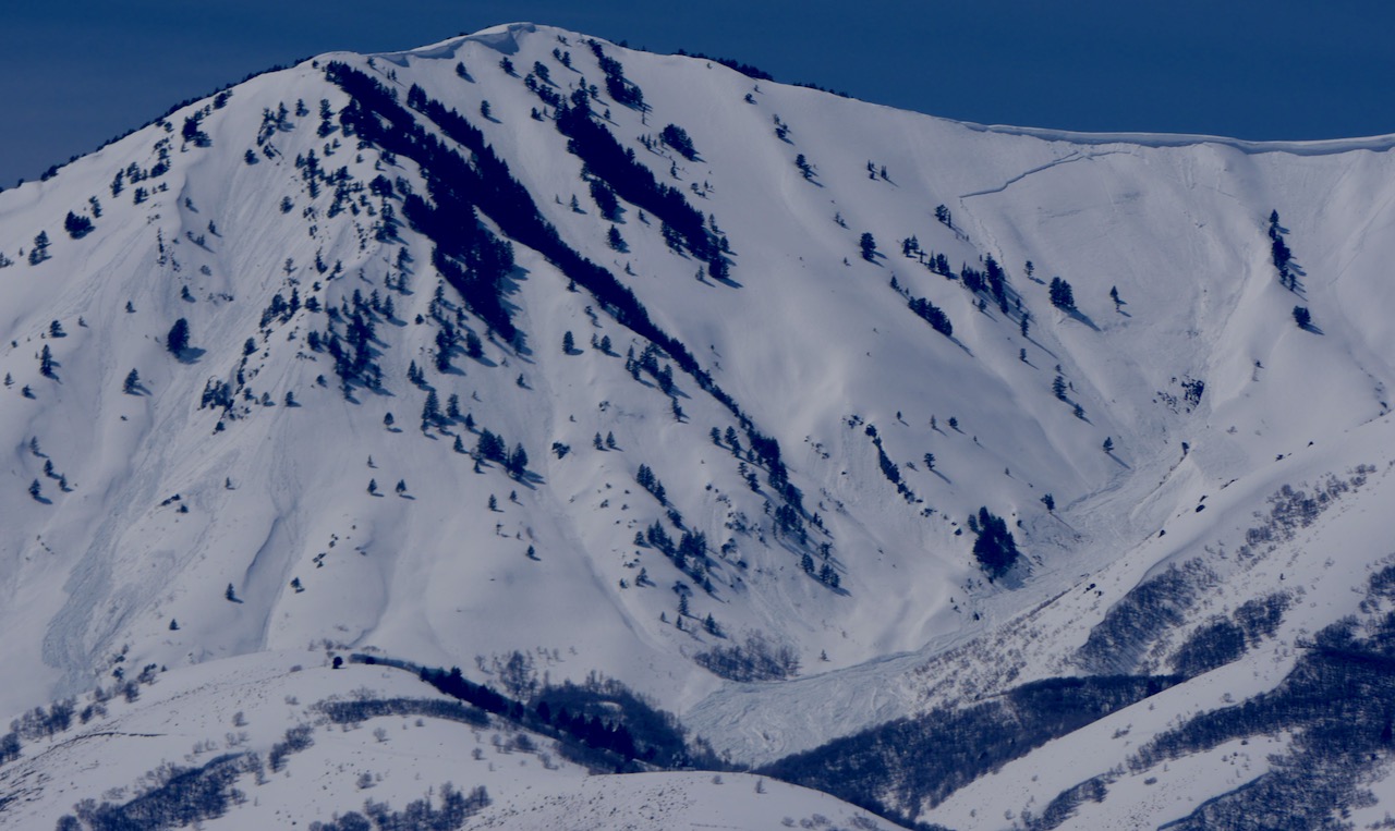
- Widespread natural wet avalanches occurred earlier this week in the Wellsville Range. Large natural cornice falls and loose avalanches triggered long running and dangerously large wet slabs. I was quite relieved to see no cars parked at the Rattlesnake TH Sunday, after seeing the huge debris pile from a massive natural avalanche that came off the north ridge of Mitton Peak....HERE
A recent large natural avalanche triggered by a cornice fall in the Wellsvilles. Rattlesnake Canyon, N Ridge of Mitton Pk, 4-9-23
- For a list of recent avalanches in the Logan Zone go HERE.
- There was tons of recent natural wet avalanche activity in the mountains of Northern Utah. Find a list of all recent observations & avalanches from across Utah go HERE.


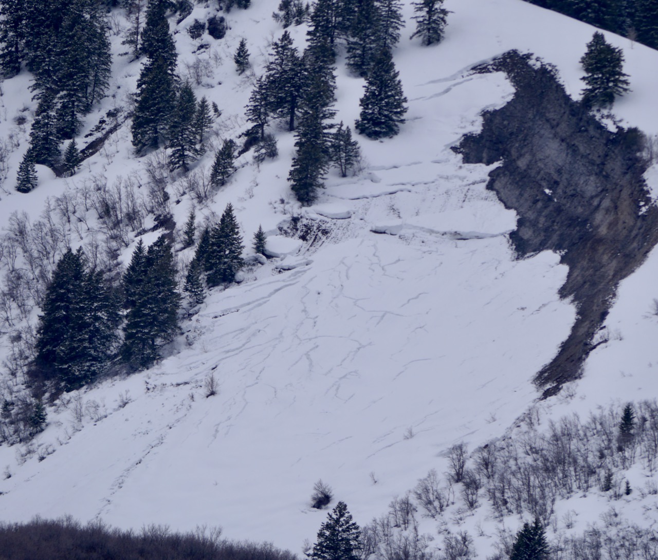 Natural glide avalanche activity is apparent on the Red Slide at 6000' on east racing rock slabs in the Wellsville Mountain Wilderness above Mendon. 4-14-23


