Forecast for the Logan Area Mountains

Toby Weed
Issued by Toby Weed for
Monday, April 15, 2019
CONSIDERABLE: Dangerous avalanche conditions exist in the backcountry today. A foot of heavy new snow fell at upper elevations, it was drifted by sustained southwest winds, and rain fell on the snow up to about 8500' in elevation last night. Human triggered avalanches of heavy wind drifted storm snow up high and wet snow lower down are likely today, and natural activity is quite possible.
Use extra caution in the backcountry today. Evaluate snow and terrain carefully, and make conservative decisions.
Low
Moderate
Considerable
High
Extreme
Learn how to read the forecast here
Special Announcements
Thank you to everyone who supported our spring fundraiser. We reached and even exceeded our goals. The Utah Avalanche Center could not exist without your support.
Spring is here and it is time to adjust our travel. Learn what to watch for during spring avalanche conditions when the snow becomes wet. Watch our Spring video
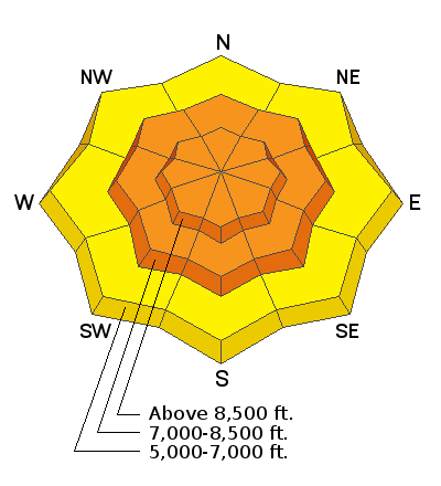
 HERE
Weather and Snow
The Tony Grove Snotel at 8400' reports about 8" of new snow with 1.4" SWE in the last 24 hours, and it looks like it rained overnight. There's 91 inches of total snow, and it's 33ºF this morning. I'm reading 25ºF at the 9700' CSI Logan Peak weather station, and west-northwest winds are currently averaging around 17 mph, with a gust of 46 mph earlier this morning. It rained last night in Cache Valley and in the mountains up to around 8500'.

A stalled frontal band will remain across northern Utah today. A stronger storm system will impact much of the area Tuesday through early Wednesday. Strong high pressure aloft will build across the region for the latter half of the week.
Snow showers will continue this morning, with little in the way of accumulation. It will be mostly cloudy today, but periods of sun are possible in the afternoon. High temperatures at 9000' expected to be around 42ºF, with 11 to 16 mph west-northwest winds. Rain and snow are likely tonight with little accumulation expected, low temperatures around 28ºF, and 10 to 17 mph south-southwest winds. Rain and snow are likely tomorrow, with 2 to 4 inches possible. High temperatures of around 34ºF are expected, with south wind 13 to 16 mph, veering from the north in the afternoon.
Recent Avalanches
No new avalanches were reported from the backcountry this weekend.
The sun popped out for a few short periods Friday morning and we noticed a few natural wet loose avalanches at upper elevations on east and southeast facing slopes in the Tony Grove Area in the afternoon.
3 new wet loose avalanches entraining a few inches of saturated fresh snow were apparent on the east side of Mt. Magog in the afternoon, 4/12/19.

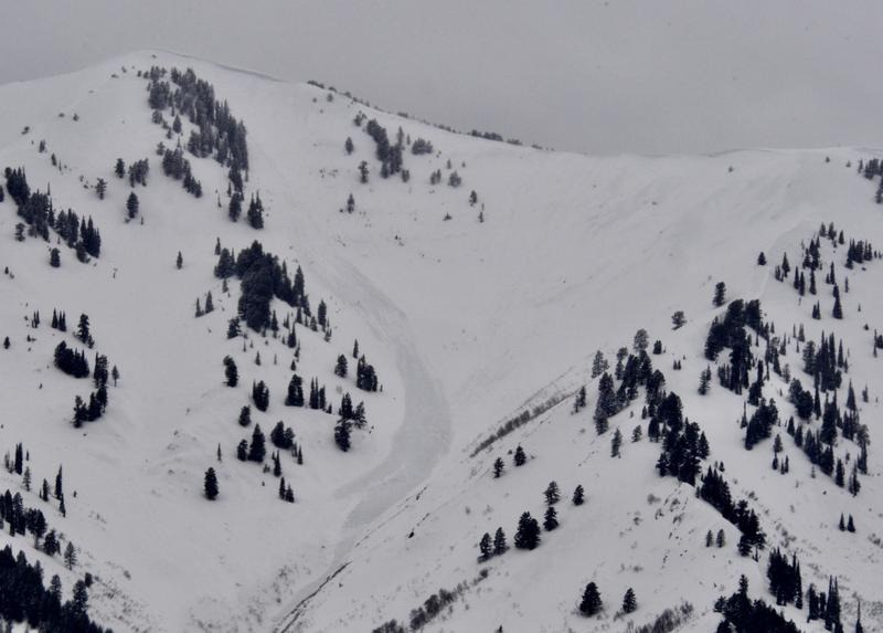
Despite poor visibility, we could see some minor natural activity in the Wellsville Range this week, with one fairly sizable new avalanche noted in North Shumway Canyon.
4/10/19 natural avalanche in North Shumway Canyon in the Wellsville Mountain Wilderness.
Numerous fairly large natural wet loose and a few wet slab avalanches occurred in early April across the Logan Zone. Wet loose and wet slab avalanches occurred with seasonal daytime solar warming.
Ad
Avalanche Problem #1
Wet Snow
Type
Location
Likelihood
Size
Description
It stayed well above freezing and rained in Cache Valley and up to about 8500' in the surrounding mountains overnight. Rapid seasonal daytime warming and possible periods of strong April sun will cause an increasing danger of wet avalanches entraining saturated fresh snow. Wet avalanches are possible for people to trigger on lower elevation slopes today, and even more likely on mid and upper elevation slopes. Natural wet avalanche activity is possible and could become likely steep terrain at all elevations, especially if the sun comes out from behind the clouds during the heat of the day.
  • Avoid being on or under steep slopes with melt-softened saturated snow, and stay out of runout gullies.
Avalanche Problem #2
Wind Drifted Snow
Type
Location
Likelihood
Size
Description
Around a foot of heavy new snow fell at upper elevations, and sustained and fairly strong southwest winds drifted it on steep slopes and into avalanche starting zones. Human triggered soft slab avalanches of wind drifted storm snow, 1 to 2 feet deep, are likely and natural avalanches are possible above about 8500' in elevation. Avalanches might be quite sensitive or a bit stubborn and could run fast and far.
  • Avoid stiffer freshly drifted snow on the lee side of major ridges and in and around terrain features like cliff bands, gullies, tree stringers, scoops, and sub-ridges.
  • Stay off and out from under large ridge top cornices, which are likely to break further back than expected, and could trigger avalanches on steep slopes below.
Additional Information
Today is our last regular forecast. We will continue to post intermittent and weekend updates through April. I will update this forecast by 7:30 Wednesday morning.
Here is a short video from Utah Avalanche Center Staff about Spring snow.
Spring snow in the Logan Zone...
General Announcements
Now is a great time to practice companion rescue techniques with your backcountry partners. You should check out and use the new Avalanche Beacon Training Park we set up at the Franklin Basin trailhead. Special thanks to Northstars Ultimate Outdoors, USU Outdoor Program, and Beaver Mountain Ski Patrol for helping us to make this possible.
Check out the improved weather links, road conditions, and weather links for each forecast region on the new UAC IOS App. Do you use the NOAA point forecast? If so, now you can bookmark your favorite weather locations in "My Weather" in the App. HERE
Are you new to the backcountry or looking to refresh your skills? The UAC has released a free 5-part avalanche skills eLearning series. HERE
If you would like to get the daily advisory by email you subscribe HERE.
Support the UAC through your daily shopping. When you shop at Smith's, or online at REI, Backcountry.com, Patagonia, NRS, Amazon, eBay by clicking on these links, they donate a portion of your purchase to the UAC. If you sell on eBay, you can have your See our Affiliate Page for more details on how you can support the UAC when you shop
Remember your information can save lives. If you see anything we should know about, please help us out by submitting snow and avalanche observations. HERE You can call us at 801-524-5304, email by clicking HERE, or include #utavy in your Instagram.
This forecast is from the U.S.D.A. Forest Service, which is solely responsible for its content. The forecast describes general avalanche conditions and local variations always occur.