March Kicks Off Our Spring Campaign- Donate Now to Support Forecasting

Forecast for the Logan Area Mountains

Paige Pagnucco
Issued by Paige Pagnucco on
Saturday morning, March 8, 2025
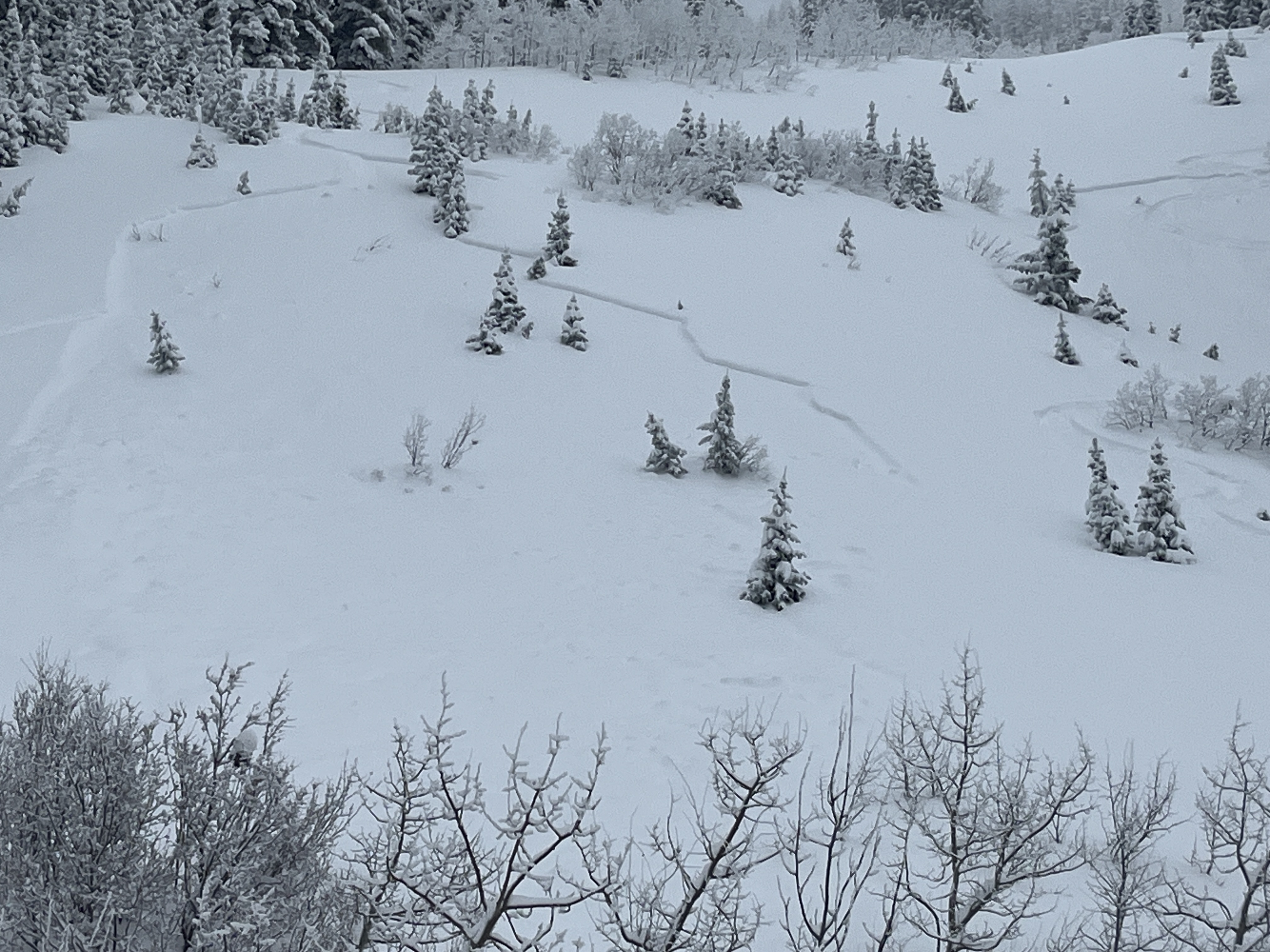
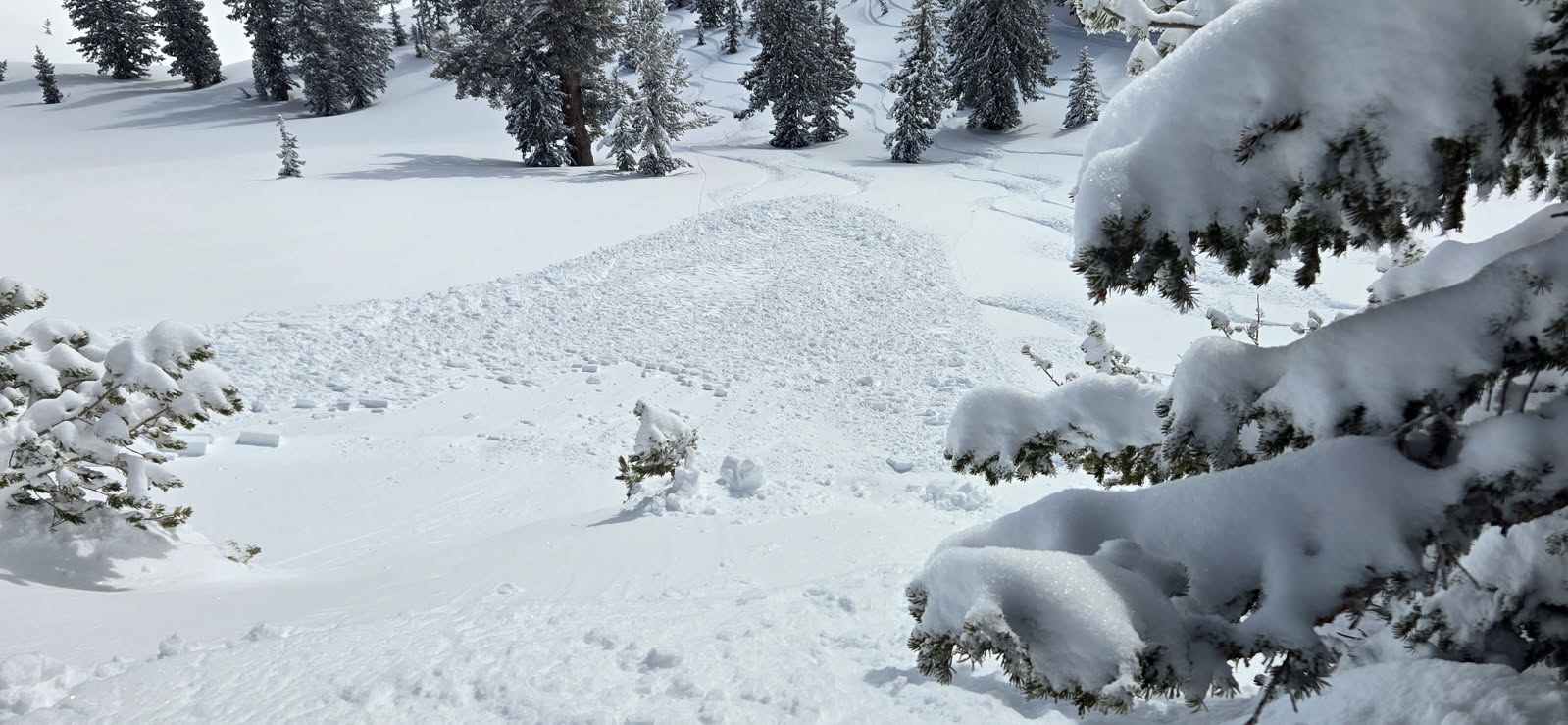
The avalanche danger is MODERATE this morning but may rise to CONSIDERABLE this afternoon with daytime heating. Natural avalanches of wet loose snow are possible under the strong March sunshine. It is still possible to trigger a soft slab avalanche up to 2 feet deep on slopes steeper than 30 degrees.
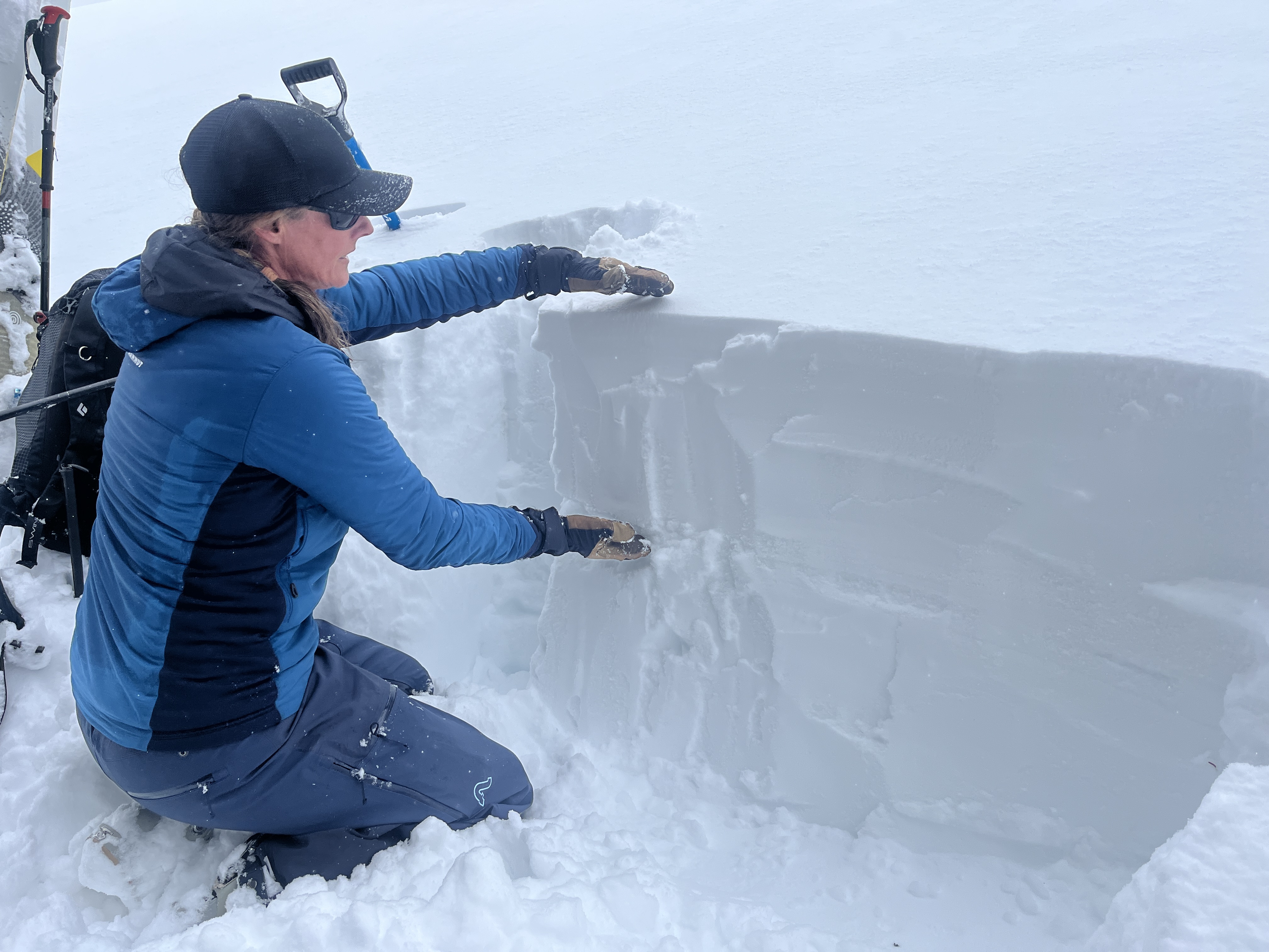
  • Evaluate snow and terrain carefully and continue to practice safe travel protocols.
  • Stay off overhanging cornices; they can break back much farther than expected.
Low
Moderate
Considerable
High
Extreme
Learn how to read the forecast here
Special Announcements
March kicks off our Spring Campaign! If everyone in Utah’s backcountry community donates the cost of something they regularly enjoy on an adventure—like a dawn patrol burrito, a backpack snack, or post-ride trailhead drinks—we could fund not just one but two forecasters for the entire season! Donate here.
Weather and Snow
Yesterday’s riding conditions were fantastic with cool mountain temperatures and consistent cloud cover. It was great to see so many people out enjoying the March powder. The snow should still be in prime condition this morning, especially in north-facing terrain, but once the sun climbs high enough, its sharp March angle will turn the fresh snow into mashed potatoes. As the snow becomes saturated, loose wet avalanches will become possible. Exercise caution in steep terrain, as the new snow may still have lingering instabilities. We received reports of natural and human-triggered soft storm slab avalanches from yesterday and Thursday, mostly in very steep areas. These avalanches were 12-18 inches deep and 50-200 feet wide. I expect any slab avalanche triggered today will be about the same size. The best riding conditions will be this morning before the sun gets too high and warm.

The Tony Grove Snotel at 8400 feet reports a trace of new snow in the last 24 hours. It's 18° F, with 99 inches of total snow. It's 16° F at the Card Canyon weather station with 74 inches of total snow. At 9700 feet at CSI's Logan Peak Wx station, winds are blowing in the teens mph from the north-northwest, gusting into the 20s and 30s, and it's 14° F. On Paris Peak at 9500 feet, it's 14° F, with winds blowing 19 to 26 mph from the north.

Expect a stunning day in the mountains with clear skies, strong sunshine, and an 8500' high in the mid-30s F. Tomorrow will be the same but even warmer. Sunshine and warm temperatures last through the early week with the next chance for snow starting Wednesday.

For more information, visit the UAC weather page here: Weather - Utah Avalanche Center
For Logan-specific weather, go here: Logan Mountain Weather - Utah Avalanche Center
Recent Avalanches
Yesterday, we received multiple reports of natural and human-triggered storm slab avalanches occurring over the past few days, ranging from 12-18 inches deep and up to 200 feet wide. These were all on very steep slopes.
Skier-triggered soft slab on a north-facing slope at 7400' occurred on 3/6/25.
Read about all avalanches and observations HERE.
Ad
Avalanche Problem #1
New Snow
Type
Location
Likelihood
Size
Description
Human-triggered soft slab avalanches are still possible today on steep slopes where instabilities within the new snow may still exist. These could be up to two feet deep and possibly 100-200' wide. We observed some cracking yesterday, but I imagine there will be fewer signs of instability today. These avalanches will be more likely in drifted mid and upper-elevation terrain. Following safe travel protocols is the best way to handle this problem.
Avalanche Problem #2
Wet Snow
Type
Location
Likelihood
Size
Description
With the strong March sun and rising temperatures, wet snow avalanches are possible, especially in the afternoon. These avalanches are more likely to occur on steep, south-facing slopes once the snow becomes saturated, and they could be significant due to the amount of new snow. As the snow begins to feel mushy or wet with daytime heating, the avalanche danger may rise to CONSIDERABLE, with natural wet avalanches becoming possible. The best approach to this problem is to move to cooler aspects or higher elevations, or avoid steep terrain altogether.
  • This afternoon, people fishing in the Logan River should avoid standing under steep snow-covered slopes, especially in places like the Dugway and Blind Hollow/Temple Fork.
Additional Information
Paige shows how much new snow accumulated Thursday in northeast-facing terrain at 8800 feet in the Central Bear River Range.
General Announcements
-National Forest Winter Recreation Travel Maps show where it's open to ride: UWCNF Logan, Ogden LRD Tony Grove, Franklin Basin CTNF Montpelier
-For all questions on forecasts, education, Know Before You Go, events, online purchases, or fundraising, call 801-365-5522.
-Remember the information you provide could save lives, especially if you see or trigger an avalanche. To report an avalanche or submit an observation from the backcountry, go HERE.
-Receive forecast region-specific text message alerts to receive messages about changing avalanche conditions, watches, and warnings. Sign up and update your preferences HERE.
-We are excited to announce the launch of our new mobile application available on both Android and IOS. Get all the information you need to plan your backcountry adventure and keep the information at the tip of your fingers while you are out. Install the Android version HERE and the IOS version HERE.

This forecast is from the U.S.D.A. Forest Service, which is solely responsible for its content. This forecast describes general avalanche conditions, and local variations always occur.