Get Your Ticket to the 32nd Annual Backcountry Benefit on September 11th! Support Forecasting, Awareness, and Education
Ad

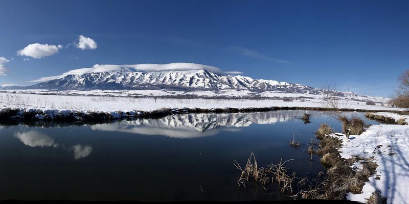
Forecast for the Logan Area Mountains

Toby Weed
Issued by Toby Weed on
Saturday morning, March 7, 2020
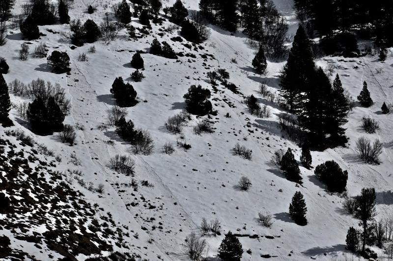
Warm temperatures in the mountains today, strong March sun, and potential green-housing will create heightened wet avalanche conditions and MODERATE danger, especially in sheltered terrain. People could trigger wet avalanches on very steep slopes, most likely in rocky areas with shallow, melt softened snow. Natural wet loose avalanches and cornice falls will become possible in some areas during the heat of the day.
  • Evaluate snow and terrain carefully, and get an early start so you can head home before the snow gets too warm and soft.
Low
Moderate
Considerable
High
Extreme
Learn how to read the forecast here
Special Announcements
The Utah Avalanche Center's Avy Awareness Auction is currently underway with tons of great gear, jewelry, artwork and experiences available. Visit the auction page HERE to help support the UAC's spring avalanche awareness and outreach efforts.
Weather and Snow
It's a toasty 38°F this morning at the 8400' Tony Grove Snotel. There is 81 inches of total snow containing around 110% of normal Snow Water Equivalent It's 33°F at the 9700' CSI Logan Peak weather station, and south winds are cranking along the ridges this morning, now blowing around 40 mph, with a gust of 63 mph around 5:00.
Snow on the valley floor is keeping nighttime temperatures cool, but it won't last for long as temperatures will approach 60°F in the valley again today.

Very warm temperatures in the mountains and strong March sun will create heightened wet avalanche conditions on very steep slopes, especially in sheltered sunny terrain. People could trigger wet avalanches when the snow surface is softened by melting. You'll want to avoid the large ridge top cornices, which will buckle and possibly fail in the heat.


A mild southwest flow aloft will maintain warm and dry conditions across the region today. A weak weather system embedded in this southwest flow along with a gradual increase in moisture will produce areas of precipitation during the latter half of the weekend. Expect partly sunny conditions in the mountain again today, with increasing clouds and a chance of snow showers late in the day. 8500' high temperatures will be close to 50°F, and south-southwest winds will blow 25 to 32 mph along the ridges. Snow showers are likely tonight at upper elevations, with 2 to 4 inches possible. Low temperatures around 26°F are expected, and 20 to 30 mph west winds will diminish to 10 to 20 mph. Snow showers will continue tomorrow, with another inch or two of accumulation possible. High temperatures will be around 32°F, and west-northwest winds will blow 3 to 7 mph.
Recent Avalanches
Yesterday, we observed recent natural wet loose avalanche activity in Logan Canyon. We could see evidence of small surface sluffs sliding on the February dusty-crust into the Logan River in the River Chutes just below Temple Fork and downstream in the Dugway Cirque.
Ad
Avalanche Problem #1
Wet Snow
Type
Location
Likelihood
Size
Description
Overnight temperatures stayed above freezing in many areas, even at the highest elevations. Very warm daytime temperatures and strong March sun will soften the surface snow and the February crusts, increasing the avalanche danger and creating heightened wet avalanche conditions. Avoid and stay out from under large ridge top cornices which will buckle and calve off during the heat of the day.
  • Roller balls, pinwheels, and naturally occurring sluffs indicate potential for wet avalanche activity.
  • Get an early start so you can go home when the snow gets too warm and soft.
Additional Information
A cross country skier was charged and trampled by a moose in upper Green Canyon last week, resulting in a very shaken skier and a broken ski pole. The big beasts are out and about, and they can be pretty grumpy this time of year. People and dogs need to yield the packed trail to the moose and give them lots of room.
General Announcements
Thanks to the generous support of our Utah ski resorts and Ski Utah, we have discount lift tickets available. All proceeds from these go towards paying for avalanche forecasting and education! Get your tickets HERE.
EMAIL ADVISORY. If you would like to get the daily advisory by email you subscribe HERE.
Remember your information can save lives. If you see anything we should know about, please help us out by submitting snow and avalanche observations....HERE. You can also call us at 801-524-5304, email by clicking HERE, or include #utavy in your tweet or Instagram.
This forecast is from the USDA Forest Service, which is solely responsible for its content. The forecast describes general avalanche conditions and local variations always occur.
I will update this forecast before about 7:30 Monday morning.