Forecast for the Logan Area Mountains

Toby Weed
Issued by Toby Weed on
Thursday morning, March 27, 2025
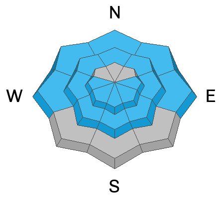
After another warm night in the mountains, very warm temperatures and strong sun will rapidly elevate the avalanche danger to CONSIDERABLE at all elevations today. Natural, long-running wet avalanches and large cornice falls are possible, and people are likely to trigger wet loose or dangerous wet slab avalanches on steep slopes with saturated snow.
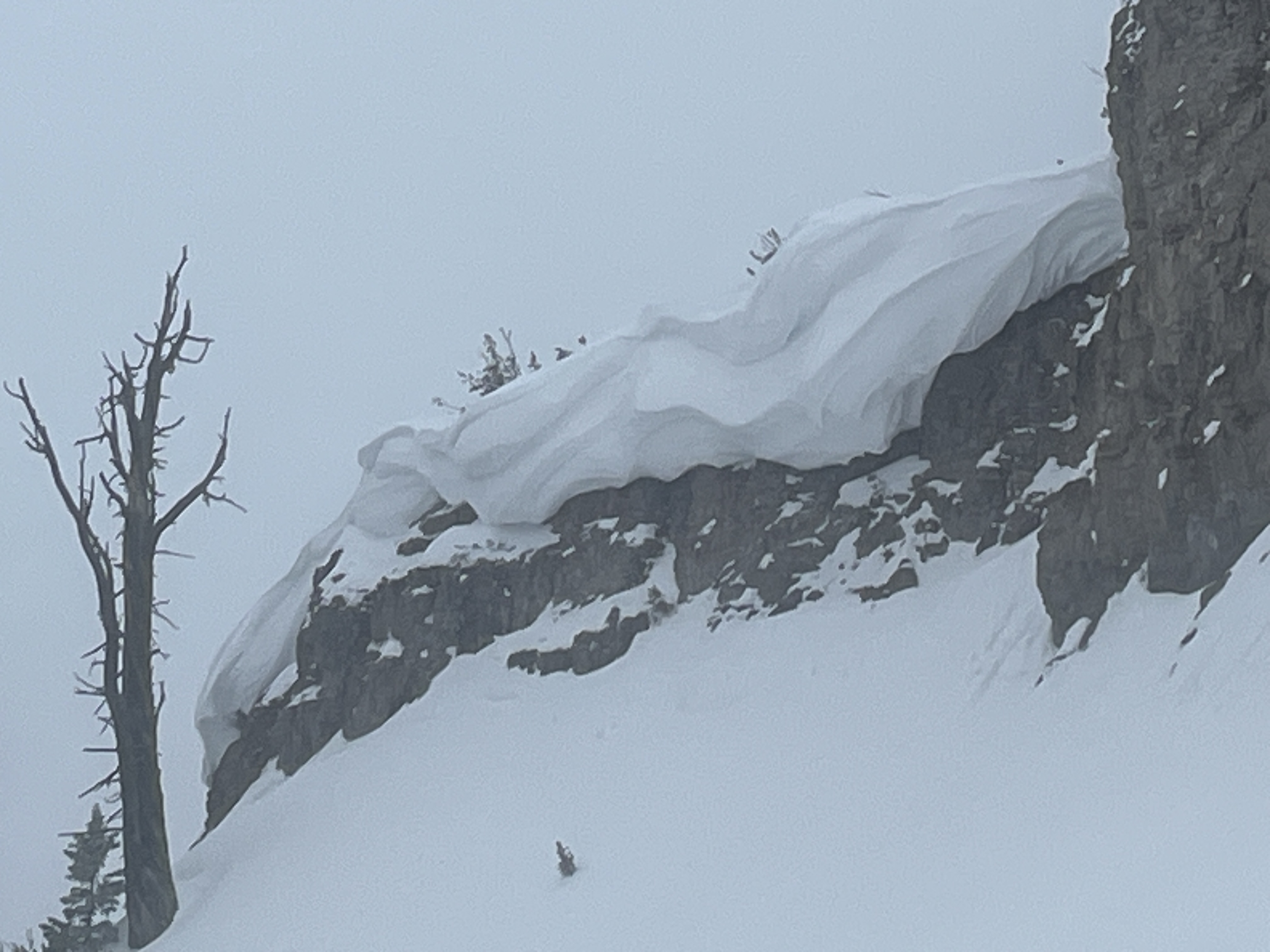
Evaluate snow and terrain carefully, and make conservative decisions. Avoid and stay out from under overhanging cornices as they could break further back than expected and could cause avalanches on slopes below.
Low
Moderate
Considerable
High
Extreme
Learn how to read the forecast here
Special Announcements
Our Spring Campaign is in full swing, and there are two great ways to support forecasting, awareness, and education across Utah:
Every dollar helps keep the backcountry community on top. Thank you for your support!
Weather and Snow
After another night with temperatures well above freezing at all stations and a poor surface refreeze, the danger of wet avalanches will rise rapidly with the temperatures again today despite increasing winds and clouds. Large natural cornice falls are possible near major ridgetops, and these could trigger large wet avalanches on slopes beneath. Today is not the day for big objectives or to explore extreme terrain. If you head into the backcountry, get an early start and finish the day early. If you start sinking into saturated snow, it's time to pull the plug, reevaluate your route, or change your location. You can find good spring riding conditions in soft, wet, or slushy snow, but today, you should stay off the steep hills due to increasingly dangerous wet avalanche conditions.

The Tony Grove Snotel at 8400 feet reports 93 inches of total snow. It's way too warm again; 44° F this morning, and temperatures stayed well above freezing overnight. It's 46° F at the Card Canyon weather station at 8800 feet, with 69 inches of total snow.
At 9700 feet at CSI's Logan Peak Wx station, winds are increasing this morning, currently blowing 30 to 39 mph from the south, and it's 41° F. The winds on Paris Peak at 9500 feet are blowing 12 to 18 mph from the south-southwest, and it's 42° F.

Today will be mostly sunny with a high temperature at 9000 feet near 52° F. Winds will blow from the southwest 15 to 18 mph. Skies will be mostly cloudy tonight, with a chance for rain or snow showers, but little accumulation is expected. Mountain temperatures will drop to around 31° F and 9 to 17 mph winds will shift from the west-northwest after midnight. Tomorrow will be mostly cloudy, with a 50% chance for snow showers but less than an inch of accumulation is expected. Expect a high temperature around 42° F and 5 to 9 mph winds switching from the south in the morning. Thankfully, mountain temperatures should drop a few degrees below freezing tomorrow night.
Snow showers are expected in the mountains over the weekend, with 2 to 4 inches of accumulation possible on Saturday, and temperatures will drop into the low-20s on Saturday night.

For more information, visit the UAC weather page here: Weather - Utah Avalanche Center
For Logan-specific weather, go here: Logan Mountain Weather - Utah Avalanche Center
Recent Avalanches
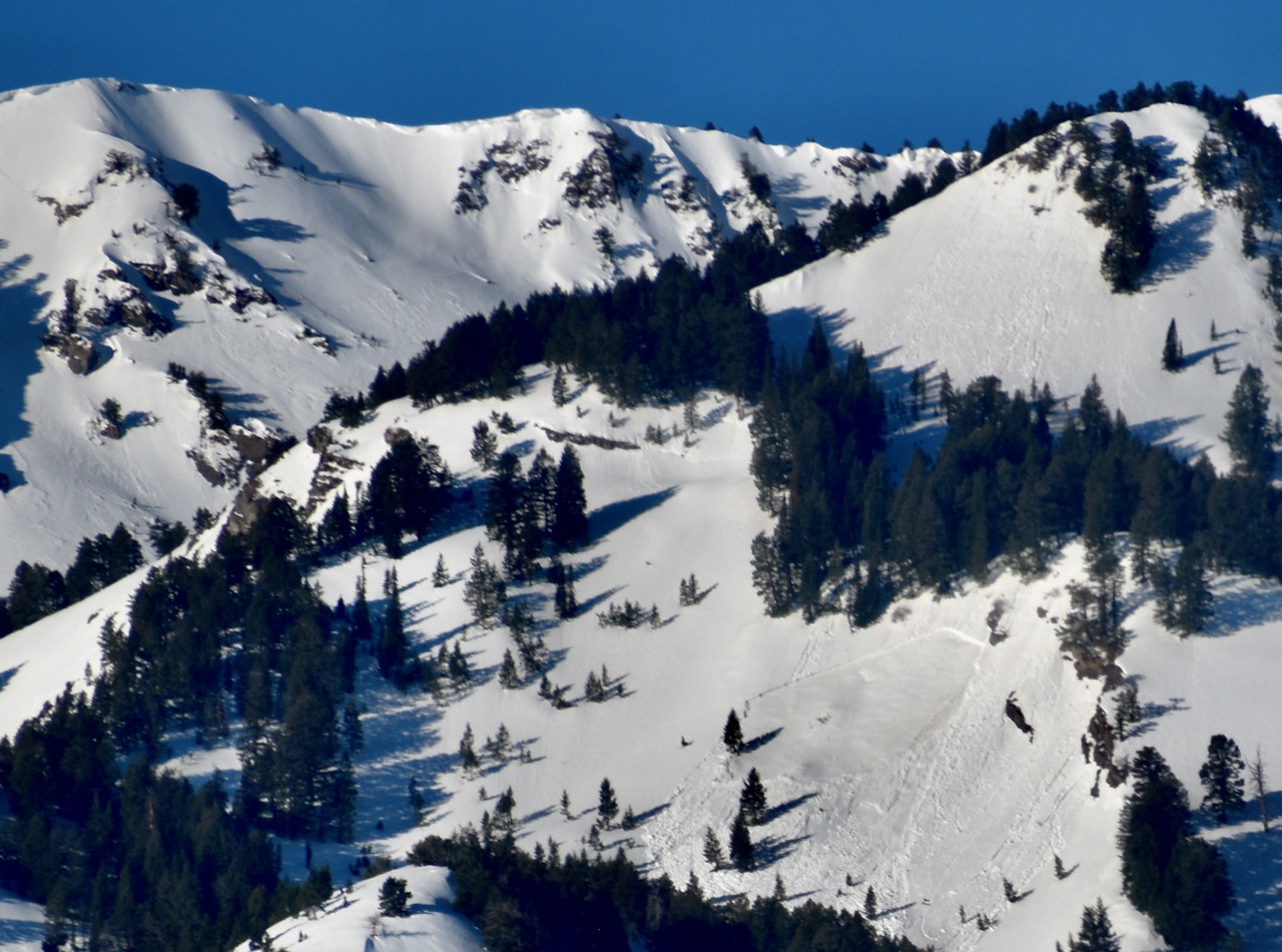
Tuesday, I saw a recent natural slab avalanche in Pine Canyon in the Wellsville Mt Wilderness. From a distance, I estimated the avalanche at around 8800 feet on an ENE-facing slope to be about 3 feet deep and 250 feet wide. Picture Window Ax report
Numerous natural wet loose avalanches and roller-ball swarms from the past two days are visible from Cache Valley, and the mountains look like they are dripping hot candle wax.

Read about all avalanches and observations HERE.
A natural wet slab avalanche in the Picture Window Area of Pine Canyon in the Wellsville Mountain Wilderness. (photo from Wednesday and the avalanche occurred on Tuesday morning)
Ad
Avalanche Problem #1
Wet Snow
Type
Location
Likelihood
Size
Description
Daytime warming and sunshine will cause the snow to become unstable at all elevations. Natural wet loose and slab avalanches will become increasingly likely as temperatures soar during the day and remain above freezing at night.
  • Watch for rollerballs, pinwheels, and sluffs, as signs of instability.
  • If you sink up to your ankles in the mushy snow, it is time to move to a cooler aspect or elevation or to lower-angle terrain.
  • Avoid travel on steep slopes above trees or other terrain traps.
  • Stay out from under the large cornices, as the heat will cause them to buckle and some to calve off large, school bus-sized chunks.
Avalanche Problem #2
Cornice
Type
Location
Likelihood
Size
Description
  • People should stay off of, out from under, and well away from the edges of large overhanging cornices, which are deceptive and often break much further back than expected.
  • With daytime heating, natural and human-triggered cornice falls are possible today, and these could trigger avalanches on slopes beneath.

General Announcements
-National Forest Winter Recreation Travel Maps show where it's open to ride: UWCNF Logan, Ogden LRD Tony Grove, Franklin Basin CTNF Montpelier
-For all questions on forecasts, education, Know Before You Go, events, online purchases, or fundraising, call 801-365-5522.
-Remember the information you provide could save lives, especially if you see or trigger an avalanche. To report an avalanche or submit an observation from the backcountry, go HERE.
-Receive forecast region-specific text message alerts to receive messages about changing avalanche conditions, watches, and warnings. Sign up and update your preferences HERE.
-We are excited to announce the launch of our new mobile application available on both Android and IOS. Get all the information you need to plan your backcountry adventure and keep the information at the tip of your fingers while you are out. Install the Android version HERE and the IOS version HERE.

This forecast is from the U.S.D.A. Forest Service, which is solely responsible for its content. This forecast describes general avalanche conditions, and local variations always occur.