Forecast for the Logan Area Mountains

Toby Weed
Issued by Toby Weed for
Saturday, March 26, 2022
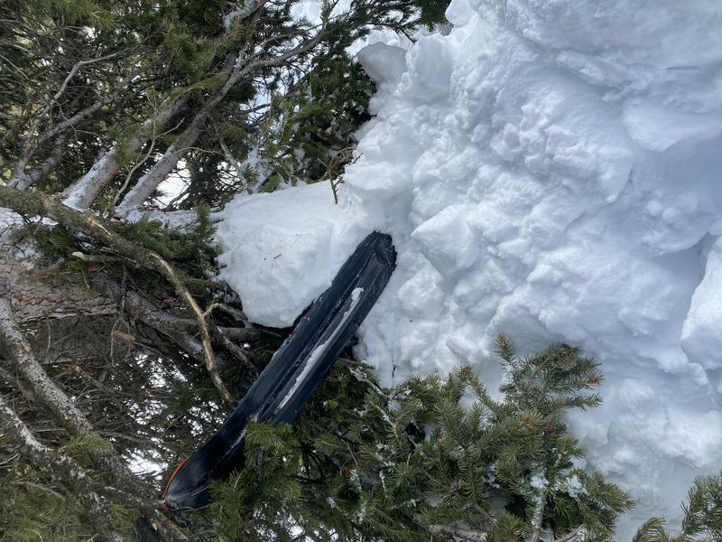
Today, the warmest temperatures of the year will cause dangerous avalanche conditions and CONSIDERABLE danger at all elevations on backcountry slopes steeper than 30°. In northerly facing terrain, natural avalanches are possible and people are likely to trigger dangerous slab avalanches, up to two feet deep and a couple hundred feet wide, failing on a buried persistent weak layer of faceted snow. Natural and human triggered loose wet avalanches are likely in steep terrain at all elevations, and dangerous wet slab avalanches are possible in some areas due to the heat.
  • Careful snowpack evaluation, cautious route-finding, and conservative decision making are essential for safe backcountry travel.
  • Avoid being on or beneath slopes steeper than 30°, particularly during the heat of the day.
Low
Moderate
Considerable
High
Extreme
Learn how to read the forecast here
Special Announcements
Two generous UAC supporters are challenging the community to invest in the future of the UAC’s forecasting program during the 2022 Spring Campaign. They will match your donation, dollar for dollar, up to $10,000. Donate today to support avalanche forecasting!..... HERE
Weather and Snow
Dangerous avalanche conditions exist at all elevations, and there are areas with unstable snow, especially on upper and mid-elevation slopes facing the north half of the compass. Weak sugary faceted snow still exists on northerly facing slopes creating poor snow structure, and people could trigger avalanches if they venture into this terrain today. Today's even warmer temperatures will cause dangerous conditions for wet avalanches at all elevations. Natural wet loose and wet slab avalanches are possible, with wet slabs most likely in very steep terrain around or under cliff bands.
The 8400' Tony Grove Snotel reports 45°F, and there is 64 inches of total snow at the site, containing 80% of normal SWE for the date. West-southwest winds are blowing around 25 mph at the 9700' CSI Logan Peak weather station, where it is a toasty 42°F this morning.

  • Today expect sunny and very warm conditions again, with high temperatures at 8500' around 56°F, and 15-20 mph west winds.
  • It will be mostly cloudy tonight, with low temperatures near 36 F, and 10 to 15 mph west winds.
  • It will be mostly sunny and HOT again tomorrow, with high temperatures around 60°F, and breezy, 15 to 22 mph wind from the southwest.
  • Temperatures will remain fairly warm as we head into next week, but we'll see a bit of a break from the high sun, with unsettled weather, snow and rain showers and breezy conditions for Monday through Wednesday.
Recent Avalanches
  • A reported large avalanche occurred earlier in the week in Steam Mill Canyon on a steep northeast facing slope at 9600'. The trigger is unknown but the avalanche measured approximately 2' deep and 900' wide. It failed on the same widespread, buried persistent weak layer. Report is HERE.
  • Last weekend people triggered a handful of dangerous slab avalanches that failed on our widespread buried persistent weak layer consisting of loose, sugary faceted snow.
A rider was mostly buried and he and his bent and broken sled had to be excavated by companions in an avalanche accident Sunday in Crescent Lake Canyon, in the Franklin Basin area just south of the Idaho state line.

Check out all the recent backcountry observations and many recent avalanche reports from across Utah HERE.
Ad
Avalanche Problem #1
Persistent Weak Layer
Type
Location
Likelihood
Size
Description
On slopes facing the north half of the compass, natural avalanches are possible and it is likely people will trigger slab avalanches failing on a sugary, buried persistent weak layer. These days there are few telltale signs of instability or apparent red flags, like cracking or collapsing. This weekend's heat will cause increasing instability on slopes plagued by this buried persistent weak layer. The warming will soften existing slabs and crust layers, and increase creep and glide rates, which will cause natural avalanches to become more possible and triggered avalanches more likely.
  • Avalanches failing on a buried persistent weak layer could be triggered remotely or from a distance.
Avalanche Problem #2
Wet Snow
Type
Location
Likelihood
Size
Description
With very warm daytime temperatures and mild nights this weekend, expect the danger of loose wet and wet slab avalanches to continue to increase, especially in the middle of the day.
Temperatures overnight did not drop below freezing in the mountains, but the clear skies probably cooled and superficially hardened the snow surface. It will be way too hot, well above average again today, and you should change your plans if you had big mountain objectives in mind this weekend. When the snow surface becomes damp or unsupportable, it's time to head home, change aspect or move to lower angle terrain. Watch for signs of heat-related instability like rollerballs, pinwheels, or sluffs of saturated surface snow. Just like a spilled 7/11 Slushy, wet or damp snow is generally unstable on steep slopes. The potential for dangerous wet slab activity will continue to increase today, and temperatures will probably not drop even close to freezing again even at the highest elevations tonight.
Additional Information
  • Now is a great time to practice your avalanche rescue skills. Thanks to the generous support of Northstar, the Franklin Basin Beacon Training Park is up and running. The park is located directly west of the parking lot and is open for anyone to use. All you need is your beacon and probe. Please do not dig up the transmitters.
  • Always follow safe backcountry travel protocols. Go one person at a time in avalanche terrain, while the rest of your party watches from a safe area. (practice anytime while traveling on or under backcountry slopes steeper than 30°)
  • Check your avalanche rescue equipment, change your batteries, and practice often with your backcountry partners.
    Check slope angles, and to avoid avalanche terrain stay off of and out from under slopes steeper than 30° and adjacent slopes. Video Here
General Announcements
Special thank you to Polaris and Northstar...Video Here
Who's up for some free avalanche training? Get a refresher, become better prepared for an upcoming avalanche class, or just boost your skills. Go to https://learn.kbyg.org/ and scroll down to Step 2 for a series of interactive online avalanche courses produced by the UAC.
  • Please submit your observations from the backcountry HERE.
This information does not apply to developed ski areas or highways where avalanche control is normally done. This forecast is from the U.S.D.A. Forest Service, which is solely responsible for its content. This forecast describes general avalanche conditions and local variations always occur.