Forecast for the Logan Area Mountains

Issued by Toby Weed on
Sunday morning, March 22, 2020
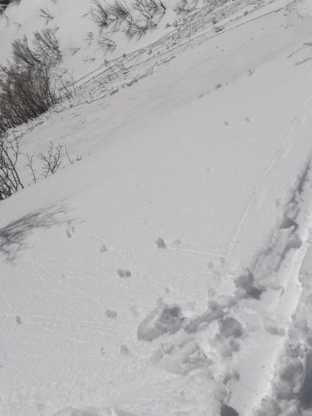
The avalanche danger will increase to MODERATE as daytime temperatures rise in the backcountry. People could trigger shallow wet avalanches entraining a few inches of surface snow, and naturals are possible on very steep upper elevation slopes, especially if the sun comes out from behind clouds for a little while today. The snow on northerly facing lower elevation and some mid elevation slopes is saturated and unconsolidated, and although difficult for a person to trigger, wet avalanches gouging loose saturated snow to the ground are possible on very steep slopes.
- Evaluate snow and terrain carefully

Low
Moderate
Considerable
High
Extreme
Learn how to read the forecast here
Special Announcements
- We know there is a lot of uncertainty regarding coronavirus, but the Utah Avalanche Center is planning to continue issuing regular avalanche forecasts into April.
- Uphill Travel at Ski Areas - Some resorts will be offering limited uphill access but not all do. Up to date info about uphill access from Ski Utah is posted HERE.
- Beaver Mountain is allowing people to earn their turns and practice good social distancing on the hill, and conditions are excellent. Non motorized use only.
Weather and Snow
It's 27°F at the 8400' Tony Grove Snotel. About 3 inches of new snow fell in the last 24 hours at the site, and there is 88 inches of total snow, containing 110% of normal Snow Water Equivalent. It's 19°F at the 9700' CSI Logan Peak weather station, and west winds picked up a bit early this morning and are currently blowing about 20 mph.
People could trigger wet avalanches in steep terrain during the heat of the day today. Lower elevation snow is melting fast and the saturated snow in some areas is too soft. Shallow natural and triggered wet avalanches consisting of fresh snow are likely today in upper and mid elevation sunny terrain, but they should stay pretty small. Although they might be hard to trigger, wet avalanches on northerly facing slopes on lower and some mid elevation slopes could gouge all the snow out to the ground, and involve deep piles of heavy wet snow.

The low elevation snow on a northeast facing slope in Wood Camp is too soft and saturated for my liking...
High pressure will build into the area today. The next storm system will spread moisture in from the southwest Monday. A colder storm system will then cross the area Tuesday through Thursday. It will be partly sunny today, with 8500' high temperatures around 38°F and 10 to 15 mph west wind. It will be mostly clear tonight with low temperatures around 20°F and 6 to 10 mph west wind switching from the south after midnight. Tomorrow will be partly sunny, with a chance of snow showers in the afternoon. High temperatures will be near 40°F and south winds 9 to 16 mph.

While water volumes on the Logan River gradually increase, the snow line on the western side of Cache Valley is slowly retreating uphill.
Recent Avalanches
Observers report triggering small slabs of wind drifted snow as well as loose avalanches of dry and moist surface snow at upper elevations this weekend.

This 1' x 20' rider triggered soft slab avalanche occurred Friday, 3-20-2020.

A skier intentionally triggered a loose wet avalanche in the Wellsville Mountain Wilderness yesterday, 3-21-2020.
Avalanche Problem #1
Wet Snow
Type

Location

Likelihood

Size

Description
- Sun may pop out from behind the clouds today, and the new snow will quickly become moist with warm temperatures. People could trigger small loose wet avalanches consisting of moist surface snow on steep upper elevation slopes, where a few inches of fresh snow accumulated. Some small natural wet activity is also possible in steep sunny terrain.
- The snow on northerly facing slopes at lower elevations and on some mid elevation slopes is melt-softened and saturated throughout, and although difficult to trigger, people might initiate loose wet avalanches that gouge to the ground and produce large piles of heavy debris.
General Announcements
EMAIL ADVISORY. If you would like to get the daily advisory by email you subscribe HERE.
Remember your information can save lives. If you see anything we should know about, please help us out by submitting snow and avalanche observations....HERE. You can also call us at 801-524-5304, email by clicking HERE, or include #utavy in your tweet or Instagram.
This forecast is from the USDA Forest Service, which is solely responsible for its content. The forecast describes general avalanche conditions and local variations always occur.
We will update this forecast before about 7:30 Monday morning.