UDOT PLANNED AVALANCHE CLOSURES!!

Forecast for the Logan Area Mountains

Toby Weed
Issued by Toby Weed for
Friday, March 17, 2023
There's MODERATE danger with elevated avalanche conditions found on drifted upper and mid elevation slopes. People could trigger large cornice falls or 1 to 2' deep slab avalanches of wind drifted snow. Clear skies and cold temperatures overnight helped with a good refreeze of the saturated snow, and the danger is LOW at lower elevations. Wet avalanches are unlikely but may become possible on sunny slopes in the warmth of the day.
Evaluate snow and terrain carefully.
Low
Moderate
Considerable
High
Extreme
Learn how to read the forecast here
Special Announcements
Please consider donating to the spring campaign to help our team implement innovative tools and better provide you with the information you rely on.
Weather and Snow
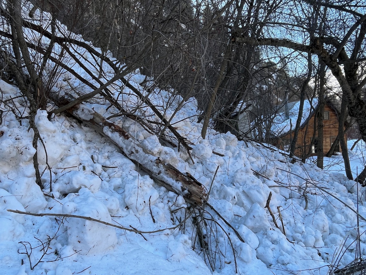
The natural wet avalanche cycle on Wednesday spawned many destructive avalanches on forested low elevation slopes where I haven't seen avalanches in my short 20 years in the hood..
Overnight temperatures dropped well below freezing and the surface of the rain saturated snow at lower elevations is now pretty solid. It could soften up again pretty quickly in the sun though. Around a foot of heavy new snow accumulated on upper elevation slopes with this week's storm, drifted by strong southwest and westerly winds. Expect to find elevated conditions in drifted terrain still, with avalanches of wind drifted snow, 1 to 2 feet deep and more than 100' wide possible. People should stay well away from and out from under huge and unstable cornices on the ridge-lines.

The 8400' Tony Grove Snotel reports 11 inches of heavy new snow from Wednesday's warm and windy storm. It's 9° F this morning, and there is 131 inches of total snow. The wind is blowing from the east-southeast around 20 mph this morning at the 9700' CSI Logan Peak weather station.

Here is the NWS point forecast for high elevations in the Central Bear River Range:
Today: Sunny, with a high near 24. Wind chill values as low as -8. East southeast wind 10 to 13 mph.
Tonight: Mostly clear, with a low around 7. Wind chill values as low as -9. East wind 11 to 13 mph.
Saturday: Sunny, with a high near 29. Wind chill values as low as -4. Southeast wind around 11 mph.

We'll see fair weather and sun through the weekend, with a return of the atmospheric river next week. Snow on Monday intensifying to heavy snow on Monday night, and continuing through at least Wednesday.
Recent Avalanches
  • Large natural wet avalanches were widespread at lower elevations in the Logan Zone Wednesday, spawned by warmth and a significant amount of rain-on-snow.
  • A natural wet avalanche hit Highway 89 at the Dugway in Logan Canyon early Wednesday morning. report is HERE
  • For a list of avalanches in the Logan Zone go HERE
  • It was a bit more active in the Wasatch Range yesterday. Find a list of all recent observations & avalanches from across Utah HERE.
Ad
Avalanche Problem #1
Wind Drifted Snow
Type
Location
Likelihood
Size
Description
Avalanches of wind drifted snow, 1 to 3 feet thick, are possible for people to trigger in windy terrain at upper and mid elevations.
  • Avoid corniced slopes and stiffer drifts on steep slopes near ridges and in and around terrain features like cliff bands, sub-ridges, mid-slope break-overs, and gully walls.
  • The overhanging cornices on the high peaks and ridges have become huge with recent storms, so its a good idea to continue to stay well away and out from under them.
  • Avalanches of wind drifted snow failing on a persistent weak layer buried 1 to 3 feet deep are possible, and some still might be triggered remotely or from a distance.
Avalanche Problem #2
Wet Snow
Type
Location
Likelihood
Size
Description
  • Despite clearing and cold overnight temperatures, human triggered loose wet avalanches remain possible on lower elevation slopes during the heat of midday, especially in sunny terrain.
  • More than normal snow cover exists even at very low elevations, and snow becomes unstable as it is saturated and loosened up by the sun (or rain).
Wednesday's natural avalanche cycle at lower elevations included many large destructive avalanches on steep forested slopes.
Additional Information
General Announcements
  • Please submit your observations from the backcountry HERE.
  • For a list of avalanche classes from the Utah Avalanche Center go HERE
  • For information on where you can ride your sled or snowbike, check out this map of the winter travel plan for the Logan and Ogden Ranger Districts HERE, and a close up of the Tony Grove and Franklin Basin Areas HERE.
This forecast is from the U.S.D.A. Forest Service, which is solely responsible for its content. This forecast describes general avalanche conditions and local variations always occur.