Forecast for the Logan Area Mountains

Toby Weed
Issued by Toby Weed for
Friday, February 10, 2023
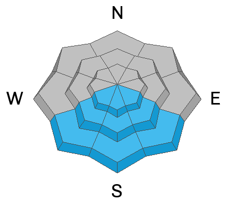
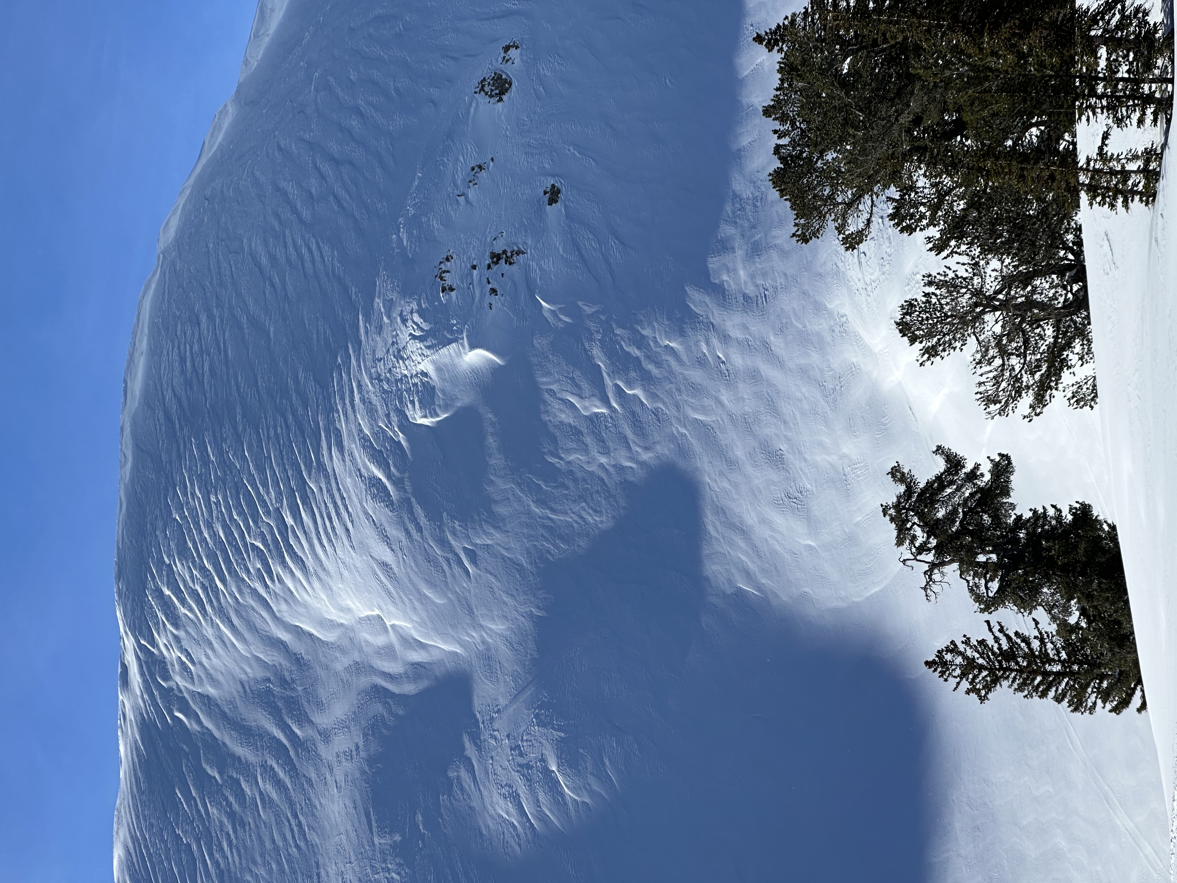
Heightened avalanche conditions exist at upper and mid elevations in the backcountry, small avalanches are possible, and the danger is MODERATE on drifted slopes steeper than 30°. Avalanches are more likely on drifted slopes facing north, east, and south, where people could trigger 1 to 2 feet thick slab avalanches of wind drifted snow. We've found mostly stable snow and nice powder in sheltered terrain and at lower elevations, where avalanches are unlikely and the danger is LOW. Loose avalanches entraining moist surface snow are possible on steep sunny slopes in the middle of the day.
  • Evaluate snow and terrain carefully.
Low
Moderate
Considerable
High
Extreme
Learn how to read the forecast here
Weather and Snow
Heightened avalanche conditions exist currently in drifted terrain, where people could trigger avalanches of wind drifted snow. The probability and potential size of triggered avalanches is much greater on drifted upper elevation slopes, and much less down lower and where the snow was not affected by the wind. Loose avalanches entraining moist surface snow are possible in sunny terrain today.
Winds at the CSI Logan Peak weather station are blowing from the west at around 15 mph, and it's 23° F at 9700'. The Tony Grove Snotel at 8400' reports 20° F, 5 inches of new snow from Wednesday, and 100 inches of total (settled) snow.

Today will be sunny, with high temperatures at 8500' around 34°F, with moderate winds from the southwest.
Tonight, expect low temperatures around 16° F and winds from the south-southwest, increasing a bit to around 13 mph.
Tomorrow will be partly sunny, with high temperatures around 33° F, and moderate winds will blow out of the south around 10 mph.
Heading into the weekend looks like fairly quiet weather with some sun, a few clouds, and continued cool temperatures with daytime highs staying below freezing in the mountains. The next winter storm will hold off until around Tuesday.
Recent Avalanches
Observers report easily triggering lots of small wind slab avalanches yesterday above about 8600' on east and northeast facing slopes in the Central Bear River Range.

For a list of local avalanches go HERE Find a list of all recent observations & avalanches from across Utah HERE.
Ad
Avalanche Problem #1
Wind Drifted Snow
Type
Location
Likelihood
Size
Description
Wednesday's strong winds out of the west were more than strong enough to drift existing powder and new snow into soft and harder wind slabs. Significant drifting occurred and it elevated avalanche danger in exposed terrain at all elevations, especially up high. In some areas, recent winds built stiffer slabs on weak surface snow consisting of small-grained faceted snow and perhaps surface hoar. These wind slabs are fairly shallow but remain sensitive, with shooting cracks observed, and numerous small human triggered avalanches of wind drifted snow reported in the last couple days.
  • Fresh wind slabs having formed on weak surface snow might still be sensitive to human triggers, and some still could potentially be remotely triggered, from a distance. Shooting cracks in drifted snow are a sure sign of instability.
  • Avoid corniced slopes and stiffer drifts on steep slopes near ridges and in and around terrain features like cliff bands, sub-ridges, mid-slope break-overs, and gully walls.
  • The good news is that shallow powder riding conditions remain pretty good in lower angled, lower elevation, and sheltered terrain.
Avalanche Problem #2
Wet Snow
Type
Location
Likelihood
Size
Description
The warmest temperatures we've seen in some time are forecast for today, with daytime high temperatures in the mountains climbing to a couple degrees above freezing. Small loose avalanches entraining sun moistened surface snow are possible on steep sunny slopes in the middle of the day. These could get pretty big on sustained slopes, and could be a problem if a person were to be swept into trees, gullies, or other terrain traps.
Additional Information
The snow on many upper elevation slopes in the Central Bear River Range was affected by strong west and northwest winds on Wednesday
General Announcements
  • Please submit your observations from the backcountry HERE.
  • For a list of avalanche classes from the Utah Avalanche Center go HERE
  • For information on where you can ride your sled or snowbike, check out this map of the winter travel plan for the Logan and Ogden Ranger Districts HERE, and a close up of the Tony Grove and Franklin Basin Areas HERE.
This forecast is from the U.S.D.A. Forest Service, which is solely responsible for its content. This forecast describes general avalanche conditions and local variations always occur.