Forecast for the Logan Area Mountains

Toby Weed
Issued by Toby Weed for
Saturday, December 3, 2022
The avalanche danger is CONSIDERABLE and conditions are dangerous in the backcountry. People are likely to trigger dangerous slab avalanches failing on a buried persistent weak layer, especially in drifted mid and upper elevation terrain. Elevated conditions also exist in sheltered terrain and on steep lower and mid elevation slopes, where people could trigger small soft slab and loose snow avalanches.
Evaluate snow and terrain carefully, make conservative decisions, and avoid slopes with recent deposits of wind drifted snow steeper than about 30°
Low
Moderate
Considerable
High
Extreme
Learn how to read the forecast here
Special Announcements
Our annual party and fundraiser is coming up on December 6 in Logan at the Cache. 19th Annual Utah Avalanche Center Pray for Snow Party and Fundraiser information and tickets HERE.
Join the Utah Avalanche Center and the Division of Outdoor Recreation to celebrate the Fourth Annual Avalanche Awareness week, from December 4 - December 11. Click HERE to view the full list of events for the week.
Weather and Snow
Dangerous avalanche conditions exist in the backcountry. Heavy snow and drifting overloaded widespread slopes with buried persistent weak layers and poor snow structure. Dangerous human triggered avalanches are likely on drifted upper and mid elevation slopes. Several parties reported triggering heart-stopping audible collapses or "wumpfs" and shooting cracks yesterday as they traveled through the new snow at mid and upper elevations above Bear Lake in the Garden City Canyon Area. These are "bulls-eye" red flags indicating unstable snow and real potential for dangerous slab avalanches failing on a persistent weak layer.
Remote mountain weather stations report around a foot of new snow from yesterday morning's storm, and around 1" Snow Water Equivalent or SWE. The wind is now blowing from the southwest around 25 mph with 40 mph gusts, and it's 16° F at the CSI weather station on Logan Peak at 9700'. I'm reading 11° F at the Franklin Basin Snotel site at 8100'.
Today will be partly sunny in the mountains, with high temperatures at 8500' around 25° F. Expect 10 to 15 mph south-southwest winds and wind chill values as low as -6° F. Clouds and southwest winds will increase tonight ahead of the next, somewhat less intense, storm. Snow is expected tomorrow and tomorrow night with another 6" to a foot of accumulation possible on upper elevation slopes by Monday morning.
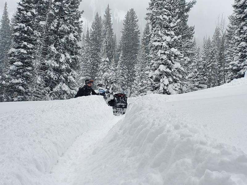
Observers report very deep ( almost too deep) powder riding conditions at upper elevations in the Bear River Range, but there are still many shallowly buried land mines (rocks) out there lurking under the light powder. (Flygare, 12-2-22). Dangerous avalanche conditions dictate staying off of and out from under steep slopes. (steeper than 30°)
Recent Avalanches
Local observers report many red flags indicating unstable snow, but as yet no large or significant avalanches were reported in the Logan Zone. I noticed a little bit of natural storm slab activity on lower elevation slopes in Logan Canyon yesterday, and observers report triggering small soft slabs in Providence Canyon on Tuesday.
Numerous human triggered avalanches were reported from yesterday in the Wasatch and Western Uinta ranges, and thankfully, no accidents.
See our updated list of observed avalanches from across Utah HERE
Ad
Avalanche Problem #1
Wind Drifted Snow
Type
Location
Likelihood
Size
Description
People are likely to trigger dangerous slab avalanches of stiffer wind drifted snow failing on a sugary buried persistent weak layer if they venture onto exposed upper elevation slopes. Drifts and wind slabs may be hidden under fresh powder. Natural avalanches are possible today as more fresh snow is drifted onto steep overloaded slopes.
  • Wind slabs often form on the lee side of exposed ridges and in and around terrain features. Watch for and avoid drifts on gully walls, under cliff bands, along sub-ridges, in scoops, saddles, and sinks.
  • Drifted snow is stiffer and more compacted than non-drifted snow. Last night's strong winds created harder drifts (called hard slabs if they avalanche). Hard slabs are often stubborn, notorious for allowing people to get out on them before releasing, kind of like a mouse trap!
  • Slab avalanches of wind drifted snow failing on a persistent weak layer might be triggered remotely, from a distance, or even below!
  • Today you should avoid travel on or under steep slopes with deposits of wind drifted snow.
  • Freshly formed wind slabs can be quite sensitive and are often remotely triggered.
  • Shooting cracks in drifted snow are a sure sign of instability.
Avalanche Problem #2
Persistent Weak Layer
Type
Location
Likelihood
Size
Description
Soft slab avalanches failing on a persistent weak layer of surface hoar, buried by Monday's storm, are likely for people to trigger, even on sheltered and mid elevation slopes steeper than 30 degrees.
  • We've found buried weak sugary snow at all elevations and on slopes facing every direction. The persistent weak layer (PWL) problem has potential to get worse as widespread slopes with poor snow structure are overloaded, and the problem is likely to be an issue for a while.
  • Areas plagued by a very sensitive PWL consisting of buried feathers of surface hoar are also widespread, but we've found them mostly in sheltered and mid elevation terrain. Persistent weak layers consisting of surface hoar are notoriously tricky, often surprising and sometimes catching experienced avy pros off guard. Avalanches failing on buried surface hoar may occur on lower angled slopes than you might expect.
  • Red Flags indicating PWL instability will include audible collapses or wumpfs and shooting cracks. Slab avalanches failing on a buried persistent weak layer are likely to be remotely triggered from a distance, hopefully from above or from an adjacent slope, and not from below.

Monday's snow fell on bare ground or very shallow snow on low and many mid elevation sunny slopes, (W, SW, S, SE) so the danger of avalanches is lower (Moderate), but potential might be higher for hitting rocks.
Additional Information
  • Take the all-new online avalanche courses the UAC built for Know Before You Go or take other online courses listed on the KBYG website (Develop skills -> Online Learning).
  • Get your avalanche rescue gear ready for winter. Put fresh batteries in your transceiver and update the firmware. Inspect your shovel and probe. Get your airbag backpack ready by possibly doing a test deployment and update the firmware if it is an electric version.
General Announcements
Please submit your observations from the backcountry HERE.
For a list of avalanche classes from the Utah Avalanche Center go HERE
For information on where you can ride your sled or snowbike, check out this map of the winter travel plan for the Tony Grove and Franklin Basin Areas HERE.
The Tony Grove Road and other forest roads in the Logan Ranger District are not maintained for wheeled vehicles in the winter.
This information does not apply to developed ski areas or highways where avalanche control is normally done. This forecast is from the U.S.D.A. Forest Service, which is solely responsible for its content. This forecast describes general avalanche conditions and local variations always occur.