Forecast for the Logan Area Mountains

Toby Weed
Issued by Toby Weed for
Wednesday, December 26, 2018
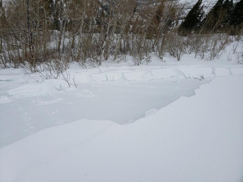
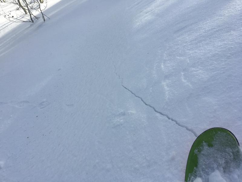
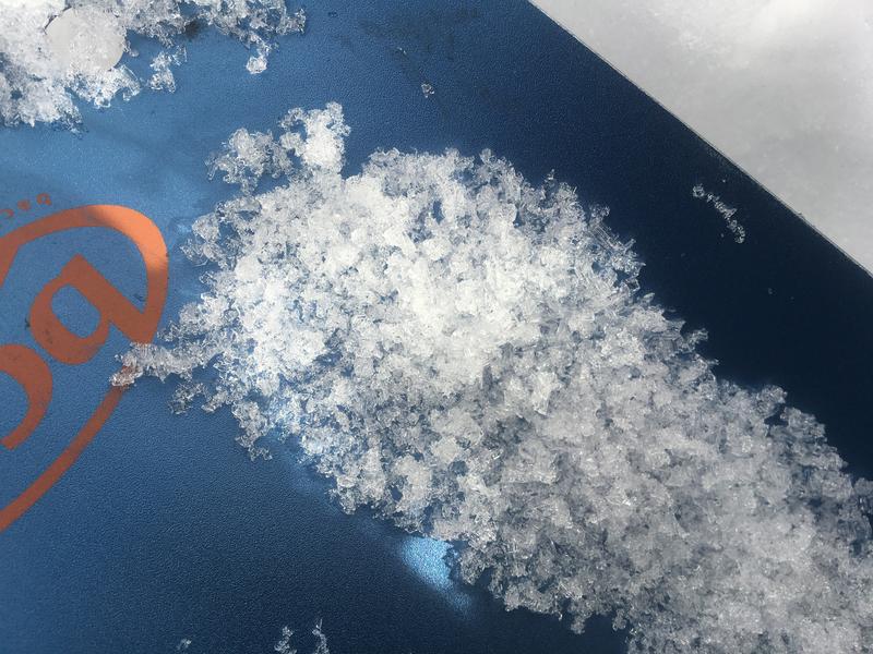
MODERATE: Heightened avalanche conditions exist on drifted upper and mid-elevation slopes, and you could trigger avalanches involving wind-drifted snow. After yesterday's easterly wind, avalanches are possible in unusual or unexpected places. Dangerous deeper slab avalanches failing on a buried sugary persistent weak layer are unlikely yet remain possible on isolated very steep upper elevation slopes with poor snow structure.
Evaluate snow and terrain carefully.
Low
Moderate
Considerable
High
Extreme
Learn how to read the forecast here
Weather and Snow
It'll be pretty dang cold in the mountains today, but it's clearing up and we'll see a bit of sunshine by afternoon. You'll find nice shallow powder, but heightened avalanche conditions exist on drifted upper and mid elevation slopes where human triggered avalanches involving wind drifted snow are possible. The Tony Grove Snotel at 8400' reports 5 inches of new snow with .5" SWE in the last 48 hours. It's 15º F and there's 39" of total snow containing 88% of average SWE. It's 9º F at the 9700' CSI Logan Peak weather station, and northwest winds are increasing, currently averaging about 22 mph.
A new and much colder storm system will approach Utah from the northwest today. The storm will arrive tomorrow and bring a few inches of snow to the Logan Zone. High pressure aloft will return to the area this weekend. Expect a high temperature at 8500' near 20º F and 17 to 21 mph northwest wind. Wind chill values as low as -10 are expected. Clouds will increase tonight and some snow is possible. Low temperatures around 7º F, and 10 to 15 mph north wind will cause wind chills around -11. We'll see snow in the mountains tomorrow, with 2 to 4 inches of accumulation forecast. A high temperature around 18º F is expected, with 8 to 13 mph southeast wind, veering from the north.
Recent Avalanches
No avalanches were reported recently in the Logan Zone. But, yesterday's easterly winds drifted snow on the ridges, and there was a human triggered avalanche in closed terrain at Powder Mountain.
Ad
Avalanche Problem #1
Wind Drifted Snow
Type
Location
Likelihood
Size
Description
Heightened avalanche conditions exist on upper and some mid-elevation slopes, and you could trigger avalanches consisting of wind drifted snow. Drifting occurred in exposed terrain much of last week, and there are some deeper hard wind slabs lurking under the fresh snow in places. Southeast winds yesterday built fresh drifts at upper elevations in unexpected or unusual places.
  • Watch for and avoid fresh or older drifts on the lee sides of major ridges and in and around terrain features like cliff bands, scoops, gullies, stringers, and sub-ridges.
  • Avoid steep slopes that have a smooth, rounded appearance, or that sound hollow like a drum.
  • Hard wind slabs have a nasty tendency to let you get well out on them before releasing.
  • Cracking in the snow is a red flag indicating potential instability.
Avalanche Problem #2
Persistent Weak Layer
Type
Location
Likelihood
Size
Description
Although quite unlikely, dangerous human triggered hard slab avalanches failing on a persistent weak layer near the ground called depth hoar remain possible on upper elevation slopes. Avoid very steep previously drifted slopes with poor snow structure, including shallow, shady, or rocky terrain at upper elevations.
The shallow snow on the ground in many areas has become loose, sugary, and faceted in the past couple weeks. I found particularly weak snow in the backcountry near Beaver Mountain, where the total snow is only about 2-feet-deep or less. In these areas the snow is currently stable despite it's weakness, but it'll get interesting when we get significant accumulation in the future.
Sugary, faceted snow from the Thanksgiving storm creates a persistent weak layer near the ground on slopes with shallow snow cover. This from 12/20/18, on a west facing slope at 8500' on Beaver Mountain's backside.
Additional Information
I will update this advisory Friday morning.
General Announcements
The new UAC IOS mobile app is now available on the app store. Check out the new "My Weather" feature. HERE
Check out the new free online avalanche course series developed by the Utah Avalanche Center. This is a great way to refresh your skills or prepare you for a Backcountry 101 or Level 1 class. HERE
Now is a great time to practice companion rescue techniques with your backcountry partners. Here is our practice video.
If you would like to get the daily advisory by email you subscribe HERE.
Support the UAC through your daily shopping. When you shop at Smith's, or online at REI, Backcountry.com, Patagonia, NRS, Amazon, eBay by clicking on these links, they donate a portion of your purchase to the UAC. If you sell on eBay, you can have your See our Affiliate Page for more details on how you can support the UAC when you shop
Remember your information can save lives. If you see anything we should know about, please help us out by submitting snow and avalanche observations. HERE You can call us at 801-524-5304, email by clicking HERE, or include #utavy in your Instagram.
This advisory is from the U.S.D.A. Forest Service, which is solely responsible for its content. This advisory describes general avalanche conditions and local variations always occur.