Forecast for the Logan Area Mountains

Issued by Toby Weed on
Wednesday morning, December 16, 2015
Wednesday morning, December 16, 2015
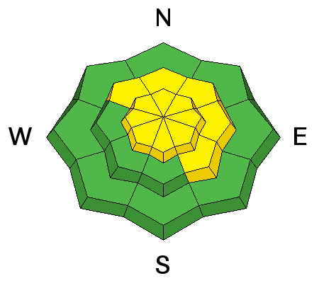
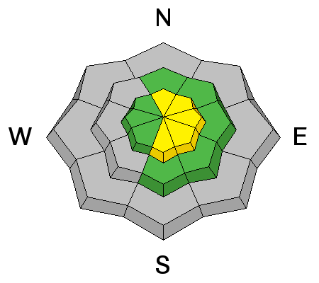
MODERATE (level 2): Heightened avalanche conditions exist in the backcountry and you could trigger dangerous persistent or wind slab avalanches on slopes steeper than about 30 degrees in drifted terrain, mainly at upper elevations. The danger will rise and become more widespread with accumulating snowfall and intensifying west winds later today and overnight, with dangerous (level 3) conditions likely to develop in some areas by tomorrow. Evaluate the snow and terrain carefully and continue to practice wise travel protocols.
Low
Moderate
Considerable
High
Extreme
Learn how to read the forecast here