It is currently 10°F cooler than it was yesterday at the Card Canyon weather station, with 35°F and just over 15 inches of total snow at 8700 feet. The Tony Grove Snotel at 8400 feet reports 23 inches of total snow, and it's 36°F. On Logan Peak at 9700 feet, temperatures have dropped to 32°F. The wind sensor is fixed on the communication tower elevated 40 feet off the ground, and this morning, the winds are blowing from the west-southwest around 20 mph. At 9500 feet on Paris Peak, it's a cool 31°F with 15 mph wind blowing from the west-southwest.
A widespread melt-freeze or rain-crust now caps dense snow from the December 5/6 storm, overlaying a sugary, persistent weak layer near the ground. While obvious signs of instability like cracking and whumpfing have generally subsided, snow stability tests continue to show potential for slab avalanches to propagate.
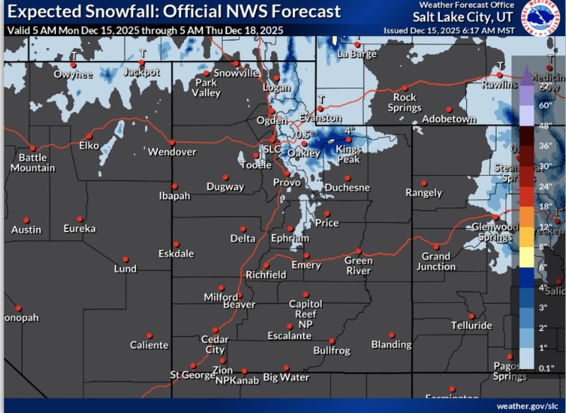
It’ll be another sunny and warm day today in the mountains, with highs around 39°F and light winds blowing from the west. Tomorrow, there's a chance of snow, with little accumulation expected. Skies will be mostly cloudy, with a high near 35°F and winds around 10 mph from the west-southwest.
A more wintry weather pattern will develop in the latter half of the week. Snow is likely at upper elevations on Wednesday, with 3 to 5 inches of accumulation possible. Another 2 to 4 inches could accumulate on Thursday. The weather pattern appears to stay active, and snow is likely at upper elevations every day through next weekend. The primary uncertainty centers on the elevation of the rain-snow line, and the jury is still out on whether it will be a snowy holiday in Cache Valley.
No new avalanches have been reported since last week. For all observations and avalanche activity in the Logan Zone, go HERE