Get Your Ticket to the 32nd Annual Backcountry Benefit on September 11th! Support Forecasting, Awareness, and Education
Ad

Forecast for the Logan Area Mountains

Toby Weed
Issued by Toby Weed on
Tuesday morning, December 15, 2020
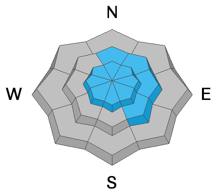
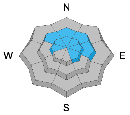
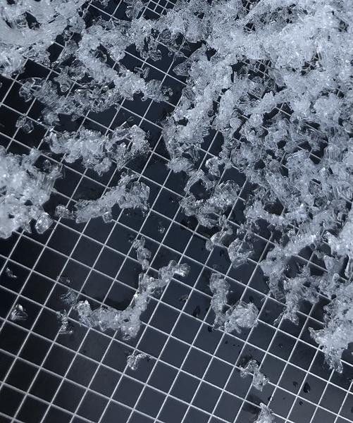
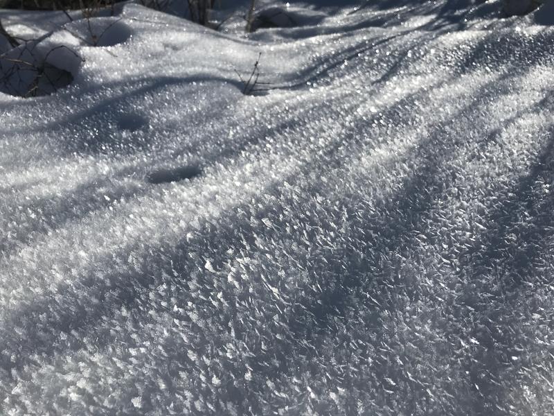
Heightened avalanche conditions exist on upper and some mid elevation slopes where people could trigger slab avalanches consisting of recently drifted snow. The overall danger is MODERATE, with avalanches most possible on drifted upper elevation slopes facing northwest through southeast. Some avalanches could be triggered remotely or from a distance. You will find safer conditions and LOW danger in sheltered, low angle, and lower elevation terrain.
  • Evaluate snow and terrain carefully, and stay off and out from under steep drifted slopes.
Low
Moderate
Considerable
High
Extreme
Learn how to read the forecast here
Special Announcements
The holiday season is right around the corner!! Looking for that special something for your partner?
Well, we've got an easy shopping solution for you ...Buy your gifts at our Pray for Snow online auction and support the UAC in Logan. HERE
Weather and Snow
About 4 inches of new snow fell Sunday night at upper elevations in the Bear River Range, drifted by fairly strong south and southwest winds. Only a trace of new snow accumulated during the day yesterday, but northwest winds continued to drift snow at upper elevations. Today will be partly sunny and cold in the mountains, with a north wind this morning, veering from the west this afternoon. With 8500' high temperatures only in the mid teens, the wind chill values will be as low as -8°F. Expect cold unsettled weather to continue through the week, with heavy snow possible in the mountains Thursday and Thursday night.
Currently, hitting rocks or other shallowly buried obstacles presents a significant hazard in the backcountry. A few inches of nice light powder now obscures many hazards. Most slopes have little more than about 2' of total snow, and a steep temperature gradient is turning the shallow snow into loose sugary or faceted grains. In many places, the weak snow is easy to punch through to the rocks below.
A thick layer of very weak, sugary, or faceted snow will likely be a problematic persistent weak layer on many slopes, as future snow overloads it.
Recent Avalanches
An observer reports easily triggering small wind slabs and sluffs of new snow at upper elevations in the Central Bear River Range Saturday. No other avalanches were reported recently.
Ad
Avalanche Problem #1
Wind Drifted Snow
Type
Location
Likelihood
Size
Description
People could trigger wind slab avalanches on steep upper and mid elevation slopes where drifts formed on weak, sugary or faceted snow. In more sheltered terrain, loose sluffs and shallow soft slabs of new snow are possible because the older snow underneath is very weak, faceted, and loose.
  • Even a small avalanche could be very dangerous due to shallow early season snow conditions. You do not want to get caught and carried over rocks or strained through bushes and stumps, so it's best to avoid travel on all steep drifted slopes.
Avalanche Problem #2
Persistent Weak Layer
Type
Location
Likelihood
Size
Description
During the extended November dry spell, the shallow snow on the ground was subjected to a significant temperature gradient and resulting sublimation caused the snow on many slopes to become sugary, non-cohesive, faceted, and very weak. Drifted snow is a wind slab and when stiffer, more cohesive slabs develop on top of weak, sugary, faceted snow they are unstable. Many slopes in the region are now plagued by weak faceted snow, but most do not yet have a slab layer formed on top of it.
  • Avalanches failing on a persistent weak layer can be very sensitive, and they might be triggered remotely, from a distance, or worse from below!

In more sheltered areas and down in the basins and canyon bottoms, glittering surface hoar feathers on the snow surface were common before the light snow this weekend. These also could become the failing persistent weak layer in future avalanches when buried by enough snow to create a slab.
Additional Information
Everybody should make time to examine and practice with your avalanche rescue equipment, and convince your backcountry partners to practice with you. Watch our companion rescue video HERE
My tip for avoiding avalanches in the backcountry is to keep your slope angles low. Avoid and stay out from under slopes steeper than about 30 degrees. Get a tool to measure slope angle and practice with it in the backcountry.
General Announcements
Visit this website with information about Responsible Winter Recreation by the Utah Office of Outdoor Recreation.
If you missed the 13th Annual Utah Snow and Avalanche Workshop, the recordings are available for purchase from the UAC Store. HERE
The Tony Grove Road is not maintained for wheeled vehicles in the winter.
EMAIL ADVISORY. If you would like to get the daily advisory by email you subscribe HERE.
Remember your information can save lives. If you see anything we should know about, please help us out by submitting snow and avalanche observations....HERE. You can also call us at 801-524-5304, email by clicking HERE, or include #utavy in your tweet or Instagram.
I will update this advisory by around 7:30 tomorrow morning.
This forecast is from the USDA Forest Service, which is solely responsible for its content. The forecast describes general avalanche conditions and local variations always occur.