Forecast for the Logan Area Mountains

Toby Weed
Issued by Toby Weed for
Saturday, November 5, 2022
A powerful early season winter storm will cause rising avalanche danger in the backcountry today. Heavy snow, rapid accumulations, warming temperatures, and drifting from gusty west-southwest winds will create potential for soft slab and loose avalanches of storm snow as well as stiffer slab avalanches of wind drifted snow. Dangerous avalanche conditions may develop on drifted upper elevation slopes, and people could trigger avalanches. With the existing very shallow early season snow conditions, any avalanche could be quite dangerous especially if you get caught carried through the rocks..
Low
Moderate
Considerable
High
Extreme
Learn how to read the forecast here
Weather and Snow
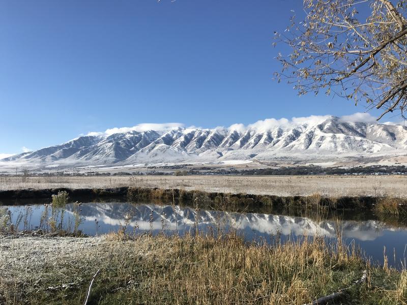
As of 5:00 this morning about 4 inches of heavy new snow has already accumulated at upper elevations in the Bear River Range. The 8,400' Snotel near Tony Grove Lake reports rising temperatures this morning, currently 28°F and 14 inches of total snow, with 4 new inches overnight and .08" of Snow Water Equivalent. The wind sensor at the 9700' CSI Logan Peak weather station is showing sustained 30 to 40 mph west-southwest winds with gusts in the upper 50s.
Very shallow early season snow conditions exist, with not much more than about a foot of total snow covering the rocks on most upper elevation slopes. Extreme caution is required to avoid hitting shallowly buried rocks, stumps, or down trees. Avalanches are becoming increasingly possible, and dangerous conditions may develop on upper elevation slopes with this weekend's powerful storm. The main issue today will be deposits of wind-drifted and radidly accumulating heavy new snow that could produce soft slab avalanches. The snow is so shallow that people could sustain serious injuries if they are caught and caried over rocks in even a small avalanche.

The National Weather Service has issued a Winter Storm Warning for this morning through Sunday morning. Heavy snowfall, rising temperatures, and strong winds are forecast for the mountains around Logan, and the avalanche danger will increase throughout the day and overnight n the backcountry.
Even if you're not planning to get onto the snow, it's never too early to start thinking about avalanches. A few things to consider doing:
  1. Attend USAW and learn more about avalanches and decision making. (scroll down to the bottom of this page for more info and links)
  2. Sign up for an avalanche class.
  3. Take the all-new online avalanche courses the UAC built for Know Before You Go or take other online courses listed on the KBYG website (Develop skills -> Online Learning).
  4. Get your avalanche rescue gear ready for winter. Put fresh batteries in your transceiver and update the firmware. Inspect your shovel and probe. Get your airbag backpack ready by possibly doing a test deployment and update the firmware if it is an electric version.

Ad
Avalanche Problem #1
New Snow
Type
Location
Likelihood
Size
Description
Soft slabs of storm snow will become increasingly likely today as temperatures rise and heavy dense snow piles up on steep slopes. Natural avalanches are most possible during periods of particularly heavy snowfall.
Avalanche Problem #2
Wind Drifted Snow
Type
Location
Likelihood
Size
Description
Drifts will quickly grow in upper elevation terrain, and potential wind slab avalanches on steep slopes will become increasingly sensitive to human triggers, more likely, and larger.
Additional Information
Sign up for the 15th Annual Utah Snow and Avalanche Workshop (USAW) on two nights, November 2nd and 9th. Sign up and get more info for the first session HERE and the second session HERE.
The Avalanche Professional and Ski Patrol Snow and Avalanche Workshop (PROSAW) will be during the day of November 7th. Sign up and get more info HERE. (note - PROSAW will be offered both in-person and virtual).
General Announcements
The Tony Grove Road is not maintained for wheeled vehicles in the winter, and you are likely to encounter unimproved winter driving conditions as snow piles up this weekend.
Please submit your observations from the backcountry HERE.

This information does not apply to developed ski areas or highways where avalanche control is normally done. This forecast is from the U.S.D.A. Forest Service, which is solely responsible for its content. This forecast describes general avalanche conditions and local variations always occur.