Check Out Our Holiday Auction!

Forecast for the Logan Area Mountains

Toby Weed
Issued by Toby Weed on
Sunday morning, November 30, 2025

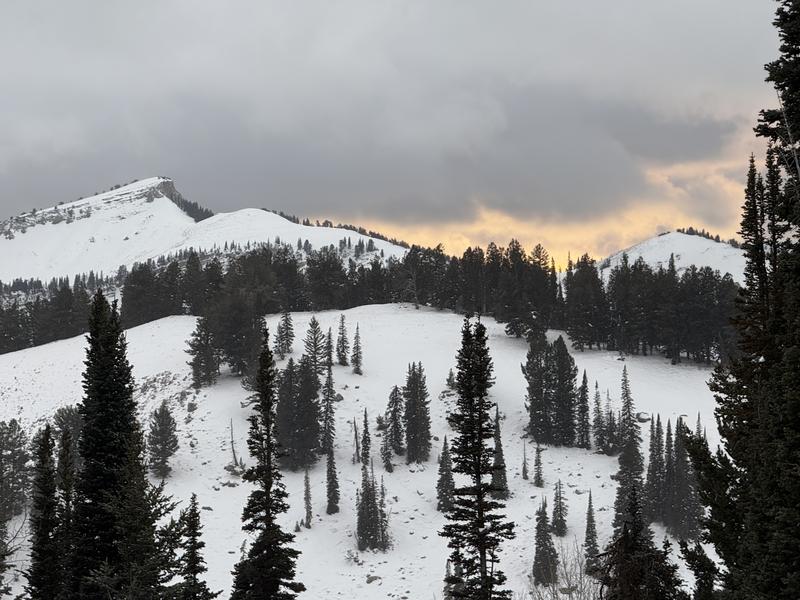
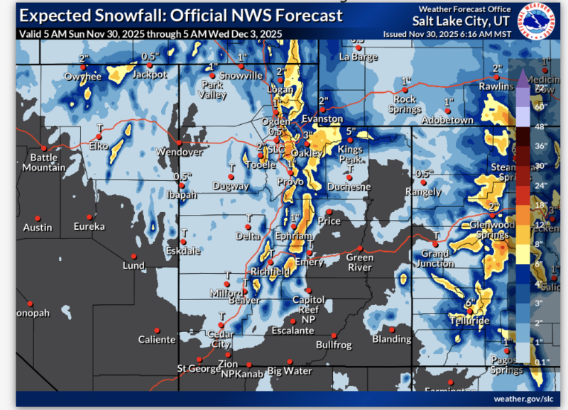
The avalanche danger will rise to MODERATE today in the backcountry as snow begins to accumulate and is drifted onto upper-elevation slopes with preexisting shallow, weak snow. People could trigger small slab avalanches on drifted slopes steeper than about 30 degrees above 8000' in elevation.

Low
Moderate
Considerable
High
Extreme
Learn how to read the forecast here
Special Announcements
UTAH AVALANCHE AWARENESS WEEK EVENTS...
-We are pleased to announce our 22nd annual Pray 4 Snow fundraiser-party at the Cache on the evening of December 2... Tickets and Info
- The USU Outdoor Programs will hold a free KNOW BEFORE YOU GO avalanche awareness presentation on Wednesday, December 3, at the Aggie Rec Center, 7:00 PM.
-The 18th annual Utah Snow and Avalanche Workshop in SLC will be held on December 6. The event from 4 PM to 8 PM at Wasatch Jr High School Auditorium (3750 S 3100 E, Salt Lake City, UT 84109) is open to the public....Tickets and Info
Weather and Snow

Several inches of heavy snow fell in upper-elevation terrain last week, capping some wet snow from October still on north-facing slopes above about 8000' in elevation. A few clear, cold nights changed the heavy, damp snow into sugary, faceted grains, and now the snow is quite weak on high slopes facing all directions. A strong temperature gradient is driving rapid sublimation and "drying out" the snow, turning the snow grains into weak sugary facets. A few inches accumulated in upper elevation terrain on Friday. Although we found a bit more than a foot of sugary snow in upper-elevation terrain earlier in the week, there is still nowhere near enough for safe recreation.

*This from this morning's NWS forecast discussion: "An approaching early winter storm system will cross the region today. Cooler and stable conditions will follow for Monday, with another system expected midweek.
A Winter Weather Advisory is in effect for the mountains of northern and central Utah through 11 PM this evening. In the Logan Zone, snow is expected, mainly before 2 pm. The snow could be heavy at times. High temperatures are expected near 24° F. Winds will blow from the southwest at 5 to 10 mph, becoming west-northwest in the afternoon. The chance of precipitation is 100%. Total daytime snow accumulation of 3 to 7 inches is possible.

Recent Avalanches
For observations and avalanche activity in the Logan Zone, go HERE
Avalanche Problem #1
Normal Caution
Type
Location
Likelihood
Size
Description
Now is a good time to inspect your rescue gear, ensure it's in working order, replace batteries, update the software, and practice companion rescue techniques with your backcountry partners.
Avalanche Problem #2
New Snow
Type
Location
Likelihood
Size
Description
People could trigger small soft slab avalanches of storm snow or stiffer wind slabs on upper elevation slopes steeper than about 30° in slope steepness.
Additional Information

For more information, visit the UAC weather page here: UAC Weather Page For Logan-specific weather, go here: Logan Mountain Weather

-For all questions on forecasts, education, Know Before You Go, events, online purchases, or fundraising, call 801-365-5522.

-Remember, the information you provide could save lives, especially if you see or trigger an avalanche. To report an avalanche or submit an observation from the backcountry, go HERE

-Receive forecast region-specific text message alerts to receive messages about changing avalanche conditions, watches, and warnings. Sign up and update your preferences HERE

This forecast is from the U.S.D.A. Forest Service, which is solely responsible for its content. This forecast describes general avalanche conditions and local variations always occur.

General Announcements
This information does not apply to developed ski areas or highways where avalanche control is normally done. This forecast is from the U.S.D.A. Forest Service, which is solely responsible for its content. This forecast describes general avalanche conditions and local variations always occur.