Get Your Ticket to the 32nd Annual Backcountry Benefit on September 11th! Support Forecasting, Awareness, and Education
Ad

Forecast for the Logan Area Mountains

Toby Weed
Issued by Toby Weed on
Saturday morning, November 30, 2019
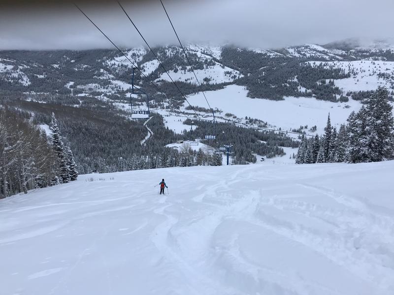
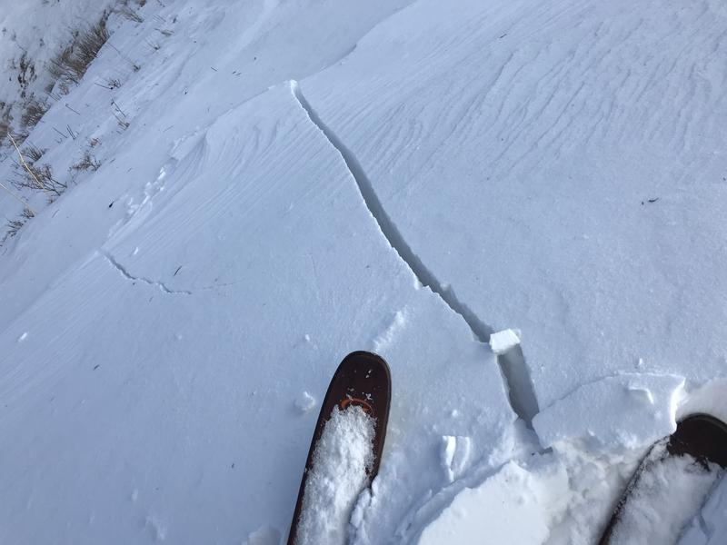
The powerful Thanksgiving storm caused dangerous avalanche conditions and CONSIDERABLE danger on upper elevation slopes facing northwest, north, and northeast in the backcountry. Human triggered avalanches are likely and natural avalanches possible on steep drifted slopes with weak, sugary, preexisting snow. Avalanches could be triggered remotely, from a distance, or below! You can find much safer conditions at lower elevations and on sheltered slopes that were bare last week.
  • Continue to stay off and out from under steep, wind-drifted slopes.
  • Even small avalanches can be very dangerous in shallow snow conditions, because you could be dragged into rocks or stumps.
  • Evaluate snow and terrain carefully. Use caution while route finding, and make conservative decisions.
Low
Moderate
Considerable
High
Extreme
Learn how to read the forecast here
Special Announcements
Join us for our 16th annual Pray for Snow Party, December 4, at The Cache in downtown Logan.
Come join us for an evening filled with good friends, good food, and good music all to support avalanche forecasting, awareness, and education. Music from The Swinging Lights!!!! Lucky Slice will be serving up gourmet slices once again.
Buy your tickets early to save $5! See you there! HERE
Weather and Snow
It's 13°F at the 8400' Tony Grove Lake Snotel this morning, and I'm reading 6 inches of new snow from overnight. The site has recorded 2.3" SWE from the Thanksgiving Storm, and there's now 37 inches of total snow. It's 6°F at the 9700' CSI Logan Peak weather station, west winds sustained 20 mph average wind speeds for much of the night, with a 37 mph gust. Dangerous avalanche conditions exist in the backcountry, and avalanches are likely in upper elevation north facing terrain where there are slopes plagued by very weak, sugary or faceted October snow.
Snow showers will be winding down this morning, but blustery west winds will continue throughout the day. It will be cloudy, with high temperatures at 8500' around 17°F. It'll be partly cloudy and cold in the mountains tonight, with 8 to 13 mph west-northwest winds, temperatures around -2°F and wind chills as low as -19°F. We might see a little sun on Sunday, but clouds will be increasing through the day, with light southwest winds and temperatures topping out around 26°F.
11/28/19: The new snow was almost too deep to do turns on the "Ridge". Beaver Mountain welcomes non-motorized travel and offers a good option for early season turns. Before the lifts open you should treat it as the backcountry, but most of the terrain is not steep enough for avalanches. Come on up and help pack out all the fresh powder.
Recent Avalanches
Numerous human triggered avalanches were reported in the past couple days in the Central Wasatch Range backcountry above Salt Lake and Park City. No avalanches were reported in the Logan Zone, but I won't be surprised if we see evidence of natural activity from the Thanksgiving Storm with clearing this weekend. Please let us know what you see....
Ad
Avalanche Problem #1
Wind Drifted Snow
Type
Location
Likelihood
Size
Description
Avalanches consisting of recently wind drifted snow are likely today on steep upper elevation slopes. Cracking and collapsing are red flags indicating unstable snow conditions.
Avalanche Problem #2
Persistent Weak Layer
Type
Location
Likelihood
Size
Description
Most sunny slopes were bare and many others patchy or crusty after the prolonged November dry spell. But on shady slopes above about 8000' facing the north half of the compass, the old October snow has grown sugary and very weak. Dangerous and destructive avalanches failing near the ground are possible, and the danger on many of these slopes will persist for a while even after the storm abates.
The very same slopes that will tempt us to play on them, are the ones that are the most dangerous and need to be avoid
Additional Information
  • Beware of heavy snow sliding off metal roofs as daytime temperatures warm up.
  • The First Annual Avalanche Awareness Week is December 2-7 We have a week full of fun and educational events planned. Check out the schedule HERE
  • As part of your early season tune-up, consider taking an avalanche class. We have lots of avalanche education classes listed already, from Know Before You Go to Companion Rescue to our Backcountry 101. Click on the Education menu on our webpage for a full list of classes from the UAC and other providers. Check out the Know Before You Go eLearning program for free, online, avalanche classes.....HERE
General Announcements
The Tony Grove Road is not maintained for wheeled vehicles in the winter, and it is snowpacked, narrow, and icy in places. You could easily get stuck in today's very deep snow. Hikers, cross country skiers, snow bikers, dogs, sleds, and 4x4s share the road this time of year, so be nice and keep your speed down around others.
It's key to head into the early avalanche season with the proper mindset. In this podcast, we talk with UAC program director Bo Torrey. Bo talks about particular risks unique to the early season, tips and tricks for knocking the rust off your early season rescue skills, and charts out the path forward with avalanche education. HERE